Category:Pakuratahi Truss Bridge
Jump to navigation
Jump to search
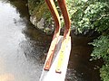
The Howe Truss Bridge, over the Pakuratahi River, Rimutaka Rail Trail
| Object location | | View all coordinates using: OpenStreetMap |
|---|
Media in category "Pakuratahi Truss Bridge"
The following 9 files are in this category, out of 9 total.
-
 Truss bridge 0.jpg 1,307 × 1,506; 656 KB
-
 Truss bridge 1.jpg 2,048 × 1,536; 661 KB
-
 Truss bridge 2.jpg 2,048 × 1,536; 661 KB
-
 Truss bridge 3.jpg 2,048 × 1,536; 660 KB
-
 Truss bridge 4.jpg 2,048 × 1,536; 664 KB
-
 Truss bridge 6.jpg 1,536 × 2,048; 656 KB
-
 Truss bridge 7.jpg 2,048 × 1,536; 656 KB
-
 Truss bridge 8.jpg 2,048 × 1,536; 660 KB
-
 Pakuratahi Truss Bridge.jpg 1,024 × 768; 334 KB


