Category:Piz Dolf
Jump to navigation
Jump to search
| Object location | | View all coordinates using: OpenStreetMap |
|---|
mountain  | |||||
| Upload media | |||||
| Instance of | |||||
|---|---|---|---|---|---|
| Location |
| ||||
| Mountain range | |||||
| Topographic prominence |
| ||||
| Topographic isolation |
| ||||
| Elevation above sea level |
| ||||
| Parent peak | |||||
 | |||||
Piz Dolf / Trinserhorn 3027 m
Media in category "Piz Dolf"
The following 14 files are in this category, out of 14 total.
-
 Bargistal Übersicht.jpg 1,800 × 1,116; 359 KB
-
 Bergbahnen Flims Graubergbahn mit Dolf.jpg 3,264 × 2,448; 2.41 MB
-
 Calfeisen und Ringel.jpg 2,592 × 1,456; 1.08 MB
-
 Dolf vom Fil de Cassons.jpg 860 × 722; 235 KB
-
 Dolf vom Segnesboden.jpg 860 × 571; 200 KB
-
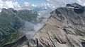
 Glarus Thrust Fault at Piz Segnes.JPG 3,264 × 745; 797 KB
-
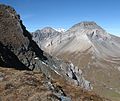
 Hiking Switzerland Piz Dolf from Fil de Cassons.jpg 704 × 568; 177 KB
-
 Nagens relativer Schneemangel 03.jpg 3,072 × 2,304; 3.44 MB
-
 Nagens relativer Schneemangel 05.jpg 2,304 × 3,072; 3.57 MB
-
 Ofen vom Bündner Vorab.jpg 1,318 × 849; 280 KB
-
 Panorama Laax.jpg 19,240 × 2,784; 5.37 MB
-
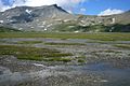
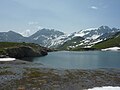 Plattenseeli Dolf Sardona.jpg 2,560 × 1,920; 2.18 MB
-
 Sardonagruppe hinter Flimserstein.jpg 2,560 × 1,920; 2.3 MB
-
 Westende mit Segnesboden.jpg 1,200 × 674; 175 KB


