Category:Pubs in Cheshire
Jump to navigation
Jump to search
Wikimedia category | |||||
| Upload media | |||||
| Instance of | |||||
|---|---|---|---|---|---|
| |||||

Subcategories
This category has the following 65 subcategories, out of 65 total.
*
- Pubs in Alsager (21 F)
- Pubs in Crewe (27 F)
- Pubs in Disley (22 F)
- Pubs in Helsby (14 F)
B
- Beehive Inn, Halebank (7 F)
- Bickerton Poacher (5 F)
C
- Cat and Fiddle Inn, Cheshire (43 F)
- Cheshire Cheese, Wheelock (3 F)
- Childe of Hale pub (13 F)
- Coachman Hotel, Hartford (6 F)
- Comfortable Gill, Cheshire (2 F)
- Crown Inn, Goostrey (3 F)
- The Crown, Swan Green (2 F)
D
- The Dog, Peover Heath (2 F)
F
G
- George and Dragon, Tarvin (9 F)
- The Grey Horse, Glazebury (2 F)
- The Gunners, Wolverham (2 F)
J
M
- Mersey View, Halebank (4 F)
N
- Nags Head, Bunbury (3 F)
O
- The Olde Barbridge Inn (6 F)
P
- The Pack Horse, Culcheth (6 F)
- Park Gate Inn, Over Peover (4 F)
R
S
- Shroppie Fly, Audlem (18 F)
- The Swan, Winwick (3 F)
- Swan Inn, Marbury (4 F)
- The Swan Inn, Kettleshulme (2 F)
T
- Tollemache Arms, Alpraham (3 F)
- Tudor Rose, Two Mills (2 F)
W
- The Wellington, Hale (5 F)
- Wheelwright Arms, Elton (6 F)
- Whipping Stocks Inn (9 F)
- The Wizard, Alderley Edge (9 F)
Y
- Yacht Inn, Woodbank (3 F)
- Ye Olde No 3 (3 F)
- The Yew Tree Inn, Spurstow (4 F)
Media in category "Pubs in Cheshire"
The following 200 files are in this category, out of 242 total.
(previous page) (next page)-
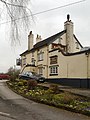
 "The Woodside" from Woodside Lane - geograph.org.uk - 280924.jpg 640 × 427; 430 KB
-
 113, London Road North - geograph.org.uk - 1471560.jpg 640 × 480; 101 KB
-
 Aldford, Grosvenor Arms - geograph.org.uk - 3981141.jpg 640 × 480; 255 KB
-

-
 Anderton, Stanley Arms PH - geograph.org.uk - 205455.jpg 640 × 426; 93 KB
-
 Axe and Cleaver public house.jpg 1,024 × 749; 318 KB
-
 Bear Paw Public House - geograph.org.uk - 213597.jpg 640 × 389; 19 KB
-
 Bears Paw, Warmingham.jpg 640 × 480; 207 KB
-
 Beeston Castle - geograph.org.uk - 2060283.jpg 800 × 600; 190 KB
-
 Beeston Castle - geograph.org.uk - 2060289.jpg 800 × 600; 230 KB
-
 Beeston Castle pub on A49 north - geograph.org.uk - 2900227.jpg 640 × 449; 70 KB
-
 Blue Cap Hotel, Sandiway - geograph.org.uk - 167274.jpg 640 × 504; 96 KB
-
 Boot and Slipper pub, Wettenhall - geograph.org.uk - 188751.jpg 640 × 483; 57 KB
-
 Boot Inn, Boothsdale Nr Kelsall - geograph.org.uk - 214235.jpg 635 × 476; 98 KB
-
 Bucklow Hill, The Swan Hotel (geograph 3417869).jpg 640 × 480; 418 KB
-
 Bull Inn, Shocklach.jpg 953 × 639; 120 KB
-
 Bulls Head, London Road North - geograph.org.uk - 1471555.jpg 640 × 480; 117 KB
-
 Bulls Head, Poynton - geograph.org.uk - 2690919.jpg 1,280 × 960; 826 KB
-
 Bulls Head, Poynton - geograph.org.uk - 3428366.jpg 640 × 480; 95 KB
-
 Bunbury Arms, Stoak, Cheshire.jpg 2,024 × 1,440; 2.01 MB
-
 Canalside by the Frog and Nightingale - geograph.org.uk - 818302.jpg 640 × 480; 181 KB
-
 Cherry Orchard pub, Chapel Lane, Chester - DSC07971.JPG 3,648 × 2,736; 3.6 MB
-
 Cheshire Cheese, Shavington.jpg 1,200 × 746; 831 KB
-
 Chimneys, Hooton - geograph.org.uk - 213931.jpg 640 × 480; 87 KB
-
 Cholmondeley Arms, Bickley Moss.jpg 1,000 × 728; 328 KB
-
 Cholmondeley Arms, near Bickley Moss - geograph.org.uk - 713033.jpg 640 × 404; 137 KB
-
 Church View Inn, Lunt's Heath Road - geograph.org.uk - 466894.jpg 640 × 480; 86 KB
-
 Coach and Four (10571475896).jpg 2,048 × 1,150; 329 KB
-
 Coach+Horses, Bradfield Green.jpg 576 × 384; 175 KB
-
 Crag Inn, Wildboarclough - geograph.org.uk - 386530.jpg 640 × 480; 173 KB
-
 Davenport Arms, Calveley.jpg 2,399 × 1,822; 2.1 MB
-
 Drovers Arms, Allostock - geograph.org.uk - 1202450.jpg 640 × 480; 55 KB
-
 Drovers Arms, Allostock - geograph.org.uk - 168448.jpg 640 × 425; 60 KB
-
 Entrance to the Red Fox - geograph.org.uk - 1162940.jpg 640 × 468; 99 KB
-
 Farners Arms Ravensmoor.jpg 640 × 420; 110 KB
-
 Farnworth Village - geograph.org.uk - 379916.jpg 640 × 463; 77 KB
-
 Ferry Tavern, Penketh in winter snow - geograph.org.uk - 568190.jpg 640 × 426; 116 KB
-
 Flickr - ronsaunders47 - TOO COLD EVEN FOR A PINT...jpg 3,648 × 2,736; 2 MB
-
 Forest View Inn, Oakmere - geograph.org.uk - 190429.jpg 640 × 482; 86 KB
-
 Golden Pheasant - geograph.org.uk - 2004578.jpg 800 × 600; 167 KB
-
 Grappenhall - St Wilfrid's Church - geograph.org.uk - 1172594.jpg 640 × 480; 79 KB
-
 Grappenhall.jpg 4,000 × 3,000; 4.88 MB
-
 Greenbank Hotel - geograph.org.uk - 176891.jpg 640 × 435; 87 KB
-
 Halfway House, Childer Thornton.JPG 3,648 × 2,736; 3.52 MB
-
 Hankelow Cottage - geograph.org.uk - 2675082.jpg 640 × 480; 130 KB
-
 Hare and Hounds public house, Crowton - geograph.org.uk - 211421.jpg 640 × 481; 120 KB
-
 Harrington Arms - geograph.org.uk - 1549365.jpg 640 × 426; 77 KB
-
 Hazel Pear, Acton Bridge - geograph.org.uk - 3512874.jpg 640 × 480; 54 KB
-
 Hollins Green - The Black Swan Pub - geograph.org.uk - 1338655.jpg 640 × 480; 175 KB
-
 Hollins Green - Ye Olde Red Lion Pub - geograph.org.uk - 1338650.jpg 640 × 480; 139 KB
-
 Holmes Chapel, George and Dragon - geograph.org.uk - 1469106.jpg 640 × 480; 78 KB
-
 Horse Shoe Inn - geograph.org.uk - 467424.jpg 640 × 522; 128 KB
-
 Horse Shoe, Shavington - geograph.org.uk - 265792.jpg 640 × 427; 134 KB
-
 Horseshoe Inn at Lawton Heath End - geograph.org.uk - 4582659.jpg 800 × 560; 108 KB
-
 Jazz Band - geograph.org.uk - 386534.jpg 640 × 480; 147 KB
-
 Kingslocktrentandmersey.jpg 3,648 × 2,736; 2.92 MB
-
 Lawton Arms - geograph.org.uk - 3927110.jpg 2,855 × 1,924; 2.27 MB
-
 Lawton Arms in Alsager - geograph.org.uk - 4582679.jpg 800 × 599; 98 KB
-
 Legh Arms, Brook Street, Knutsford (1).JPG 4,320 × 3,240; 3.54 MB
-
 Legh Arms, Brook Street, Knutsford (2).JPG 4,320 × 3,240; 2.72 MB
-
 Lion Salt Works - The Salt Barge.jpg 1,738 × 1,345; 401 KB
-
 Memphis Belle - geograph.org.uk - 509908.jpg 640 × 480; 92 KB
-
 Mill Lane - geograph.org.uk - 1336465.jpg 640 × 457; 83 KB
-
 Old Hall Farm pub, Little Stanney.JPG 4,320 × 3,240; 2.82 MB
-
 Outbuilding, Tiger's Head Inn, Norley - geograph.org.uk - 190862.jpg 640 × 512; 133 KB
-
 Parr Arms, Grappenhall-geograph-2053103-by-Stephen-McKay.jpg 1,280 × 856; 202 KB
-
 Phone Box, Wheelwright Arms, Elton 2015.jpg 1,106 × 1,479; 784 KB
-
 Place to pause - geograph.org.uk - 131716.jpg 640 × 426; 85 KB
-
 Plough and Flail pub-restaurant car park entrance - geograph.org.uk - 3300350.jpg 3,456 × 2,304; 3.2 MB
-
 Pub in Sandbach (5413).jpg 4,288 × 2,848; 5.75 MB
-
 Queens Head Hotel, Sarn Bridge - geograph.org.uk - 232804.jpg 640 × 480; 97 KB
-
 Rake & Pikel, Huntington (2).JPG 4,320 × 3,240; 3.43 MB
-
 Rake & Pikel, Huntington, Cheshire.JPG 4,608 × 3,456; 3.59 MB
-
 Ring 'O' Bells Public House, Daresbury - panoramio - Joe Blundell.jpg 3,648 × 2,736; 4.01 MB
-
 Ring O' Bells pub, Christleton, Cheshire - DSC07956.JPG 3,648 × 2,736; 3.57 MB
-
 Royal Oak, Worleston, Cheshire.jpg 1,000 × 772; 306 KB
-
 Shocklach Bull Inn 1985 - geograph.org.uk - 456090.jpg 600 × 448; 62 KB
-
 Shocklach Bull Inn 2006 - geograph.org.uk - 456108.jpg 640 × 435; 110 KB
-
 Sign, The Stamford Bridge pub, near Chester.JPG 3,648 × 2,736; 3.61 MB
-
 Stamford Bridge Inn - geograph.org.uk - 107535.jpg 640 × 480; 86 KB
-
 Stanley Arms - geograph.org.uk - 289797.jpg 640 × 480; 82 KB
-
 Stanley Arms - geograph.org.uk - 3878199.jpg 3,879 × 2,351; 1.34 MB
-

-
 Stanley Arms, Anderton - geograph.org.uk - 3118602.jpg 640 × 481; 422 KB
-
 Stretton Fox - geograph.org.uk - 1725535.jpg 2,816 × 2,112; 986 KB
-
 Syhlet Lodge (formerly the White Lion PH) - geograph.org.uk - 1311027.jpg 3,456 × 2,304; 2.62 MB
-
 The Albert Hotel, Albert Road - geograph.org.uk - 379921.jpg 640 × 480; 65 KB
-
 The Bhurtpore Inn sign - geograph.org.uk - 338367.jpg 450 × 640; 115 KB
-
 The Bird in Hand, Kent Green - geograph.org.uk - 603995.jpg 639 × 430; 50 KB
-
 The Black Greyhound, Higher Wincham - geograph.org.uk - 87454.jpg 640 × 480; 88 KB
-
 The Blacksmith's Arms - geograph.org.uk - 532114.jpg 640 × 480; 107 KB
-
-
 The Boot Inn, Boothsdale - geograph.org.uk - 152547.jpg 640 × 480; 60 KB
-
 The Bridge Inn, Boughton, Chester - geograph.org.uk - 671685.jpg 640 × 480; 73 KB
-
 The Bull's Head, Mobberley - geograph.org.uk - 4753473.jpg 1,600 × 1,197; 467 KB
-
 The Bulls Head - geograph.org.uk - 126120.jpg 640 × 480; 52 KB
-
 The Bulls Head, Clotton - geograph.org.uk - 3049891.jpg 4,000 × 3,000; 2.28 MB
-
 The Bunbury Arms, Stoak - geograph.org.uk - 1407352.jpg 640 × 480; 71 KB
-
 The Bunbury Arms, Stoak, Cheshire - DSC06313.JPG 3,648 × 2,736; 3.55 MB
-
 The Bunbury Arms, Stoak, Cheshire - DSC06315.JPG 3,648 × 2,736; 3.51 MB
-
 The Cat and Lion - geograph.org.uk - 1725578.jpg 2,816 × 2,112; 917 KB
-
 The Cetwode Arms in Lower Whitley - geograph.org.uk - 1110753.jpg 640 × 426; 54 KB
-
 The Chain and Gate pub - geograph.org.uk - 1129131.jpg 640 × 480; 60 KB
-
 The Chapel House - geograph.org.uk - 3376447.jpg 640 × 481; 504 KB
-
 The Chapel House Inn - geograph.org.uk - 4115524.jpg 3,888 × 2,592; 1.83 MB
-
 The Chapel House Pub - geograph.org.uk - 1634282.jpg 640 × 480; 72 KB
-
 The Chat Moss Hotel, Glazebury - geograph.org.uk - 636968.jpg 640 × 480; 49 KB
-
 The Chimneys, Hooton.JPG 3,648 × 2,736; 3.65 MB
-
 The Combermere Arms - geograph.org.uk - 183711.jpg 640 × 480; 127 KB
-
 The Cross Keys - geograph.org.uk - 682545.jpg 640 × 453; 72 KB
-
 The Duke of Wellington pub, Ince.JPG 4,320 × 3,240; 2.93 MB
-
 The Dusty Miller and Wrenbury Lift Bridge - geograph.org.uk - 279468.jpg 640 × 427; 326 KB
-
 The Dusty Miller at Wrenbury - geograph.org.uk - 653665.jpg 640 × 480; 102 KB
-
 The Elephant, Shavington - geograph.org.uk - 265805.jpg 640 × 427; 102 KB
-
 The Farmers Arms in Kelsall - geograph.org.uk - 3674018.jpg 1,600 × 1,151; 270 KB
-
 The Farmers Arms, Kelsall.JPG 3,648 × 2,736; 3.67 MB
-
 The Ferry Tavern - Sankey Canal - geograph.org.uk - 529050.jpg 640 × 419; 37 KB
-
 The Ferry Tavern, Penketh at dusk (geograph 5142250).jpg 4,718 × 3,199; 1.41 MB
-
 The Foxcote pub - geograph.org.uk - 98294.jpg 640 × 480; 84 KB
-
 The Golden Pheasant at Plumley - geograph.org.uk - 86493.jpg 640 × 480; 92 KB
-
 The Golden Pheasant, Plumley - geograph.org.uk - 642281.jpg 640 × 428; 93 KB
-
 The Grapes Public House Runcorn - panoramio.jpg 4,288 × 2,864; 4.55 MB
-
 The Greyhound Inn, Ashley, Cheshire, England.jpg 3,024 × 4,032; 3.53 MB
-
 The Griffin Inn, Farnworth - geograph.org.uk - 948361.jpg 640 × 480; 58 KB
-
 The Grosvenor Arms - geograph.org.uk - 1350516.jpg 640 × 479; 68 KB
-
 The Grosvenor Arms, Aldford (detail) - geograph.org.uk - 1350521.jpg 467 × 640; 105 KB
-
 The Hammer and Pincers - geograph.org.uk - 668974.jpg 640 × 480; 62 KB
-
 The Harrington Arms, Bosley - geograph.org.uk - 4289070.jpg 1,600 × 1,200; 624 KB
-

-
 The Horse and Jockey, Birchfield Road - geograph.org.uk - 379949.jpg 640 × 480; 78 KB
-
 The Horse Shoe, Croft - geograph.org.uk - 29476.jpg 640 × 426; 102 KB
-
 The Jolly Thresher, Broomedge - geograph.org.uk - 729539.jpg 640 × 469; 109 KB
-
 The Kingfisher 2.jpg 4,342 × 2,898; 7.33 MB
-
 The Kings Lock, Trent and Mersey Canal (1997) - geograph.org.uk - 2147904.jpg 1,024 × 726; 160 KB
-
 The Leigh Arms, Acton Bridge - geograph.org.uk - 1396878.jpg 640 × 480; 69 KB
-
 The Lion - geograph.org.uk - 288645.jpg 480 × 640; 98 KB
-
 The Lord Combermere PH, Audlem - geograph.org.uk - 189804.jpg 640 × 427; 67 KB
-
 The Market House, Hampton Heath - geograph.org.uk - 232616.jpg 640 × 480; 88 KB
-
 The Maypole at Acton Bridge - geograph.org.uk - 1110917.jpg 640 × 426; 70 KB
-
 The Mermaid, Handforth - Saturday 13th March 2010 - panoramio.jpg 3,072 × 2,304; 1.81 MB
-
 The Miners Arms, Adlington, Cheshire - geograph.org.uk - 1535887.jpg 640 × 427; 95 KB
-
 The Morris Dancer, Kelsall.JPG 3,648 × 2,736; 3.63 MB
-
 The Moss Inn, Canal Street, Congleton - geograph.org.uk - 575729.jpg 640 × 488; 142 KB
-
 The Mount Inn, Chester (1).JPG 4,608 × 3,456; 3.42 MB
-
 The Mount Inn, Chester (2).JPG 4,608 × 3,456; 3.34 MB
-
 The Oak pub, Kelsall 1.JPG 3,648 × 2,736; 3.57 MB
-
 The Oak pub, Kelsall 2.JPG 3,648 × 2,736; 3.54 MB
-
 The Old Broken Cross an old waterways inn - geograph.org.uk - 937703.jpg 640 × 480; 106 KB
-
-
 The Old Broken Cross Public House - geograph.org.uk - 87441.jpg 640 × 480; 141 KB
-
 The Plough Inn, Brown Heath. - geograph.org.uk - 107541.jpg 640 × 480; 99 KB
-
 The Plough Inn, Eaton - geograph.org.uk - 220109.jpg 640 × 480; 105 KB
-
 The Poachers Inn - geograph.org.uk - 3221202.jpg 800 × 533; 121 KB
-
 The Railway at Mobberley - geograph.org.uk - 3376461.jpg 640 × 480; 475 KB
-
 The Railway, Station Road, Mobberley - geograph.org.uk - 3376460.jpg 480 × 640; 481 KB
-
 The Rams Head Inn, Grappenhall-geograph-1699230-by-Dave-Dunford.jpg 2,000 × 1,333; 282 KB
-
 The Rams Head Inn, Grappenhall-geograph-1833735-by-canalandriversidepubs-co-uk.jpg 2,048 × 1,536; 601 KB
-

-
 The Red Bull along Congleton Road South - geograph.org.uk - 4568144.jpg 1,024 × 830; 196 KB
-
 The Red Bull Hotel Pub, Church Lawton, Stoke on Trent - geograph.org.uk - 1949327.jpg 2,048 × 1,536; 538 KB
-
 The Red Fox - geograph.org.uk - 126141.jpg 640 × 480; 69 KB
-
 The Rigger pub, Elton (1).JPG 4,320 × 3,240; 2.97 MB
-
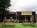 The Rigger pub, Elton (2).JPG 4,320 × 3,240; 3.03 MB
-
 The Ring 'O' Bells - geograph.org.uk - 1725651.jpg 2,816 × 2,112; 1.58 MB
-
 The Rising Sun, near Marshfield Bank - geograph.org.uk - 365350.jpg 640 × 472; 124 KB
-
 The Rose & Crown, Allgreave - geograph.org.uk - 5441664.jpg 2,592 × 1,936; 1.71 MB
-
 The Rose and Crown - geograph.org.uk - 212415.jpg 640 × 480; 110 KB
-
 The Rose and Crown - geograph.org.uk - 504980.jpg 640 × 480; 151 KB
-
 The Sarn or is it The Queens Head^ - geograph.org.uk - 489104.jpg 640 × 427; 62 KB
-
 The Shady Oak Pub, Bates Mill - geograph.org.uk - 1830424.jpg 2,048 × 1,536; 599 KB
-
 The Shady Oak Public House - geograph.org.uk - 3654361.jpg 5,184 × 3,456; 3.03 MB
-
 The Ship Inn at Wincle - geograph.org.uk - 473327.jpg 640 × 498; 121 KB
-
 The Stamford Bridge pub and restaurant - geograph.org.uk - 2762461.jpg 4,000 × 3,000; 2.51 MB
-
 The Stamford Bridge pub, near Chester.JPG 3,648 × 2,736; 3.61 MB
-
 The Stanley Arms - geograph.org.uk - 1805126.jpg 4,000 × 3,000; 2.96 MB
-
 The Stanley Arms - geograph.org.uk - 2559284.jpg 3,648 × 2,736; 5.01 MB
-
 The Stanley Arms - geograph.org.uk - 693974.jpg 640 × 426; 90 KB
-

-
 The Three Greyhounds Public House - geograph.org.uk - 83936.jpg 640 × 480; 77 KB
-
 The Travellers Rest, Little Sutton, Cheshire.JPG 3,648 × 2,736; 3.59 MB
-

-
 The Wheatsheaf - geograph.org.uk - 44944.jpg 640 × 418; 145 KB
-

-
 The White Horse Inn, Great Barrow - geograph.org.uk - 2762774.jpg 4,000 × 3,000; 2.14 MB
-
 The White Lion at Alvanley - geograph.org.uk - 214278.jpg 640 × 481; 120 KB
-
 The White Lion in Hankelow - geograph.org.uk - 183752.jpg 640 × 480; 92 KB
-
 The White Lion pub, Childer Thornton.jpg 4,320 × 3,240; 2.92 MB
-
 The Windmill at Whiteley Green - geograph.org.uk - 4172587.jpg 3,264 × 2,448; 2.48 MB
-
 The Windmill Inn - geograph.org.uk - 248458.jpg 640 × 480; 104 KB
-
 The Windmill Inn at Tabley - geograph.org.uk - 80905.jpg 640 × 480; 101 KB
-
 Thorn Inn - geograph.org.uk - 283690.jpg 640 × 480; 116 KB
-
 Travellers Rest Moulton - geograph.org.uk - 288650.jpg 640 × 480; 81 KB
-
 Upton-by-Chester (9).JPG 4,320 × 3,240; 2.84 MB
-
 Vale Royal Abbey Arms.jpg 1,800 × 1,350; 538 KB
-
 Wheatsheaf Inn - geograph.org.uk - 2862978.jpg 640 × 427; 329 KB
-
 Wheatsheaf Inn, Ness - geograph.org.uk - 1495728.jpg 640 × 480; 70 KB
-
 White Hart, Hough.jpg 640 × 480; 77 KB
-
 White Lion PH, Alvanley - geograph.org.uk - 433077.jpg 640 × 480; 154 KB
-
 Wild Boar Inn - geograph.org.uk - 1587699.jpg 640 × 480; 75 KB
-
 Willey Moor Lock - geograph.org.uk - 522142.jpg 640 × 480; 159 KB


.jpg)


.jpg)


.JPG)
.JPG)


.jpg)

.JPG)


_-_geograph.org.uk_-_1311027.jpg)


.jpg)


_-_geograph.org.uk_-_1350521.jpg)


_-_geograph.org.uk_-_2147904.jpg)


.JPG)
.JPG)


.JPG)
.JPG)


.JPG)


