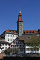
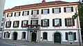
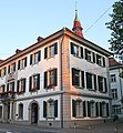
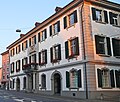
Category:Rathaus Frauenfeld
Jump to navigation
Jump to search
| Object location | | View all coordinates using: OpenStreetMap |
|---|
 | |||||
| Upload media | |||||
| Instance of | |||||
|---|---|---|---|---|---|
| Part of | |||||
| Location |
| ||||
| Street address |
| ||||
| Heritage designation |
| ||||
 | |||||
|
This is a category about a cultural property of national significance in Switzerland with KGS number 5019
|
Media in category "Rathaus Frauenfeld"
The following 21 files are in this category, out of 21 total.
-
 20080507 1708MESZ Schloss Frauenfeld 1680x1050 HDR.jpg 1,680 × 1,050; 1.63 MB
-
 CH-NB - Das Rathaus = L'Hôtel de ville -Randvignette unten Mitte rechts- - Collection Gugelmann - GS-GUGE-83-45-12.tif 1,375 × 1,049, 2 pages; 4.19 MB
-
 CH-NB - Grafiken Orts- und Landschaftsansichten - GS-GRAF-ANSI-TG-16.tif 7,754 × 5,409, 2 pages; 120.06 MB
-
 Frauenfeld Rathaus am Abend.JPG 3,352 × 2,138; 1.41 MB
-
 Frauenfeld rathaus.jpg 300 × 450; 36 KB
-
 Frauenfeld Schloss2.jpg 1,152 × 864; 362 KB
-
 Frauenfeld-Rathaus.jpg 1,333 × 2,012; 1.8 MB
-
 FrauenfeldRathausFront.JPG 4,224 × 2,376; 6.76 MB
-
 FrauenfldFreieStr.JPG 4,046 × 2,376; 6.82 MB
-
 FrauenfldRathaus.JPG 2,376 × 2,558; 4.37 MB
-
 FrauenfledRathausTor.JPG 2,376 × 3,564; 2.93 MB
-
 FraunfldRathaus.JPG 2,375 × 2,013; 3.67 MB
-
 FrdfldStrasseEvanglKirche.JPG 2,376 × 2,521; 4.27 MB
-
 FrnfldRathausAbend.JPG 4,224 × 2,376; 6.85 MB
-
 FrnfldRathausFront.JPG 4,171 × 2,308; 6.14 MB
-
 FrnfldRathausPortalBalkon.JPG 2,278 × 4,131; 5.51 MB
-
 FrnfldSonne.JPG 4,224 × 2,376; 6.11 MB
-
 Rathaus Frauenfeld (Bj. ab 1667).jpg 2,733 × 4,000; 5.01 MB
-
 Rathaus in Frauenfeld (2013).jpg 2,736 × 3,648; 6.32 MB
-
 Rathaus in Frauenfeld.jpg 2,669 × 2,447; 4.03 MB
-
 Sämannbrunnen und Rathaus in Frauenfeld (2013).jpg 2,516 × 3,354; 5.41 MB


.jpg)
.jpg)
.jpg)