Category:Rathaus Zittau
Jump to navigation
Jump to search
| Object location | | View all coordinates using: OpenStreetMap |
|---|
rathaus in Zittau, Germany  | |||||
| Upload media | |||||
| Instance of | |||||
|---|---|---|---|---|---|
| Location | Zittau, Görlitz, Saxony, Germany | ||||
| Architectural style | |||||
| Architect | |||||
| Significant event |
| ||||
 | |||||
| (Wikidata) |
Media in category "Rathaus Zittau"
The following 48 files are in this category, out of 48 total.
-
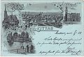
 05269-Zittau-1904-Blick über die Stadt zum Rathaus-Brück & Sohn Kunstverlag.jpg 1,519 × 1,000; 677 KB
-
 05272-Zittau-1904-Blick nach Zittau-Brück & Sohn Kunstverlag.jpg 1,528 × 1,000; 483 KB
-
 07305-Zittau-1906-Böhmische Straße-Brück & Sohn Kunstverlag.jpg 1,528 × 1,000; 585 KB
-
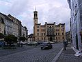
 20031003200DR Zittau Rathaus am Markt.jpg 2,561 × 2,022; 1.9 MB
-
 20031003250DR Zittau Marktplatz Rolandbrunnen Rathaus.jpg 2,577 × 1,959; 2.12 MB
-
 Das Zittauer Rathaus.jpg 800 × 600; 492 KB
-
 Markt 1-2 Zittau.jpg 768 × 900; 458 KB
-
 Markt 1-3 Zittau.jpg 780 × 900; 361 KB
-
 Marktplatz Zittau 2016.jpg 3,666 × 2,460; 2.36 MB
-
 Marktstrasse, 02763, Zittau, Sachsen, Deutschland - panoramio (1).jpg 1,024 × 768; 719 KB
-
 Marktstrasse, 02763, Zittau, Sachsen, Deutschland - panoramio (3).jpg 768 × 1,024; 588 KB
-
 Marktstrasse, 02763, Zittau, Sachsen, Deutschland - panoramio (4).jpg 1,024 × 768; 714 KB
-
 Marktstrasse, 02763, Zittau, Sachsen, Deutschland - panoramio (5).jpg 1,024 × 768; 698 KB
-
 MondscheinkarteZittau.jpg 1,638 × 1,115; 815 KB
-
 Rathaus (Zittau).jpg 1,691 × 1,592; 1.04 MB
-
 Rathaus und Brunnen (Zittau).jpg 2,808 × 1,869; 3.31 MB
-
 Rathaus Zittau 2022.jpg 5,152 × 3,864; 5.2 MB
-
 Rathaus Zittau in Abendsonne.jpg 3,526 × 2,592; 2.39 MB
-
 RathausZittau.jpg 700 × 499; 79 KB
-
 Sachsen sonst und jetzt (334)a.jpg 2,208 × 1,403; 1.36 MB
-
 ZI-Rathaus-1.jpg 3,356 × 2,517; 2.13 MB
-
 ZI-Rathaus-2.jpg 3,230 × 2,423; 1.95 MB
-
 ZI-RathausNO.JPG 2,506 × 3,345; 585 KB
-
 ZI-Rathausturm.JPG 2,736 × 3,648; 1.29 MB
-
 Zittau (Żytawa) Rathaus (Ratusz) 05.JPG 3,088 × 2,056; 2.68 MB
-
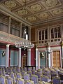 Zittau Bürgersaal.JPG 1,536 × 2,048; 1.56 MB
-
 Zittau plein 2022 1.jpg 5,472 × 3,648; 7.1 MB
-
 Zittau Rathaus (9919).jpg 2,848 × 4,288; 5.69 MB
-
 Zittau Rathaus 05.jpg 4,725 × 3,597; 8.88 MB
-
 Zittau Rathaus Frauenstraße (9893).jpg 2,848 × 4,288; 5.34 MB
-
 Zittau Rathaus Klosterstraße (9916).jpg 2,848 × 4,288; 5.19 MB
-
 Zittau Rathaus.JPG 1,200 × 1,155; 142 KB
-
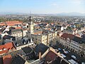 Zittau von oben.jpg 1,024 × 768; 258 KB
-
 Zittau-06.IV.07-151.jpg 1,024 × 768; 668 KB
-
 Zittau-06.IV.07-174.jpg 1,024 × 768; 579 KB
-
 Zittau-rathaus.jpg 1,000 × 750; 226 KB
-
 ZittauFrauenstr.JPG 2,144 × 2,864; 747 KB
-
 ZittauRathP.JPG 2,026 × 2,545; 945 KB
-
 ZittauRathsP2.jpg 2,864 × 2,144; 1 MB
-
 Żytawa Brama ratusza.JPG 2,036 × 2,850; 2.42 MB
-
 Żytawa Ratusz 03.JPG 2,056 × 2,220; 1.99 MB
-
 Żytawa Rynek z ratuszem.jpg 2,772 × 1,898; 2.81 MB
-
 Žitava radnice 1.jpg 2,048 × 1,379; 2.54 MB
-
 Žitava radnice 10.jpg 2,048 × 1,197; 2.17 MB
-
 Žitava radnice 1a.jpg 2,048 × 1,294; 2.34 MB
-
 Žitava radnice 2.jpg 2,048 × 1,082; 1.94 MB
-
 Žitava radnice 3.jpg 2,048 × 1,294; 2.28 MB
-
 Žitava radnice 4.jpg 2,048 × 1,399; 2.43 MB


.jpg)
.jpg)
.jpg)
.jpg)

.jpg)
.jpg)


a.jpg)


_Rathaus_(Ratusz)_05.JPG)


.jpg)

.jpg)
.jpg)


