Category:Ravines
Vai alla navigazione
Vai alla ricerca
incisioni erosive scavate dalle acque  | |||||
| Carica un file multimediale | |||||
| Sottoclasse di | |||||
|---|---|---|---|---|---|
| Distinto da | |||||
| |||||
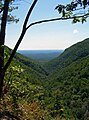
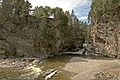
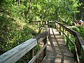
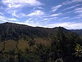
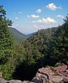
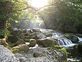
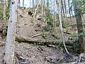
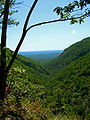
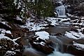
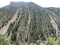
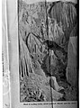
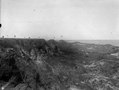
A ravine is similar to a canyon or gorge, but smaller, produced by running water.

Sottocategorie
Questa categoria contiene le 14 sottocategorie indicate di seguito, su un totale di 14.
*
C
- Chlusenbrücke (4 F)
G
- Gilfenklamm (20 F)
H
- Hammerlöcher (3 F)
Q
R
- Ravine Gardens State Park (33 F)
- Rua da Barroca (Lisbon) (1 F)
T
- Tekizha Creek (22 F)
Pagine nella categoria "Ravines"
Questa categoria contiene un'unica pagina, indicata di seguito.
File nella categoria "Ravines"
Questa categoria contiene 162 file, indicati di seguito, su un totale di 162.
-
 300mm full zoom lens of the mouth of mount Mayon Volcano, Philippines.jpg 4 272 × 2 848; 7,64 MB
-
 Allt Chreaga Dubha - geograph.org.uk - 403141.jpg 640 × 480; 111 KB
-

-
 Barranc d'Escuriet (Castelló de la Ribera-País Valencià), 2.JPG 2 248 × 4 000; 4,51 MB
-
 Barranc d'Escuriet (Castelló de la Ribera-País Valencià).JPG 2 248 × 4 000; 4,72 MB
-
 Barranc de Carrasquer i la Pobla de Roda.jpg 3 676 × 1 828; 1,83 MB
-
 Barranc del Castellet.jpg 3 744 × 2 050; 3,86 MB
-
 Barranc del Senyor (Alginet).jpg 4 000 × 3 000; 1,55 MB
-
 Barranco de Erques.jpg 1 600 × 694; 389 KB
-
 Bild från familjen von Hallwyls resa genom Algeriet och Tunisien, 1889-1890 - Hallwylska museet - 92014.tif 5 602 × 3 735, 2 pagine; 59,92 MB
-
 Bild från familjen von Hallwyls resa genom Algeriet och Tunisien, 1889-1890 - Hallwylska museet - 92015.tif 3 735 × 5 603, 2 pagine; 59,93 MB
-
 Bild från familjen von Hallwyls resa genom Algeriet och Tunisien, 1889-1890 - Hallwylska museet - 92018.tif 3 712 × 5 567, 2 pagine; 59,18 MB
-
 Bild från familjen von Hallwyls resa genom Algeriet och Tunisien, 1889-1890 - Hallwylska museet - 92055.tif 3 721 × 5 581, 2 pagine; 59,47 MB
-
 Bild från familjen von Hallwyls resa genom Algeriet och Tunisien, 1889-1890. "Chiffa-ravinen - Hallwylska museet - 92056.tif 3 744 × 5 616, 2 pagine; 60,21 MB
-
 Bild från familjen von Hallwyls resa genom Algeriet och Tunisien, 1889-1890. "Constantine - Hallwylska museet - 92013.tif 5 616 × 3 744, 2 pagine; 60,21 MB
-
 Bild från familjen von Hallwyls resa genom Algeriet och Tunisien, 1889-1890. - Hallwylska museet - 92057.tif 3 744 × 5 616, 2 pagine; 60,21 MB
-

-

-
 Denevér-szakadék, Széchenyihegy, Hegyvidék, 2016 Budapest.jpg 3 264 × 2 448; 1,72 MB
-
 Die Gartenlaube (1858) b 138.jpg 893 × 1 273; 481 KB
-
 Down The Ravine (173585839).jpeg 1 365 × 2 048; 1,07 MB
-
 East view over Platte Clove, NY.jpg 1 836 × 2 479; 3,73 MB
-
 Eastern ravine at Fort Azatlan.jpg 2 816 × 2 112; 4,14 MB
-
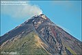
 El misti.jpg 640 × 416; 48 KB
-
 Elvegjel.jpg 1 200 × 1 600; 313 KB
-
 Erdrutsch im Küsnachter Tobel Seite Allmend.jpg 3 888 × 5 184; 7,68 MB
-
 ETH-BIB-Ravines, Montenol, Clos du Doubs-LBS H1-014851.tif 6 753 × 4 625; 89,51 MB
-
 ETH-BIB-Ravines, Montenol, Clos du Doubs-LBS H1-014852.tif 6 794 × 4 625; 90,06 MB
-
 Ferrocarril Mexicano railroad (21222649964).jpg 1 000 × 688; 600 KB
-
 Ferrocarril Mexicano railroad (21605879178).jpg 1 000 × 688; 601 KB
-
 Ferrocarriles Nacionales de Mexico railroad bridge, Mexico (21833529652).jpg 1 000 × 733; 467 KB
-
 Ferrocarriles Nacionales de Mexico railroad tunnel, Mexico (21658527969).jpg 1 000 × 733; 503 KB
-
 Fort Amanda ravine.jpg 2 112 × 2 816; 4,08 MB
-
 Fresta de luz em caverna.jpg 5 760 × 3 840; 2,36 MB
-
 Fryajuvet.jpg 3 684 × 2 456; 3,51 MB
-
 Gangani ravines , the grand canyon of Bengal.jpg 3 648 × 2 056; 5,1 MB
-
 Gesperrter Fussweg Steinschlag im Küsnachter Tobel.jpg 3 888 × 5 184; 7,64 MB
-
 Gold Head Branch SP ravine path01.jpg 2 448 × 3 264; 3,27 MB
-
 Gold Head Branch SP ravine path02.jpg 2 448 × 3 264; 2 MB
-
 Gold Head Branch SP ravine path03.jpg 3 264 × 2 448; 3,21 MB
-
 Gold Head Branch SP ravine path04.jpg 2 448 × 3 264; 1,79 MB
-
 Gold Head Branch SP ravine path05.jpg 3 264 × 2 448; 1,55 MB
-
 Gold Head Branch SP ravine path06.jpg 3 264 × 2 448; 2,51 MB
-
 Gold Head Branch SP ravine path07.jpg 2 448 × 3 264; 3,43 MB
-
 Gold Head Branch SP ravine stream01.jpg 3 264 × 2 448; 3,16 MB
-
 Gold Head Branch SP ravine stream02.jpg 3 264 × 2 448; 3,21 MB
-
 Gold Head Branch SP ravine stream03.jpg 3 264 × 2 448; 1,21 MB
-
 Gold Head Branch SP ravine01.jpg 3 264 × 2 448; 3,53 MB
-
 Gold Head Branch SP ravine02.jpg 3 264 × 2 448; 3,18 MB
-
 Gunung Kursi.jpg 4 096 × 3 072; 4,73 MB
-
 Haraldssund, Faroe Islands (3).JPG 2 560 × 1 704; 2,52 MB
-
 HiLL.jpg 5 184 × 3 456; 17,43 MB
-
 Horsetails in snow.png 3 054 × 2 186; 12,92 MB
-
 Jordania Petra Al-Khazeneh czyli Skarbiec Faraona 31.JPG 2 304 × 3 072; 2,79 MB
-
 Kaaterskill Clove.jpg 2 748 × 3 360; 6,69 MB
-
 Kikuchi-Keikoku Hirogawara.JPG 2 304 × 1 728; 2,34 MB
-
 Klippor vid stranden. Amborovy. Madagaskar - SMVK - 022004.tif 3 555 × 2 734; 55,64 MB
-
 Kourtaliotiko Bogen.jpg 1 410 × 1 860; 562 KB
-
 Kungsklyftan.jpg 2 112 × 2 816; 1,07 MB
-
 Küsnachter Tobel Hangrutsch unterhalb Drachenhöhle 1.jpg 5 184 × 3 888; 8,38 MB
-
 Lonesome Ridge WSA (9469127925).jpg 5 614 × 3 742; 15,52 MB
-
 Lonesome Ridge WSA (9469159079).jpg 5 614 × 3 742; 20,06 MB
-
 Luchon , ravin de Esbatet (^) - Fonds Trutat - MHNT.PHa.912.L178.jpg 2 048 × 1 538; 797 KB
-
 Merapi and 6 other Volcanoes in Java Indonesia.jpg 2 331 × 1 384; 830 KB
-
 Merapi banner.jpg 2 331 × 341; 172 KB
-
 Moremi gorge 2.jpg 683 × 983; 994 KB
-
 Moremi gorge1.jpg 677 × 977; 999 KB
-
 Mount merbabu.jpg 4 272 × 2 848; 2,16 MB
-
 Murgang im Küsnachter Tobel bei Drachenhöhle.jpg 5 184 × 3 888; 5,33 MB
-
 Narragansett Trail - Green Fall River ravine south of Green Fall Pond.jpg 1 936 × 2 592; 2,27 MB
-
 Normanskill Farm Bridge, Albany, NY, from ravine.jpg 1 024 × 768; 186 KB
-
 Ovrag.jpg 6 000 × 4 000; 8,13 MB
-
 Palmstrand i bakgrunden. Amborovy. Madagaskar - SMVK - 022003.tif 3 450 × 2 781; 54,93 MB
-
 Pierre-Auguste Renoir - Paysage algérien.jpg 2 562 × 2 058; 1,69 MB
-
 Platte Clove.jpg 806 × 1 075; 346 KB
-
 PSM V54 D495 Lower part of death gulch.jpg 1 670 × 1 686; 503 KB
-
 PSM V54 D497 The gulch and its latest victim.jpg 1 681 × 1 670; 447 KB
-
 Quebrada, Valle del Lunarejo, Vista superior, Cerros chatos..JPG 4 320 × 3 240; 5,75 MB
-
 Ravine Couleuvre 2.jpg 1 960 × 4 032; 4,52 MB
-
 Ravine Couleuvre à Deshaies.jpg 1 960 × 4 032; 3,93 MB
-
 Ravine in Lambafell.jpg 1 138 × 1 500; 661 KB
-
 Ravine near Ad-Deir, Petra.jpg 2 700 × 3 521; 7,56 MB
-
 Ravine Scipion 2.jpg 1 960 × 4 032; 5,57 MB
-
 Rio Grande Gorge.jpg 2 272 × 1 704; 799 KB
-
 Rive, Roberto (18..-1889) - Sorrento - Ravina e ponte.jpg 772 × 995; 472 KB
-
 Rugged-winter-ravine-waterfall - West Virginia - ForestWander.jpg 5 616 × 3 744; 3,01 MB
-
 Río Ara oeste Boltaña 01.JPG 4 896 × 3 672; 7,24 MB
-
 Sand Stone Eroding Ravine(GN04757).jpg 2 448 × 3 264; 750 KB
-
 Skookum Gulch, Yukon Territory, ca 1898 (HEGG 816).jpeg 768 × 622; 128 KB
-
 Snowy-winter-wv-ravine-waterfall - West Virginia - ForestWander.jpg 5 616 × 3 744; 6,79 MB
-
 Start point of the Prosotsani gorge, Drama.jpg 3 942 × 2 462; 3,42 MB
-
 Stream at the Walhalla ravine.jpg 1 024 × 768; 764 KB
-
 Södra delen av ön Mahakamby. Mahakamby, Île Mahakamby. Madagaskar - SMVK - 022024.tif 3 573 × 2 694; 55,1 MB
-
 Teichbachschlucht.JPG 1 280 × 960; 437 KB
-
 Texel - Hoge Berg - Doolhof - ICE Photocompilation Viewing Down, East & Up.jpg 2 746 × 4 302; 16,13 MB
-
 Texel - Hoge Berg - Doolhof - July 2010 04.jpg 6 048 × 4 032; 27,99 MB
-
 Texel - Hoge Berg - Doolhof - View East & Down I.jpg 6 048 × 4 032; 30,05 MB
-
 Texel - Hoge Berg - Doolhof - View ENE IV.jpg 6 048 × 4 032; 28,43 MB
-
 Texel - Hoge Berg - Doolhof - View ESE III.jpg 4 032 × 6 048; 26,08 MB
-
 The American Museum journal (c1900-(1918)) (18160980995).jpg 2 032 × 2 790; 1,72 MB
-
 The ravine of Nant y Llestri - geograph.org.uk - 694963.jpg 640 × 480; 130 KB
-
 The top of the Afon Gafr ravine - geograph.org.uk - 436576.jpg 640 × 480; 156 KB
-
 The upper reaches of Wemmergill Beck - geograph.org.uk - 594191.jpg 640 × 480; 183 KB
-
 Tonilita Barranca (21833529492).jpg 1 000 × 733; 530 KB
-
 Torrente 2.JPG 2 048 × 1 536; 1,39 MB
-
 View down a ravine (Unsplash).jpg 5 184 × 3 456; 2,54 MB
-
 Walhalla-Ravine.jpg 213 × 320; 112 KB
-
 Wellhopehead - geograph.org.uk - 135208.jpg 640 × 480; 80 KB
-
 Winter-waterfall-ravine - West Virginia - ForestWander.jpg 3 744 × 5 616; 3,48 MB
-
 Winter-waterfall-rocks-ravine - West Virginia - ForestWander.jpg 3 744 × 5 616; 2,34 MB
-
 YellowRiver Gorges.jpg 1 464 × 1 536; 900 KB
-
 Allen's Cleugh - geograph.org.uk - 158552.jpg 640 × 480; 118 KB
-
 Allt Coire a' Mhusgain - geograph.org.uk - 238899.jpg 478 × 640; 186 KB
-
 Allt Glac na Doimhne tributary - geograph.org.uk - 1098200.jpg 640 × 480; 80 KB
-
 Allt Gobhlach - geograph.org.uk - 1055942.jpg 480 × 640; 89 KB
-
 Allt Phadruig - geograph.org.uk - 532860.jpg 640 × 427; 93 KB
-
 Approaching Ceunant Blaen-y-Cwm - geograph.org.uk - 558587.jpg 640 × 339; 61 KB
-
 Black Gutter - geograph.org.uk - 819073.jpg 640 × 480; 78 KB
-
 Branksome, ravine in Martello Woods - geograph.org.uk - 1427572.jpg 640 × 480; 102 KB
-
 Cargill's Leap - geograph.org.uk - 305583.jpg 399 × 600; 92 KB
-
 Ceunant Afon Gafr Ravine - geograph.org.uk - 436561.jpg 640 × 480; 192 KB
-

-
 Ceunant Ifan. John's Ravine - geograph.org.uk - 398355.jpg 640 × 480; 111 KB
-
 Ceunant Mawr from Pont Gwastadannas - geograph.org.uk - 408327.jpg 480 × 640; 105 KB
-
 Ceunant yr Allt from Dros-bern - geograph.org.uk - 253907.jpg 640 × 480; 80 KB
-
 Ceunant-Ravine - geograph.org.uk - 398490.jpg 640 × 480; 126 KB
-
 Cons Cleugh - geograph.org.uk - 342559.jpg 480 × 640; 68 KB
-
 Cote Gill - geograph.org.uk - 44345.jpg 640 × 480; 150 KB
-
 Cwm, Llandudoch-St Dogmaels - geograph.org.uk - 329127.jpg 640 × 480; 114 KB
-
 Darden Cleugh - geograph.org.uk - 521163.jpg 640 × 480; 84 KB
-
 Drygill Beck upper reaches - geograph.org.uk - 196261.jpg 640 × 478; 155 KB
-
 Dundale Griff - geograph.org.uk - 692703.jpg 480 × 640; 165 KB
-
 Eas Garbh - geograph.org.uk - 24839.jpg 640 × 357; 72 KB
-
 Ettrick Water - geograph.org.uk - 237507.jpg 480 × 640; 134 KB
-
 Grainings Beck - geograph.org.uk - 378486.jpg 640 × 480; 173 KB
-
 High Beck Ennerdale - geograph.org.uk - 427445.jpg 427 × 640; 124 KB
-
 In the Gafr ravine - geograph.org.uk - 436586.jpg 640 × 480; 140 KB
-
 Killiecrankie - view down the River Garry - geograph.org.uk - 360733.jpg 480 × 640; 135 KB
-
 Knock Ore Gill - geograph.org.uk - 158353.jpg 640 × 480; 101 KB
-
 Leap Linn - geograph.org.uk - 235785.jpg 640 × 480; 100 KB
-
 Little Gill in mist - geograph.org.uk - 73702.jpg 597 × 400; 53 KB
-
 Long Grain - geograph.org.uk - 136640.jpg 640 × 480; 78 KB
-
 Mallwyd Bridge - geograph.org.uk - 669487.jpg 640 × 427; 119 KB
-
 Nant Fforch - geograph.org.uk - 575884.jpg 640 × 480; 72 KB
-
 Puck's Glen - geograph.org.uk - 32454.jpg 640 × 480; 166 KB
-
 Ravine - geograph.org.uk - 52683.jpg 640 × 480; 308 KB
-
 Ravine above Geodh' Eisgaidh - geograph.org.uk - 496287.jpg 640 × 427; 102 KB
-
 Ravine near Coumeenoole - geograph.org.uk - 16708.jpg 640 × 480; 444 KB
-
 Ravine near Fox Hill - geograph.org.uk - 483231.jpg 640 × 480; 154 KB
-
 Ravine Near Leaplish Crag - geograph.org.uk - 204558.jpg 480 × 640; 189 KB
-
 Ravine of the Nant Dinas - geograph.org.uk - 553865.jpg 640 × 480; 107 KB
-
 Ravine of the River Lair - geograph.org.uk - 691098.jpg 1 000 × 673; 353 KB
-
 Ravine, Burn Todd - geograph.org.uk - 654039.jpg 640 × 480; 102 KB
-
 Ravine, Coirean Riabhach - geograph.org.uk - 241298.jpg 480 × 640; 280 KB
-
 River Coe Ravine - geograph.org.uk - 395107.jpg 480 × 640; 100 KB
-
 Soap Cove - geograph.org.uk - 371683.jpg 640 × 480; 93 KB
-
 The edge of the Mawddach chasm - geograph.org.uk - 477174.jpg 640 × 402; 100 KB
-
 The gorge on the Tees below High Force - geograph.org.uk - 344831.jpg 585 × 403; 114 KB
-
 Willy Sike - geograph.org.uk - 378685.jpg 640 × 480; 151 KB
-
 Ограждение промоины.jpg 2 592 × 1 944; 4,19 MB
-
 Палеогеновые глины в Восточном Казахстане. Paleogene clays. Eastern Kazakhstan.JPG 2 000 × 1 328; 794 KB
-
 Աղջկա բերդի ձոր, Կապան.jpg 3 627 × 2 497; 2,78 MB


,_2.JPG)
.JPG)


.jpg)


_b_138.jpg)
.jpeg)


.jpg)
.jpg)
.jpg)
.jpg)


.JPG)


.jpg)
.jpg)
_-_Fonds_Trutat_-_MHNT.PHa.912.L178.jpg)


_-_Sorrento_-_Ravina_e_ponte.jpg)


.jpg)
.jpeg)


)_(18160980995).jpg)


.jpg)

.jpg)


