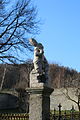
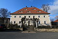
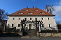
Category:Rittergut Wohla
Jump to navigation
Jump to search
| Object location | | View all coordinates using: OpenStreetMap |
|---|
 | |||||
| Upload media | |||||
| Instance of | |||||
|---|---|---|---|---|---|
| Location | Löbau, Görlitz, Saxony, Germany | ||||
| Street address |
| ||||
| Heritage designation | |||||
| Inception |
| ||||
 | |||||
Media in category "Rittergut Wohla"
The following 46 files are in this category, out of 46 total.
-
 20080428700DR Wohla (Löbau) Barockschloß Hotel.jpg 2,411 × 1,694; 5.65 MB
-
 20080428705DR Wohla (Löbau) Barockschloß Hotel.jpg 2,422 × 1,701; 4.64 MB
-
 20080428710DR Wohla (Löbau) Barockschloß Hotel.jpg 2,377 × 1,666; 4.3 MB
-
 20080428715DR Wohla (Löbau) Barockschloß Hotel.jpg 2,454 × 1,694; 4.46 MB
-
 20080428720DR Wohla (Löbau) Barockschloß Diele OG.jpg 2,468 × 1,654; 3 MB
-
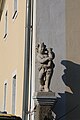
 20080428745DR Wohla (Löbau) Schloß Sandsteinputte.jpg 1,704 × 2,343; 3.38 MB
-
 2016-03-26 Rittergut Wohla by DCB.jpg 5,472 × 3,648; 6.68 MB
-
 2016-03-26 Rittergut Wohla by DCB–1.jpg 5,472 × 3,648; 7.45 MB
-
 2016-03-26 Rittergut Wohla by DCB–10.jpg 3,648 × 5,472; 7.1 MB
-
 2016-03-26 Rittergut Wohla by DCB–11.jpg 3,648 × 5,472; 7.16 MB
-
 2016-03-26 Rittergut Wohla by DCB–12.jpg 3,648 × 5,472; 7.01 MB
-
 2016-03-26 Rittergut Wohla by DCB–13.jpg 3,648 × 5,472; 7.06 MB
-
 2016-03-26 Rittergut Wohla by DCB–14.jpg 3,648 × 5,472; 5.95 MB
-
 2016-03-26 Rittergut Wohla by DCB–15.jpg 3,648 × 5,472; 5.87 MB
-
 2016-03-26 Rittergut Wohla by DCB–16.jpg 3,648 × 5,472; 4.96 MB
-
 2016-03-26 Rittergut Wohla by DCB–17.jpg 3,648 × 5,472; 5.01 MB
-
 2016-03-26 Rittergut Wohla by DCB–18.jpg 3,648 × 5,472; 6.05 MB
-
 2016-03-26 Rittergut Wohla by DCB–19.jpg 3,648 × 5,472; 5.72 MB
-
 2016-03-26 Rittergut Wohla by DCB–2.jpg 5,472 × 3,648; 6.06 MB
-
 2016-03-26 Rittergut Wohla by DCB–20.jpg 3,648 × 5,472; 6.15 MB
-
 2016-03-26 Rittergut Wohla by DCB–21.jpg 3,648 × 5,472; 4.81 MB
-
 2016-03-26 Rittergut Wohla by DCB–22.jpg 3,648 × 5,472; 6.87 MB
-
 2016-03-26 Rittergut Wohla by DCB–23.jpg 3,648 × 5,472; 4.9 MB
-
 2016-03-26 Rittergut Wohla by DCB–24.jpg 3,648 × 5,472; 6.04 MB
-
 2016-03-26 Rittergut Wohla by DCB–25.jpg 3,648 × 5,472; 6.61 MB
-
 2016-03-26 Rittergut Wohla by DCB–26.jpg 5,472 × 3,648; 8.58 MB
-
 2016-03-26 Rittergut Wohla by DCB–27.jpg 5,472 × 3,648; 8.46 MB
-
 2016-03-26 Rittergut Wohla by DCB–28.jpg 5,472 × 3,648; 7.86 MB
-
 2016-03-26 Rittergut Wohla by DCB–29.jpg 5,472 × 3,648; 8.08 MB
-
 2016-03-26 Rittergut Wohla by DCB–3.jpg 5,472 × 3,648; 6.97 MB
-
 2016-03-26 Rittergut Wohla by DCB–30.jpg 5,472 × 3,648; 7.96 MB
-
 2016-03-26 Rittergut Wohla by DCB–31.jpg 5,472 × 3,648; 6.56 MB
-
 2016-03-26 Rittergut Wohla by DCB–32.jpg 3,648 × 5,472; 8.21 MB
-
 2016-03-26 Rittergut Wohla by DCB–33.jpg 3,648 × 5,472; 8.54 MB
-
 2016-03-26 Rittergut Wohla by DCB–34.jpg 5,472 × 3,648; 7.92 MB
-
 2016-03-26 Rittergut Wohla by DCB–35.jpg 5,472 × 3,648; 4.93 MB
-
 2016-03-26 Rittergut Wohla by DCB–36.jpg 5,472 × 3,648; 8.9 MB
-
 2016-03-26 Rittergut Wohla by DCB–37.jpg 3,648 × 5,472; 9.42 MB
-
 2016-03-26 Rittergut Wohla by DCB–38.jpg 5,472 × 3,648; 8.78 MB
-
 2016-03-26 Rittergut Wohla by DCB–4.jpg 5,472 × 3,648; 7.88 MB
-
 2016-03-26 Rittergut Wohla by DCB–5.jpg 5,472 × 3,648; 7.84 MB
-
 2016-03-26 Rittergut Wohla by DCB–6.jpg 5,472 × 3,648; 9.8 MB
-
 2016-03-26 Rittergut Wohla by DCB–7.jpg 3,648 × 5,472; 9.01 MB
-
 2016-03-26 Rittergut Wohla by DCB–8.jpg 3,648 × 5,472; 8.78 MB
-
 2016-03-26 Rittergut Wohla by DCB–9.jpg 3,648 × 5,472; 8.15 MB
-
 Schloß Wohla.JPG 1,000 × 682; 402 KB
_Barockschlo%C3%9F_Hotel.jpg)
_Barockschlo%C3%9F_Hotel.jpg)
_Barockschlo%C3%9F_Hotel.jpg)
_Barockschlo%C3%9F_Hotel.jpg)
_Barockschlo%C3%9F_Diele_OG.jpg)
_Schlo%C3%9F_Sandsteinputte.jpg)


