Category:Romford
Jump to navigation
Jump to search
town in northeast London, United Kingdom  | |||||
| Upload media | |||||
| Instance of | |||||
|---|---|---|---|---|---|
| Location |
| ||||
 | |||||
English: Romford is a large suburban area in northeast London, England and the administrative headquarters of the London Borough of Havering. It is located northeast of Charing Cross and is one of the major metropolitan centres identified in the London Plan. It was historically a market town in the county of Essex and formed the administrative centre of the liberty of Havering, until it was dissolved in 1892. Good road links and the opening of the railway station in 1839 were key to the development of the town It now forms one of the largest commercial, retail, entertainment and leisure districts outside central London (→romford). Also, it is a large postal town of outer London and encompasses postcode districts: RM1, RM2, RM3, RM4, RM5, RM6, RM7
Français : Romford est une ville de la banlieue nord-est de Londres, en Angleterre, et le chef-lieu administratif du district londonien de Havering. Elle est située à au nord-est de Charing Cross et est l'un des onze centres métropolitains identifiés par le plan londonien. Historiquement, Romford est un bourg du comté d'Essex et a été le centre administratif de la Royal Liberty of Havering jusqu'à sa dissolution en 1892. Les axes routiers et l'ouverture d'une gare ferroviaire en 1839 ont été les clés du développement de la ville et l'histoire de Romford est marquée par une transition de l'agriculture à l'industrie, puis au commerce et au détail. Englobé par la croissance suburbaine de Londres, Romford s'est étendu et sa population a augmenté. Romford est devenu un district municipal (municipal borough) en 1937 et fait partie du Grand Londres depuis 1965. C'est un des principaux centre de commerce, de loisir et de divertissement en dehors de Londre, disposant d'une économie nocturne développée. (→Romford)
Italiano: Romford è una città del Regno Unito, appartenente al distretto londinese di Havering. (→Romford)
Nederlands: Romford is een wijk in het Londense bestuurlijke gebied Havering, in de regio Groot-Londen. (→Romford)
Română: Romford este o suburbie din cadrul regiunii Londra Mare, Anglia, situată în extremitatea nord-estică a aglomeraţiei londoneze. Romford aparţine din punct de vedere administrativ de burgul londonez Havering al cărui principal centru urban este. Până în 1965 a fost un oraş în comitatul Essex. (→Romford)
Simple English: Romford is a place in the east London Borough of Havering, England. It was first recorded as a town in 1153 in the Red Book of the Exchequer. The name "Romford" means "wide ford". The stream that flows through it was only later called "the Rom River" after the town. (→Romford)
Subcategories
This category has the following 26 subcategories, out of 26 total.
A
- A1251 road (England) (2 F)
B
- The Brewery, Romford (8 F)
- Brookside Theatre (5 F)
C
E
F
- Ray Fenwick (1 F)
G
H
- Hare Hall (6 F)
- Havering Museum (3 F)
- Havering Town Hall (9 F)
J
L
M
- Marks Manor House (3 F)
N
- Noak Hill, London (2 F)
O
- Oldchurch Hospital (6 F)
P
R
- Romford Greyhound Stadium (1 F)
- Romford Ice Arena (2 F)
- Romford Market (18 F)
- Romford War Memorial (3 F)
S
T
- The Mercury Mall (7 F)
- Time 107.5 (1 F)
Media in category "Romford"
The following 98 files are in this category, out of 98 total.
-
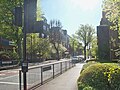
 'Office City', Romford - geograph.org.uk - 46864.jpg 514 × 640; 114 KB
-
 175 bus terminus, Hillrise Estate Romford.jpg 3,072 × 2,304; 1.36 MB
-
 ECR(1851) p57a - Romford.jpg 960 × 792; 188 KB
-
 Acer in snow April 2008.jpg 1,194 × 724; 183 KB
-
 Alan Buck.jpg 538 × 784; 57 KB
-

-
 Axis development london.jpg 1,024 × 768; 110 KB
-
 Blacks canal looking west.jpg 3,072 × 2,304; 1.46 MB
-
 Blacks canal.JPG 3,072 × 2,304; 1.52 MB
-
 Brook Road, rear of Raphael's Park, Gidea Park, Romford, Essex - panoramio.jpg 3,072 × 2,304; 1.13 MB
-
 Bus 2.JPG 2,560 × 1,920; 1.83 MB
-
 Canada goose blacks canal.jpg 1,207 × 1,600; 537 KB
-
 Church House, Romford - geograph.org.uk - 282602.jpg 640 × 611; 82 KB
-
 Cotleigh Road - geograph.org.uk - 367629.jpg 640 × 480; 86 KB
-
 Cottages at Romford by Mackay Hugh Baillie Scott Interior 01.png 996 × 706; 1.04 MB
-
 Cottages at Romford by Mackay Hugh Baillie Scott Interior 02.png 1,062 × 719; 1.14 MB
-
 Cottages at Romford by Mackay Hugh Baillie Scott Interior 03.png 984 × 706; 1.03 MB
-
 Cottages at Romford by Mackay Hugh Baillie Scott.png 1,122 × 706; 1.02 MB
-
-
 Eastern Avenue ( east , A.12 ) ^ Pettits Lane, Romford, Essex - panoramio.jpg 3,072 × 2,304; 721 KB
-
 Eastern Road, Romford - geograph.org.uk - 5343421.jpg 1,600 × 1,200; 481 KB
-
 Eastern Road, Romford - geograph.org.uk - 5343425.jpg 1,600 × 1,200; 580 KB
-
 Eastern Road, Romford - geograph.org.uk - 5343429.jpg 1,600 × 1,200; 580 KB
-
 Empty Debenhams in Romford.jpg 4,032 × 3,024; 3.12 MB
-
-
 Flickr - law keven - Take a walk with me.....jpg 3,888 × 2,592; 2.95 MB
-
 Footpath under Railway - geograph.org.uk - 367634.jpg 640 × 480; 82 KB
-
 Footpath under railway - geograph.org.uk - 367637.jpg 480 × 640; 53 KB
-
 Gas Works, Nursery Walk - geograph.org.uk - 336388.jpg 640 × 480; 91 KB
-
 Harold Court Junior School, Church Road, Harold Wood, Hornchrch, Essex - panoramio.jpg 3,072 × 2,304; 4.13 MB
-
 Havering romford welcome sign.jpg 1,024 × 768; 114 KB
-
 High Street, Romford - geograph.org.uk - 2009453.jpg 3,072 × 2,304; 2.3 MB
-
 Highfield Towers, Hillrise Estate, Romford.jpg 3,072 × 2,304; 1.38 MB
-
 Houses on corner of Western Road, Romford - geograph.org.uk - 5971136.jpg 1,024 × 768; 320 KB
-
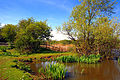
 Ingrebourne River, Harold Park - geograph.org.uk - 69848 (cropped).jpg 574 × 383; 102 KB
-
 Ingrebourne River, Harold Park - geograph.org.uk - 69848.jpg 640 × 427; 126 KB
-

-
 Kingfisher in Romford.jpg 3,024 × 4,032; 2.99 MB
-
 London from the Air - panoramio (1).jpg 4,320 × 3,240; 3.09 MB
-
 Main Road, Romford - geograph.org.uk - 5302893.jpg 1,990 × 1,454; 914 KB
-
 Market place romford.jpg 1,024 × 768; 98 KB
-
 Marshalls Park School (originally Pettits Lane School, Romford, Essex - panoramio.jpg 3,072 × 2,304; 805 KB
-
 Mercury Gardens, Romford - geograph.org.uk - 46862.jpg 640 × 480; 90 KB
-
 Nat West Bank Romford - geograph.org.uk - 1775612.jpg 3,296 × 2,472; 1.89 MB
-
 Navestock, UK - panoramio.jpg 1,536 × 2,560; 1.07 MB
-
 North Street Romford - geograph.org.uk - 3022392.jpg 640 × 429; 61 KB
-
 North ^ South St - geograph.org.uk - 3022351.jpg 429 × 640; 65 KB
-
 Ordnance Survey One-Inch Sheet 107 London and Epping Forest, Published 1935.jpg 13,553 × 11,758; 19.72 MB
-
 Ordnance Survey One-Inch Sheet 107 London NE & Epping Forest, Published 1920.jpg 11,844 × 8,546; 12.67 MB
-
 Ordnance Survey One-Inch Sheet 161 London NE, Published 1940.jpg 11,021 × 12,814; 17.22 MB
-
 Pathfinder Luxury of Chadwell Heath Ford R226- Plaxton GCG 983K.jpg 1,608 × 971; 95 KB
-
 Petersfield Avenue, Harold Hill, Essex - panoramio.jpg 3,072 × 2,304; 3.82 MB
-
 Pettits Lane in Romford in the snow.jpg 3,072 × 2,304; 1.22 MB
-
 Phyllostachys Nigra in the snow April 2008.jpg 1,369 × 1,025; 414 KB
-
 Poster Essex RFA.jpg 1,911 × 2,852; 1.23 MB
-
 Premiere Cinema, Romford.jpg 2,268 × 2,359; 3.04 MB
-
 Princes Road, Romford - geograph.org.uk - 3488905.jpg 640 × 480; 69 KB
-
 Queen Street - geograph.org.uk - 367642.jpg 640 × 480; 86 KB
-
 Queens Court, Romford.jpg 2,246 × 2,727; 2.07 MB
-
 Raphael park lake in winter.jpg 3,019 × 1,698; 1.14 MB
-
-
 Redden Court School, Coombe Road, Harold Wood, Hornchurch, Essex - panoramio.jpg 3,072 × 2,304; 4.22 MB
-
 Richardson's Hall 1.jpg 4,096 × 2,638; 3.78 MB
-
 Richardson's Hall 2.jpg 4,096 × 2,893; 3.8 MB
-
 Romford - New Development, Liberty 2 - geograph.org.uk - 271977.jpg 640 × 624; 103 KB
-
 Romford 15 mile radius.png 1,126 × 1,080; 108 KB
-
 Romford borough 1911.png 2,742 × 1,769; 75 KB
-

-
 Romford County Court.jpg 2,048 × 1,536; 1.4 MB
-
 Romford fire station.JPG 2,048 × 1,484; 368 KB
-
 Romford hornchurch boundary marker.JPG 768 × 1,024; 200 KB
-
 Romford horror festival.jpg 1,080 × 1,080; 42 KB
-
 Romford Police Station - geograph.org.uk - 271979.jpg 640 × 461; 128 KB
-
 Romford Ring Road - geograph.org.uk - 46845.jpg 640 × 480; 79 KB
-
 Romford Rooftops - geograph.org.uk - 46849.jpg 640 × 480; 66 KB
-
 Romford station old LTS entrance.JPG 1,600 × 1,200; 418 KB
-
 Romford, Salvation Army Citadel - geograph.org.uk - 906037.jpg 640 × 480; 69 KB
-
 Romford, Stewards Walk - geograph.org.uk - 906100.jpg 640 × 480; 68 KB
-
 Romford, Trinity Methodist Church - geograph.org.uk - 905997.jpg 640 × 480; 77 KB
-
 Roofs and Spires, Romford - geograph.org.uk - 46866.jpg 455 × 640; 73 KB
-
 Shimmering and Dirty.jpg 4,032 × 3,024; 3.38 MB
-

-
 South Street, Romford - geograph.org.uk - 3488899.jpg 640 × 480; 62 KB
-
 South Street, Romford - geograph.org.uk - 4227678.jpg 4,000 × 3,000; 1.71 MB
-
 Street art fox in Romford.jpg 4,032 × 3,024; 5.81 MB
-
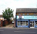
 The Dolphin center Romford.jpg 400 × 266; 37 KB
-
 The Gas Works, Romford - geograph.org.uk - 336391.jpg 640 × 480; 77 KB
-

-
 Victoria Road Romford - geograph.org.uk - 1280072.jpg 640 × 480; 79 KB
-
 Victoria Road Romford shop 2022.jpg 3,120 × 4,160; 2.48 MB
-
 Victoria Road, Romford, Essex - geograph.org.uk - 26368.jpg 640 × 480; 121 KB
-

-

-
 Wall with snow.jpg 2,304 × 3,072; 1.2 MB
-
 Waterloo Road, Romford - geograph.org.uk - 282561.jpg 640 × 480; 109 KB
-
 Western Road, Romford - geograph.org.uk - 282575.jpg 640 × 515; 107 KB
-
 Western Road, Romford - geograph.org.uk - 4172432.jpg 1,600 × 1,222; 328 KB
-
 Hornbeam pollard - geograph.org.uk - 585784.jpg 640 × 480; 168 KB


_p57a_-_Romford.jpg)


_%5E_Pettits_Lane,_Romford,_Essex_-_panoramio_-_Michael_A_Town.jpg)
_%5E_Pettits_Lane,_Romford,_Essex_-_panoramio.jpg)


.jpg)


.jpg)


