Category:Rossinière - Maison de la place
Jump to navigation
Jump to search
| Object location | | View all coordinates using: OpenStreetMap |
|---|
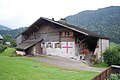
rural building in Rossinière in the canton of Vaud, Switzerland  | |||||
| Upload media | |||||
| Instance of | |||||
|---|---|---|---|---|---|
| Part of | |||||
| Location | Rossinière, Riviera-Pays-d'Enhaut District, canton Vaud, Switzerland | ||||
| Street address |
| ||||
| Heritage designation | |||||
| Inception |
| ||||
 | |||||
Media in category "Rossinière - Maison de la place"
This category contains only the following file.
-
 Rossinière - Maison de la place.jpg 6,048 × 4,032; 15.76 MB