Category:Spurstow
Jump to navigation
Jump to search
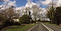
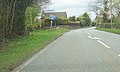
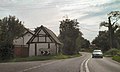
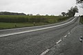
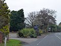
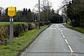
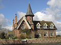
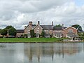
English: Spurstow is a village and civil parish in the unitary authority of Cheshire East and the ceremonial county of Cheshire, England, which is located 6½ miles to the north west of Nantwich. The parish also includes the settlement of Spurstow Sketh and part of Radmore Green. Nearby villages include Bunbury, Haughton and Peckforton. The A49 runs north–south through the parish.
village and civil parish in Cheshire, United Kingdom  | |||||
| Upload media | |||||
| Instance of | |||||
|---|---|---|---|---|---|
| Location | Cheshire East, Cheshire, North West England, England | ||||
 | |||||
Media in category "Spurstow"
The following 76 files are in this category, out of 76 total.
-
 A49 approaching Badcock Lane - geograph.org.uk - 2777057.jpg 640 × 480; 67 KB
-
 A49 approaching Spurstow crossroads - geograph.org.uk - 2777068.jpg 640 × 480; 74 KB
-
 A49 at Badcock's Lane - geograph.org.uk - 2810393.jpg 640 × 462; 50 KB
-
 A49 at Radley - geograph.org.uk - 4439782.jpg 640 × 331; 58 KB
-
 A49 at Radleywood - geograph.org.uk - 2777059.jpg 640 × 480; 81 KB
-
 A49 at the footpath crossing - geograph.org.uk - 2777070.jpg 640 × 480; 45 KB
-
 A49 entering Sprustow - geograph.org.uk - 2777062.jpg 640 × 480; 72 KB
-
 A49 north at Spurstow - geograph.org.uk - 2900195.jpg 640 × 385; 78 KB
-
 A49 Radleywood - geograph.org.uk - 2058481.jpg 800 × 480; 155 KB
-
 A49, Bunbury Heath - geograph.org.uk - 2058471.jpg 640 × 480; 160 KB
-
 A49, Spurstow - geograph.org.uk - 2058474.jpg 640 × 480; 144 KB
-
 A49, Spurstow - geograph.org.uk - 2058492.jpg 640 × 480; 142 KB
-
 A49, Spurstow - geograph.org.uk - 5225894.jpg 640 × 480; 75 KB
-
 A49-Badcocks Lane Junction - geograph.org.uk - 5022825.jpg 640 × 480; 417 KB
-
 A534 at Ridley looking East. - geograph.org.uk - 395780.jpg 640 × 427; 54 KB
-
 Approaching Badcock Lane junction - geograph.org.uk - 4439779.jpg 640 × 362; 54 KB
-
 Back Lane (also known as Nursery Lane), Spurstow - geograph.org.uk - 2858072.jpg 4,000 × 3,000; 2.6 MB
-
 Badcock's Lane - geograph.org.uk - 2810378.jpg 640 × 480; 62 KB
-
 Badcocks Lane junction - geograph.org.uk - 2810362.jpg 640 × 480; 111 KB
-
 Bath House - geograph.org.uk - 1371580.jpg 640 × 426; 59 KB
-
 Cappers Lane - geograph.org.uk - 1371543.jpg 426 × 640; 62 KB
-
 Cheshire Footpath - geograph.org.uk - 541334.jpg 427 × 640; 118 KB
-
 Close up, Elizabeth II postbox on South Croft, Spurstow - geograph.org.uk - 5251221.jpg 1,074 × 1,975; 452 KB
-
 Country Lane, Spurstow - geograph.org.uk - 1914975.jpg 640 × 480; 132 KB
-
 Driveway near Bunbury Heath - geograph.org.uk - 166449.jpg 640 × 480; 119 KB
-

-
 Entering Spurstow - geograph.org.uk - 5225889.jpg 640 × 480; 99 KB
-
 Entrance to Brownhills - geograph.org.uk - 4439787.jpg 640 × 308; 48 KB
-
 Gated track to Green Butts Farm - geograph.org.uk - 5225903.jpg 640 × 480; 116 KB
-
 Gatepiers at Spurstow Lower Hall.jpg 4,000 × 3,000; 4.66 MB
-
 Grazing, Spurstow - geograph.org.uk - 5225893.jpg 640 × 480; 85 KB
-
 Half timbered house on Long Lane - geograph.org.uk - 5225900.jpg 640 × 480; 61 KB
-
 Haughton village sign on Long Lane - geograph.org.uk - 2808989.jpg 640 × 480; 61 KB
-
 Haycroft, Spurstow.jpg 1,800 × 1,350; 743 KB
-
 Layby on Southbound A49 - geograph.org.uk - 5022828.jpg 640 × 480; 374 KB
-
 Long Lane - geograph.org.uk - 2808988.jpg 640 × 480; 72 KB
-
 Long Lane - geograph.org.uk - 2808996.jpg 640 × 491; 71 KB
-
 Long Lane, Spurstow - geograph.org.uk - 2808905.jpg 640 × 457; 54 KB
-
 Long Lane, Spurstow - geograph.org.uk - 5225897.jpg 640 × 480; 102 KB
-
 Long Lane-Hall Lane junction - geograph.org.uk - 2808998.jpg 640 × 471; 38 KB
-
 Lower Hall Cottage, Spurstow 01.jpg 4,000 × 3,000; 4.81 MB
-
 Lower Hall Cottage, Spurstow 02.jpg 4,000 × 3,000; 5.39 MB
-
 Lower Hall Cottage, Spurstow 03.jpg 4,000 × 3,000; 5.06 MB
-
 Old School House, Spurstow 01.jpg 4,000 × 3,000; 5 MB
-
 Old School House, Spurstow 02.jpg 4,000 × 3,000; 5.25 MB
-
 Old School House, Spurstow 03.jpg 3,000 × 4,000; 4.93 MB
-
 Old School House, Spurstow 04.jpg 4,000 × 3,000; 4.99 MB
-
 Open Gateway but not to Hunters^ - geograph.org.uk - 541366.jpg 640 × 427; 127 KB
-
 Peartree Farm, Spurstow - geograph.org.uk - 276573.jpg 640 × 427; 119 KB
-
 Peckforton Hall Lane, Spurstow - geograph.org.uk - 4299593.jpg 4,320 × 3,240; 2.71 MB
-
 Restaurant sign in Spurstow - geograph.org.uk - 4271084.jpg 1,024 × 769; 158 KB
-
 Road to Bunbury from Spurstow - geograph.org.uk - 4271090.jpg 1,024 × 768; 141 KB
-
 Site of Spurstow Spa.jpg 4,000 × 3,000; 4.57 MB
-
 Speed Camera on the A49 near Spurstow - geograph.org.uk - 5022823.jpg 640 × 427; 367 KB
-
 Spurstow - Spurstow School.jpg 640 × 480; 115 KB
-
 Spurstow Hall - geograph.org.uk - 108632.jpg 640 × 480; 115 KB
-
 Spurstow Hall 01.jpg 4,000 × 3,000; 2.64 MB
-
 Spurstow Hall 02.jpg 4,000 × 3,000; 5.32 MB
-
 Spurstow Hall 03.jpg 4,000 × 3,000; 4.86 MB
-
 Spurstow Hall 04.jpg 4,000 × 3,000; 5.26 MB
-
 Spurstow Hall Cottages 01.jpg 4,000 × 3,000; 4.85 MB
-
 Spurstow Hall Cottages 02.jpg 4,000 × 3,000; 5.15 MB
-
 Spurstow Lower Hall - geograph.org.uk - 151531.jpg 640 × 480; 92 KB
-
 The A49 approaching Bunbury Heath - geograph.org.uk - 2858181.jpg 4,000 × 3,000; 3.18 MB
-
 The A49 at Spurstow - geograph.org.uk - 2858050.jpg 4,000 × 3,000; 3.25 MB
-
 The A49 near Bunbury Heath - geograph.org.uk - 2858194.jpg 4,000 × 3,000; 3.32 MB
-
 Tiny Cottage in Spurstow - geograph.org.uk - 2858096.jpg 4,915 × 3,541; 2.48 MB
-
 Whitchurch Road, Bunbury Heath - geograph.org.uk - 1914949.jpg 640 × 480; 91 KB
-
 Whitchurch Road, Spurstow - geograph.org.uk - 1914963.jpg 640 × 480; 93 KB
-
 Beeston water pumping station. - geograph.org.uk - 118890.jpg 640 × 480; 86 KB
-
 Cheshire loam - geograph.org.uk - 166444.jpg 640 × 480; 104 KB
-
 Field boundary in arable field - geograph.org.uk - 712305.jpg 640 × 427; 162 KB
-
 Lichen Coated Road Sign - geograph.org.uk - 541375.jpg 640 × 427; 133 KB
-
 Ridley Green Farm, Outbuildings - geograph.org.uk - 108646.jpg 640 × 480; 94 KB
-
 Spurstow Village - geograph.org.uk - 166447.jpg 640 × 480; 100 KB
-
 The lane to Meadow Farm - geograph.org.uk - 166454.jpg 640 × 480; 86 KB


,_Spurstow_-_geograph.org.uk_-_2858072.jpg)


