Category:St Austell
Jump to navigation
Jump to search
town in Cornwall, UK  | |||||
| Upload media | |||||
| Instance of | |||||
|---|---|---|---|---|---|
| Location | Cornwall, South West England, England | ||||
| Population |
| ||||
| official website | |||||
 | |||||
Subcategories
This category has the following 18 subcategories, out of 18 total.
B
- Boscoppa (2 F)
C
- Clay Planet (sculpture) (3 F)
- Countryside around St Austell (14 F)
E
- Earth Goddess (sculpture) (2 F)
G
- Gover Viaduct (13 F)
M
- Maps of St Austell (10 F)
P
- Pine Lodge Gardens (7 F)
- Post boxes in St Austell (10 F)
S
T
W
Media in category "St Austell"
The following 72 files are in this category, out of 72 total.
-
 "Free Beer".jpg 3,456 × 2,304; 6.85 MB
-
 2021 ToB stage 1 - 066 Nicolas Sessler.JPG 1,024 × 1,366; 406 KB
-
 2021 ToB stage 1 - 176 Max Walker, 095 Jacob Scott and 056 Oliver Stockwell.JPG 1,366 × 910; 219 KB
-
 2021 ToB stage 1 peloton in St Austell.JPG 1,366 × 820; 650 KB
-
 A very misty Gover Valley - geograph.org.uk - 5156208.jpg 640 × 426; 29 KB
-
Autism.ogg 5 min 0 s; 3.82 MB
-
 Brexitometer, St Austell - geograph.org.uk - 5899106.jpg 1,024 × 768; 180 KB
-
 Cemetery Park (1) - geograph.org.uk - 5447410.jpg 4,320 × 3,240; 4.3 MB
-
 Cemetery Park (2) - geograph.org.uk - 5447415.jpg 4,320 × 3,240; 4.17 MB
-
 Cemetery Park (3) - geograph.org.uk - 5447451.jpg 4,320 × 3,240; 3.94 MB
-
 Cemetery Park (4) - geograph.org.uk - 5447454.jpg 4,320 × 3,240; 3.95 MB
-

-
 Ceramic Street art, Old Vicarage Place, St Austell, Cornwall - February 2024 (1).jpg 3,908 × 2,949; 1.91 MB
-
 Ceramic Street art, Old Vicarage Place, St Austell, Cornwall - February 2024 (2).jpg 3,024 × 4,032; 3.06 MB
-
 Ceramic Street art, Old Vicarage Place, St Austell, Cornwall - February 2024 (3).jpg 3,806 × 3,456; 2.15 MB
-
 Ceramic Street art, Old Vicarage Place, St Austell, Cornwall - February 2024 (4).jpg 3,176 × 3,856; 2.57 MB
-
 Change here for ... adventure - geograph.org.uk - 5087556.jpg 640 × 426; 104 KB
-
 Children's playground at Poltair Park, St Austell, Cornwall - July 2023.jpg 4,032 × 2,496; 1.99 MB
-
 Church, memorial and tree - geograph.org.uk - 5447360.jpg 4,320 × 3,240; 3.96 MB
-
 Cornish field, St Austell - geograph.org.uk - 5894869.jpg 1,024 × 577; 70 KB
-
 Drinking fountain - geograph.org.uk - 5447365.jpg 3,240 × 4,320; 4.06 MB
-
 Heavy rain over St Austell - geograph.org.uk - 5156228.jpg 640 × 426; 28 KB
-
-
 Hotel car park, KFC and B^Q, St Austell - geograph.org.uk - 6006244.jpg 1,600 × 1,200; 886 KB
-
 Milestone marker, on the corner of Porthpean Beach Road, St Austell.jpg 3,535 × 5,302; 8.43 MB
-
 Mount Charles milestone.jpg 4,000 × 6,000; 11.84 MB
-

-

-
 Path near Tregorrick - geograph.org.uk - 1147054.jpg 640 × 367; 65 KB
-
Paul-mcgowan.ogv 6 min 38 s, 640 × 360; 50 MB
-

-
 Restormel coat-of-arms 20070527.jpg 2,304 × 3,072; 5.19 MB
-

-
 Shiny sundial in the park - geograph.org.uk - 4207920.jpg 1,600 × 1,064; 579 KB
-
Spectrum-final.ogv 5 min 5 s, 720 × 576; 55.49 MB
-
 St Austell - geograph.org.uk - 5087571.jpg 640 × 426; 67 KB
-
 St Austell - Old Bridge - 20230913105154.jpg 4,682 × 2,926; 11.35 MB
-
 St Austell - Old Bridge - 20230913105259.jpg 4,556 × 3,218; 13.74 MB
-
 St Austell - panoramio.jpg 2,048 × 1,360; 1.37 MB
-
 St Austell Deposits, Cornwall (ASTER).jpg 1,353 × 1,049; 280 KB
-
 St Austell election results.png 733 × 415; 45 KB
-
 St Austell football ground - geograph.org.uk - 1852102.jpg 640 × 480; 88 KB
-
 St Austell foundry sign (1063903093).jpg 2,848 × 2,136; 3.01 MB
-
 St Austell Golf Course Third Hole - Feb 2023.jpg 4,032 × 3,024; 3.05 MB
-
 St Austell shopping centre - geograph.org.uk - 6003451.jpg 1,600 × 1,200; 823 KB
-
 St Austell town centre sign in Carlyon Road.jpg 1,024 × 768; 654 KB
-
 St Austell, war memorial - geograph.org.uk - 6017018.jpg 1,024 × 768; 196 KB
-
 St Piran's Day event poster, Old Vicarage Place, St Austell, Cornwall - February 2024.jpg 2,722 × 3,629; 1.96 MB
-
 Starfish at St Austell.jpg 3,264 × 2,448; 1.82 MB
-
 Steve Double, MP for St Austell and Newquay - geograph.org.uk - 5899121.jpg 1,024 × 768; 232 KB
-
 Street art, Old Vicarage Place, St Austell, Cornwall - February 2024.jpg 4,032 × 3,024; 1.77 MB
-
 Texaco garage on Southbourne Road - geograph.org.uk - 4038227.jpg 640 × 384; 54 KB
-
 The China Café, St Austell - geograph.org.uk - 4929591.jpg 3,072 × 1,728; 1,016 KB
-

-
 The Mengu Stone - geograph.org.uk - 5899127.jpg 1,024 × 770; 349 KB
-
 The sundial in St Austell Cemetery Park - geograph.org.uk - 6003467.jpg 1,600 × 1,200; 1.08 MB
-
 Tiger and cat graffiti, Fore Street, St Austell, Cornwall - November 2022.jpg 3,147 × 3,856; 1.67 MB
-
 Tiger graffiti, Fore Street, St Austell, Cornwall - November 2022.jpg 2,921 × 3,743; 2.34 MB
-
 Trenance Wood - geograph.org.uk - 5885446.jpg 1,024 × 681; 142 KB
-
 Ventilation Pipe, Poltair Road, St Austell - geograph.org.uk - 1756586.jpg 1,269 × 1,600; 683 KB
-
 View from St Austell viaduct - geograph.org.uk - 2517127.jpg 640 × 457; 214 KB
-
 View from the bus station, St Austell, Cornwall - November 2022.jpg 3,024 × 3,374; 2.97 MB
-
 View from the Trenance Viaduct - geograph.org.uk - 5087604.jpg 640 × 426; 84 KB
-
 View from the Trenance Viaduct - geograph.org.uk - 5087610.jpg 640 × 426; 91 KB
-
 View from the Trenance Viaduct - geograph.org.uk - 5087615.jpg 640 × 426; 83 KB
-
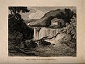 Well, St. Austell, Cornwell. Etching by J. Rowe, 1810, after Wellcome V0014442.jpg 3,356 × 2,554; 4.02 MB
-
 Western end of St Austell Station - geograph.org.uk - 5087565.jpg 640 × 426; 71 KB
-

-

-

-
 Radio Tower - geograph.org.uk - 77078.jpg 640 × 460; 58 KB
-
 Recycling Centre - geograph.org.uk - 77188.jpg 640 × 450; 73 KB


_-_geograph.org.uk_-_5447410.jpg)
_-_geograph.org.uk_-_5447415.jpg)
_-_geograph.org.uk_-_5447451.jpg)
_-_geograph.org.uk_-_5447454.jpg)

.jpg)
.jpg)
.jpg)
.jpg)


.jpg)


.jpg)


