Category:Transport in St Austell
Jump to navigation
Jump to search
Subcategories
This category has the following 6 subcategories, out of 6 total.
B
- Burngullow railway station (5 F)
- St Austell bus station (33 F)
S
- St Austell viaduct (18 F)
Media in category "Transport in St Austell"
The following 73 files are in this category, out of 73 total.
-
 2003 Seat Ibiza MK4 1.2L Model.jpg 2,448 × 3,264; 2.17 MB
-

-
 A390 junction from A391 - geograph.org.uk - 4039074.jpg 640 × 318; 53 KB
-
 A391 junction from A390 - geograph.org.uk - 4038274.jpg 640 × 429; 91 KB
-

-

-
 Aston Martin V12 Vantage S, St Austell, Cornwall - November 2022.jpg 4,018 × 2,424; 2.54 MB
-

-
 Boscoppa Road bridge over A391 - geograph.org.uk - 4038286.jpg 640 × 366; 53 KB
-
 Boscoppa Road bridge over A391 - geograph.org.uk - 6016033.jpg 1,600 × 1,067; 728 KB
-

-

-
 Bus outside St Austell Station - geograph.org.uk - 6025624.jpg 1,024 × 681; 122 KB
-
 Car park, St Austell's Station - geograph.org.uk - 5156217.jpg 640 × 426; 54 KB
-
 Carlyon Bridge.jpg 800 × 600; 158 KB
-
 Clay from Burngullow heads east - geograph.org.uk - 1040057.jpg 640 × 435; 107 KB
-
 Cromwell Road (A390) - geograph.org.uk - 4244051.jpg 640 × 480; 56 KB
-
 Escape Lane and roundabout for Boscoppa - geograph.org.uk - 2442389.jpg 800 × 600; 276 KB
-

-
 Freight train at St Austell - geograph.org.uk - 3333014.jpg 1,200 × 806; 1.44 MB
-
 Fuel for car and driver^ - geograph.org.uk - 2445096.jpg 800 × 597; 345 KB
-

-
 Holmbush Arch Road railway bridge, Charlestown - geograph.org.uk - 5991595.jpg 1,024 × 768; 269 KB
-
 Holmbush Road (A390) - geograph.org.uk - 4244056.jpg 640 × 480; 78 KB
-
 Holmbush Road (A390) - geograph.org.uk - 4244067.jpg 640 × 480; 106 KB
-
 Junction between the A3058 and A390 west of St. Austell - geograph.org.uk - 2384836.jpg 1,600 × 1,101; 422 KB
-
 National Cycle Network Route 3 milepost, East Hill, St Austell, Cornwall - November 2022.jpg 3,456 × 4,608; 5.22 MB
-
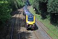
 New Year's Day train - geograph.org.uk - 1060498.jpg 640 × 435; 54 KB
-

-
 Pentewan Railway plaque (cropped).jpg 274 × 151; 43 KB
-
 Pentewan Road, Tregorrick - geograph.org.uk - 1390036.jpg 640 × 480; 102 KB
-
 Police Car, St Austell, Cornwall - November 2022.jpg 4,368 × 2,878; 2.15 MB
-
 Public Transport Interchange, St Austell - geograph.org.uk - 1313350.jpg 640 × 480; 106 KB
-
 Railway bridge over A390 - geograph.org.uk - 4038240.jpg 640 × 394; 77 KB
-

-

-
 Railway bridges, Trenance Road - geograph.org.uk - 1313426.jpg 480 × 640; 93 KB
-

-
 Roundabout on St Austell btpass - geograph.org.uk - 2442452.jpg 800 × 600; 375 KB
-
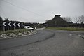
 Roundabout on the A391 - geograph.org.uk - 378468.jpg 640 × 427; 93 KB
-

-

-
 Service station on Southbourne Road - geograph.org.uk - 4244044.jpg 640 × 444; 47 KB
-

-
 Southbourne Road (A390) - geograph.org.uk - 4244045.jpg 640 × 480; 77 KB
-
 St Austell , A391 Roundabout - geograph.org.uk - 3382607.jpg 4,288 × 2,848; 4.53 MB
-
 St Austell , A391 Roundabout - geograph.org.uk - 3382609.jpg 4,288 × 2,848; 4.47 MB
-
 St Austell , Cromwell Road Roundabout - geograph.org.uk - 3382603.jpg 4,288 × 2,848; 5.3 MB
-
 St Austell , Dithmarschen Road - geograph.org.uk - 3382589.jpg 4,288 × 2,848; 5.11 MB
-
 St Austell , Holmbush Road - geograph.org.uk - 3382606.jpg 4,288 × 2,848; 4.42 MB
-
 St Austell , Pentewan Road - geograph.org.uk - 3382598.jpg 4,288 × 2,848; 4.38 MB
-
 St Austell , Penwinnick Road - geograph.org.uk - 3382587.jpg 4,152 × 2,626; 2.99 MB
-
 St Austell , Porthpean Road - geograph.org.uk - 3382604.jpg 4,288 × 2,848; 4.55 MB
-
 St Austell , Roundabouts - geograph.org.uk - 3382591.jpg 4,288 × 2,848; 4.63 MB
-
 St Austell , Southbourne Road - geograph.org.uk - 3382601.jpg 4,288 × 2,848; 4.35 MB
-
 St Austell , Trevanion Road - geograph.org.uk - 3382593.jpg 4,288 × 2,848; 5.17 MB
-
 St Austell , Truro Road - geograph.org.uk - 3382583.jpg 4,288 × 2,848; 4.39 MB
-
 St Austell - CrossCountry 220006.jpg 1,024 × 683; 478 KB
-
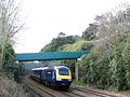
 St Austell - CrossCountry 220034 under Menacuddle Bridge.jpg 1,024 × 683; 504 KB
-
 St Austell - FGW 43012 under Menacuddle Bridge.jpg 2,048 × 1,536; 1.88 MB
-
 St Austell - First 42801 Y1EDN in Carlyon Road.jpg 1,024 × 683; 380 KB
-
 St Austell 2008 footbridge 43185.jpg 800 × 600; 229 KB
-
 St Austell Bus Station - geograph.org.uk - 5697860.jpg 640 × 426; 71 KB
-
 St Austell Carlyon Road bus stop.jpg 1,024 × 768; 439 KB
-
 St Austell East Hill - First 10178 (AN02EDN).jpg 1,024 × 768; 469 KB
-
 St Austell Railway Station - geograph.org.uk - 4243163.jpg 1,200 × 698; 172 KB
-
 St Austell Trenance Bridge (1859).jpg 1,024 × 683; 498 KB
-
 St Austell Trenance Bridge (1899).jpg 1,024 × 768; 600 KB
-
 The A390-A391 junction at Bethel - geograph.org.uk - 4954652.jpg 640 × 480; 54 KB
-
 Yet another roundabout on the A391 hill - geograph.org.uk - 2442408.jpg 800 × 600; 314 KB
-
 Raining Hard - geograph.org.uk - 378140.jpg 640 × 426; 85 KB
-
 Scredda - geograph.org.uk - 374750.jpg 640 × 480; 92 KB
-
 The Road through Menacuddle Farm - geograph.org.uk - 374730.jpg 640 × 480; 129 KB


_-_geograph.org.uk_-_4244051.jpg)


_-_geograph.org.uk_-_4244056.jpg)
_-_geograph.org.uk_-_4244067.jpg)


.jpg)


_-_geograph.org.uk_-_4244052.jpg)

_-_geograph.org.uk_-_4244047.jpg)


_-_geograph.org.uk_-_4244045.jpg)


.jpg)

.jpg)
.jpg)


