Category:Street maps of Paris 5e arrondissement
Jump to navigation
Jump to search
|
Paris 1 • 2 • 3 • 4 • 5 • 6 • 7 • 8 • 9 • 10 • 11 • 12 • 13 • 14 • 15 • 16 • 17 • 18 • 19 • 20 |
| NO WIKIDATA ID FOUND! Search for Street maps of Paris 5e arrondissement on Wikidata | |
| Upload media |
Subcategories
This category has only the following subcategory.
Media in category "Street maps of Paris 5e arrondissement"
The following 17 files are in this category, out of 17 total.
-
 Kartbok över Paris indelat i 20 distrikt, tryckt 1763 - Skoklosters slott - 86169.tif 4,176 × 2,572; 21.35 MB
-
 L'Université de Paris, 1770.jpg 4,541 × 3,003; 10.39 MB
-
 L'Université de Paris, 1880.jpg 4,550 × 3,009; 7.19 MB
-
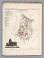
 Paris 5e & 6e arrondissement - Eugène Andriveau-Goujon.jpg 5,316 × 3,750; 7.85 MB
-
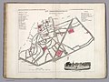
 Paris 5e arrondissement - Eugène Andriveau-Goujon.jpg 2,820 × 3,750; 3.84 MB
-
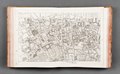
 Paris-atlas by Fernand Bournon - 16. 5e arrondissement - David Rumsey.jpg 4,657 × 6,010; 25.24 MB
-
 Paris.carte d'arrondissement.A05.jpg 1,326 × 1,104; 533 KB
-

-
-
-

-

-
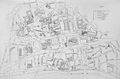
 Petit atlas pittoresque 44 - 11e arrondissement, n° 43, quartier de la Sorbonne - BHVP.jpg 3,145 × 3,811; 2.33 MB
-
 Petit atlas pittoresque 46 - 12e arrondissement, n° 45, quartier Saint Jacques - BHVP.jpg 3,210 × 3,989; 2.41 MB
-
 Petit atlas pittoresque 47 - 12e arrondissement, n° 46, quartier Saint Marcel - BHVP.jpg 3,960 × 3,085; 2.53 MB
-
 Petit atlas pittoresque 48 - 12e arrondissement, n° 47, quartier du Jardin du Roi - BHVP.jpg 3,970 × 3,180; 2.35 MB
-


