Category:Street maps of Paris 1er arrondissement
Jump to navigation
Jump to search
|
Paris 1 • 2 • 3 • 4 • 5 • 6 • 7 • 8 • 9 • 10 • 11 • 12 • 13 • 14 • 15 • 16 • 17 • 18 • 19 • 20 |
| NO WIKIDATA ID FOUND! Search for Street maps of Paris 1er arrondissement on Wikidata | |
| Upload media |
Subcategories
This category has only the following subcategory.
Media in category "Street maps of Paris 1er arrondissement"
The following 50 files are in this category, out of 50 total.
-
 2012-07-16 Paris plan de restructuration de la voirie souterraine des Halles.jpg 4,000 × 3,000; 2.08 MB
-
 CloitreSaintGermainLAuxerrois-1793-1795.png 859 × 809; 203 KB
-
 ImpasseRollinPrendGage.png 520 × 702; 189 KB
-
 Palais du Louvre, 1900 - Paris-Atlas by Fernand Bournon.svg 1,400 × 700; 109 KB
-
 Paris 1er & 2e arrondissement - Eugène Andriveau-Goujon.jpg 5,382 × 4,014; 7.78 MB
-
 Paris 1er arrondissement - Eugène Andriveau-Goujon.jpg 3,100 × 4,014; 4.25 MB
-
 Paris-atlas by Fernand Bournon - 08. 1er arrondissement - David Rumsey.jpg 5,977 × 4,571; 21.37 MB
-
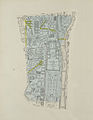
 Paris.carte d'arrondissement.A01.jpg 1,287 × 1,063; 521 KB
-

-

-

-

-

-
 Petit atlas pittoresque - 19. 4e arrondissement - Quartier du Louvre. No. 14 - David Rumsey.jpg 8,561 × 6,348; 16.35 MB
-

-
-
 Petit atlas pittoresque - 33. 7e arrondissement - Quartier des Arcis. No. 28 - David Rumsey.jpg 8,695 × 6,459; 20.48 MB
-
-
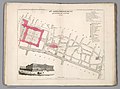
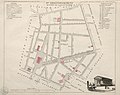
 Petit atlas pittoresque 05 - 1er arrondissement, n° 4, quartier des Tuileries - BHVP.jpg 4,021 × 3,261; 2.92 MB
-
 Petit atlas pittoresque 07 - 2e arrondissement, n° 6, quartier du Palais Royal - BHVP.jpg 3,946 × 3,191; 1.94 MB
-
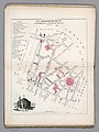
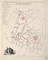
 Petit atlas pittoresque 12 - 3e arrondissement, n° 11, quartier Saint Eustache - BHVP.jpg 3,261 × 4,011; 2.64 MB
-
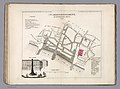
 Petit atlas pittoresque 14 - 4e arrondissement, n° 13, quartier Saint Honoré - BHVP.jpg 3,986 × 3,196; 2.27 MB
-
 Petit atlas pittoresque 15 - 4e arrondissement, n° 14, quartier du Louvre - BHVP.jpg 3,956 × 3,191; 2.56 MB
-
 Petit atlas pittoresque 16 - 4e arrondissement, n° 15, quartier des Marchés - BHVP.jpg 3,226 × 4,011; 2.32 MB
-
-
 Petit atlas pittoresque 29 - 7e arrondissement, n° 28, quartier des Arcis - BHVP.jpg 3,856 × 3,326; 2.72 MB
-
 PlaceDesTroisMaries-1793-1795.png 810 × 648; 201 KB
-
 PlanAncienQuartierSaintGermainLAuxerroisLesHallesLeChatelet.svg 1,488 × 1,052; 172 KB
-
 PlanEcolePretresVers1900.png 985 × 591; 107 KB
-
 PlanEcolePretresVers1910.png 985 × 591; 96 KB
-
 PlanEcolePretresVers1928.png 985 × 592; 87 KB
-
 PlanImpassedesProvençauxVers1900.png 700 × 700; 100 KB
-
 QuaiDeLEcole-1793-1795.png 1,066 × 930; 249 KB
-
 Quartier du Châtelet, 1750-1836.jpg 3,440 × 2,478; 4.91 MB
-
 Quartier du Châtelet, 1750.jpg 1,631 × 2,112; 1.91 MB
-
 Quartier du Châtelet, 1836.jpg 1,627 × 2,115; 2.28 MB
-
 RueBerger-1793-1795.png 1,593 × 650; 340 KB
-
 RueBertinPoirée-1793-1795.png 856 × 734; 265 KB
-
 RueBéthizy-1793-1795.png 914 × 838; 284 KB
-
 RuedAngiviller.png 483 × 614; 81 KB
-
 RueDeDeuxEcus-1793-1795.png 1,156 × 728; 262 KB
-
 RueDeLaFayette-1793-1795.png 938 × 866; 275 KB
-
 RueDesBourdonnais-1793-1795.png 645 × 912; 254 KB
-
 RueDesFuseaux-1793-1795.png 724 × 778; 236 KB
-
 RueDesPoulies-1793-1795.png 824 × 1,116; 264 KB
-
 RueDesQuenouilles-1793-1795.png 724 × 775; 235 KB
-
 RueDOrléans-1793-1795.png 862 × 772; 194 KB
-
 RueDuChevalierDuGuet-1793-1795.png 544 × 747; 211 KB
-
 RueDuPontNeuf-1793-1795.png 892 × 1,252; 407 KB
-
 Theodor Josef Hubert Hoffbauer, Quartier du Louvre, 1836.svg 3,370 × 2,140; 240 KB


