Category:Trin
Zur Navigation springen
Zur Suche springen
Gemeinde in der Schweiz    | |||||
| Medium hochladen | |||||
| Aussprache (Audiodatei) | |||||
|---|---|---|---|---|---|
| Ist ein(e) | |||||
| Ort |
| ||||
| Liegt am oder im Gewässer | |||||
| Einwohnerzahl |
| ||||
| Fläche |
| ||||
| Höhe über dem Meeresspiegel |
| ||||
| offizielle Website | |||||
 | |||||
Unterkategorien
Es werden 11 von insgesamt 11 Unterkategorien in dieser Kategorie angezeigt:
In Klammern die Anzahl der enthaltenen Kategorien (K), Seiten (S), Dateien (D)
- Burg Canaschal (20 D)
- Crap Sogn Parcazi (15 D)
B
- Bargis (31 D)
C
- Crap Mats (14 D)
D
- Piz Dolf (14 D)
K
- Kraftwerk Pintrun (3 D)
P
- Punt Ruinaulta (15 D)
R
- Reformierte Kirche Trin (7 D)
S
T
- Trin railway station (15 D)
Medien in der Kategorie „Trin“
Folgende 86 Dateien sind in dieser Kategorie, von 86 insgesamt.
-
 2004 TheRingThing Location.jpg 3.008 × 1.960; 899 KB
-
 Bargistal Übersicht.jpg 1.800 × 1.116; 359 KB
-
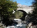
 Brücke über Aua da Mulins - panoramio.jpg 4.526 × 3.344; 8,36 MB
-
 CHE Trin Flag.svg 512 × 513; 8 KB
-
 Ebene Mulin und Uaul Grond.jpg 3.072 × 2.304; 2,85 MB
-
 Ebene Trin Herbst.jpeg 4.032 × 2.654; 1,35 MB
-
 Ebene Trin.JPG 1.920 × 1.080; 698 KB
-
 ETH-BIB-Digg (Trin) bei Flims-LBS H1-018171.tif 6.788 × 4.723; 91,88 MB
-
 ETH-BIB-Digg (Trin), Flimserstein-LBS H1-019703.tif 6.807 × 4.777; 93,11 MB
-
 ETH-BIB-Flimsterstein, Ostseite (Absturz gegen Bargisalp)-Dia 247-F-00266.tif 3.633 × 2.770; 9,69 MB
-

-
 ETH-BIB-Mulin (Trin), Flims, Vorab, Tödi, Flimserstein-Inlandflüge-LBS MH01-004944.tif 6.552 × 4.626; 86,8 MB
-
 ETH-BIB-Trin, Blick nach Nordwest, Flimserstein-LBS H1-018175.tif 6.790 × 4.706; 91,58 MB
-
 ETH-BIB-Trin, Flims-LBS H1-029181.tif 6.547 × 4.622; 86,61 MB
-
 ETH-BIB-Trin-Digg v. S. aus 800 m-Inlandflüge-LBS MH01-003919.tif 6.370 × 4.306; 78,63 MB
-
 ETH-BIB-Trin-Digg, Fidaz, Vorderrhein v. S. O. aus 2000 m-Inlandflüge-LBS MH01-004446.tif 6.648 × 4.749; 90,42 MB
-

-

-
 ETH-BIB-Trin-LBS H1-019704.tif 6.875 × 4.789; 94,29 MB
-
 ETH-BIB-Trin-LBS H1-019705.tif 6.776 × 4.783; 92,81 MB
-
 Fels - panoramio.jpg 3.454 × 4.608; 10,62 MB
-
 Fil De Cassons Ost2.jpg 1.040 × 584; 187 KB
-
 Flag of Trin.gif 216 × 216; 4 KB
-
 Flem - panoramio (1).jpg 4.602 × 3.450; 6,63 MB
-
 Flem - panoramio.jpg 4.546 × 3.370; 7,29 MB
-
 Flem vor Rhein.jpg 1.678 × 2.033; 1,03 MB
-
 Flem.JPG 2.496 × 1.664; 1,69 MB
-
 Flimserstein ringelspitz.JPG 2.048 × 1.536; 698 KB
-
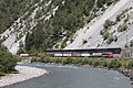 FR Ge 4-4 II 615 Trin 210715 5232 Ilanz-Landquart.jpg 2.048 × 1.365; 3,5 MB
-
 Garten - panoramio (11).jpg 4.608 × 3.456; 10,93 MB
-
 Ge 6-6 II 704 Davos bei Trin.jpg 2.542 × 2.273; 1,47 MB
-
 Hochtal von Bargis - panoramio (3).jpg 4.608 × 3.456; 8,57 MB
-
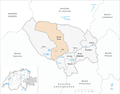 Karte Gemeinde Trin GR 2007.png 1.181 × 925; 216 KB
-
 Karte Gemeinde Trin GR 2016.png 1.476 × 1.156; 370 KB
-
 Karte Gemeinde Trin GR.png 1.181 × 923; 180 KB
-
 Mulin Ebene.jpg 3.072 × 2.304; 3,49 MB
-
 Mulin von Crap Sogn Parcazi.jpg 3.072 × 2.304; 3,6 MB
-
 Pintrun.JPG 1.821 × 1.161; 915 KB
-
 Postbus auf den Weg zum Bahnhof Versam-Safien - panoramio (1).jpg 2.123 × 1.372; 1,7 MB
-
 Punt da Trin bei Pintrun.jpg 2.580 × 1.927; 1,57 MB
-
 Rabiusa und Versam.jpg 2.560 × 1.920; 2,36 MB
-
 Rhine Gorge Versam - panoramio - Jakkes (6).jpg 2.048 × 1.536; 2,42 MB
-
 Rhine Gorge Versam - panoramio.jpg 2.048 × 1.536; 2,36 MB
-
 Ringelspitz Kunkels Calanda.JPG 2.048 × 1.536; 702 KB
-
Roh-sursilvan-Trin.ogg 1,1 s; 24 KB
-
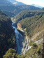 Ruinaulta beim Kraftwerk Trin.jpg 2.304 × 3.072; 3,39 MB
-
 Ruine Wackenau von der Senda Surslivana.JPG 2.816 × 2.112; 2,03 MB
-
 Silence (219601089).jpeg 2.048 × 1.202; 1,2 MB
-
 Sogn Parcazi Lage.jpg 821 × 1.157; 181 KB
-
 Stein 102d.jpg 1.944 × 2.592; 1,06 MB
-
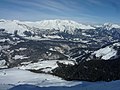
 Taminagebirge Ansicht von Süden.jpg 1.181 × 1.181; 1,34 MB
-
 CHE Trin COA.svg 227 × 265; 5 KB
-
 Trin - panoramio (1).jpg 4.602 × 3.448; 8,4 MB
-
 Trin - panoramio (2).jpg 4.441 × 2.148; 4,77 MB
-
 Trin - panoramio.jpg 4.562 × 3.394; 9,67 MB
-
 Trin 1977.JPG 1.693 × 2.061; 684 KB
-
 Trin Ansicht.jpg 2.193 × 1.579; 1,14 MB
-
 Trin Canaschal.jpg 916 × 1.228; 172 KB
-
 Trin Digg.jpg 2.871 × 2.116; 1,66 MB
-
 Trin Dorf.jpeg 5.472 × 3.648; 9,17 MB
-
 Trin from Tenner Kreuz.jpg 2.896 × 1.944; 2,38 MB
-
 Trin Hausinschrift Sursilvan.jpg 4.000 × 3.000; 2,53 MB
-
 Trin Kirche und Burg.JPG 3.754 × 2.564; 2,83 MB
-
 Trin Mulin 2020.jpeg 5.472 × 3.648; 8,58 MB
-
 Trin Mulin.jpg 1.600 × 1.200; 238 KB
-
 Trin wappen.svg 438 × 480; 3 KB
-
 Trin Weinreben.jpg 4.000 × 3.000; 3,14 MB
-
 Trin-Mulin.jpg 5.155 × 2.194; 1,69 MB
-
 Trin.jpg 1.772 × 1.175; 265 KB
-
 TrinDigg.JPG 2.592 × 1.944; 1,51 MB
-
 Trinsermühle mit Wehrmauer Sankt Pankratius.jpg 2.304 × 3.072; 1,49 MB
-
 Trinsermühle vom Stein des Heiligen Pankratius.jpg 3.072 × 2.304; 3,28 MB
-
 Une échappée belle et plus - Lisa Hopf & Alexandra Siegrist.jpg 2.896 × 1.944; 2,53 MB
-
 Val Pintrun gegen Bargis.jpg 2.552 × 1.915; 1,43 MB
-
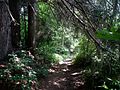 Wanderweg - panoramio (102).jpg 4.608 × 3.456; 8,93 MB
-
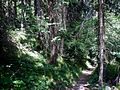 Wanderweg - panoramio (103).jpg 4.608 × 3.456; 10,68 MB
-
 Wanderweg - panoramio (104).jpg 4.608 × 3.456; 10,92 MB
-
 Wanderweg - panoramio (105).jpg 4.546 × 3.372; 9,71 MB
-
 Wasserkraftwerk Flem - panoramio.jpg 4.608 × 3.456; 7,98 MB
-
 Wiese - panoramio (11).jpg 4.608 × 2.304; 5,24 MB
-
 Winterliches Brün und Dutjen 02.jpg 3.072 × 2.304; 3,22 MB
-
 Winterliches Brün und Dutjen.jpg 3.072 × 2.304; 3,15 MB
-
 Winterliches Brün und Trin.jpg 2.304 × 3.072; 3,31 MB
-
 Winterliches Dutjen.jpg 3.072 × 2.304; 3,23 MB
-
 Zygaena transalpina 84414362.jpg 1.536 × 2.048; 949 KB
-
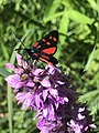 Zygaena transalpina 84414414.jpg 1.536 × 2.048; 910 KB


.jpg)


.jpg)

.jpg)


.jpg)


.jpg)


.jpeg)


.jpg)
.jpg)


.jpg)
.jpg)
.jpg)
.jpg)

.jpg)


