Category:United Kingdom photographs taken on 2006-06-25
Jump to navigation
Jump to search
Countries of Europe: Austria · Belarus · Belgium · Bosnia and Herzegovina · Czech Republic · Denmark · Finland · France‡ · Georgia‡ · Germany · Greece · Hungary · Republic of Ireland · Italy · Latvia · Netherlands‡ · Poland · Portugal‡ · Russia‡ · Slovakia · Spain‡ · Sweden · Switzerland · Turkey‡ · Ukraine · United Kingdom
Specific status: Isle of Man
‡: partly located in Europe
Specific status: Isle of Man
‡: partly located in Europe
| ← | 25 June 2006 | → | ||
| ← | June 2006 | → | ||

United Kingdom photographs taken on 25 June 2006.
Image files should be categorized here automatically using {{taken on}} template. Direct categorisation is also possible, if automatic is impossible.
Subcategories
This category has only the following subcategory.
S
Media in category "United Kingdom photographs taken on 2006-06-25"
The following 200 files are in this category, out of 739 total.
(previous page) (next page)-
 4 Heaton Road - geograph.org.uk - 359860.jpg 640 × 480; 122 KB
-
 A Bend in the Road - geograph.org.uk - 193533.jpg 640 × 427; 88 KB
-
 A train the size of a planet - geograph.org.uk - 731998.jpg 640 × 480; 92 KB
-

-
 A21 climbing Castle Hill - geograph.org.uk - 191893.jpg 640 × 480; 105 KB
-
 Access lane to Llwngwillam - geograph.org.uk - 192007.jpg 640 × 426; 114 KB
-
 Afon Glaslyn - geograph.org.uk - 227777.jpg 640 × 480; 128 KB
-
 Alpaca Farming in Herefordshire - geograph.org.uk - 192428.jpg 640 × 426; 114 KB
-
 Anacamptis pyramidis - geograph.org.uk - 192178.jpg 426 × 640; 117 KB
-
 Ancient cairn, Craighead - geograph.org.uk - 191776.jpg 640 × 478; 132 KB
-
 Apple orchard, near Golden Green - geograph.org.uk - 191835.jpg 640 × 480; 139 KB
-
 Arbory Parish Church, Ballabeg, Isle of Man.jpg 640 × 480; 72 KB
-

-
 Ashleigh Road, Solihull - geograph.org.uk - 359849.jpg 640 × 480; 128 KB
-
 Badgers Sub Rd - geograph.org.uk - 191472.jpg 640 × 426; 148 KB
-
 Baggy Point - geograph.org.uk - 1473056.jpg 640 × 480; 101 KB
-
 Banded demoiselle - geograph.org.uk - 191598.jpg 640 × 426; 80 KB
-
 Bangor Road, Groomsport (1) - geograph.org.uk - 191411.jpg 640 × 426; 165 KB
-
 Bangor Road, Groomsport (2) - geograph.org.uk - 191414.jpg 640 × 426; 142 KB
-
 Bangor Road, Groomsport (3) - geograph.org.uk - 191419.jpg 640 × 426; 124 KB
-
 Beechen Wood Footpath - geograph.org.uk - 191554.jpg 640 × 426; 141 KB
-
 Benbecula Lochan near Flodaigh.jpg 640 × 480; 79 KB
-
 Bisley , The Lock-up - geograph.org.uk - 191711.jpg 640 × 480; 78 KB
-
 Blackhurst Lane - geograph.org.uk - 191896.jpg 640 × 480; 149 KB
-
 Blair Castle - geograph.org.uk - 208808.jpg 640 × 480; 58 KB
-
 Borage Field - geograph.org.uk - 191721.jpg 640 × 480; 109 KB
-
 Born of Leaves Decaying - geograph.org.uk - 191630.jpg 640 × 426; 153 KB
-
 Boulder field in the forest - geograph.org.uk - 191774.jpg 640 × 424; 111 KB
-
 Boundary Stone and Road - geograph.org.uk - 193575.jpg 640 × 427; 122 KB
-
 Bridge Near Bempton - geograph.org.uk - 192891.jpg 640 × 480; 117 KB
-
 Bridge of Frew - geograph.org.uk - 191765.jpg 640 × 478; 148 KB
-
 Bridge over the Farigaig - geograph.org.uk - 191754.jpg 640 × 424; 72 KB
-

-
 Bridge under railway, Clayton Woods - geograph.org.uk - 192226.jpg 640 × 275; 88 KB
-
 Bridgewater Canal - geograph.org.uk - 731382.jpg 640 × 480; 89 KB
-
 Bridleway at TA071409 - geograph.org.uk - 191872.jpg 480 × 640; 125 KB
-
 Bridleway to Cosby - geograph.org.uk - 191333.jpg 640 × 480; 95 KB
-
 Bridleway to Weel Carr - geograph.org.uk - 191871.jpg 640 × 480; 137 KB
-
 BrittaniaHouseLuton.jpg 640 × 480; 87 KB
-
 Brooklands banking - geograph.org.uk - 939332.jpg 640 × 512; 101 KB
-
 Burton Villas - geograph.org.uk - 191350.jpg 640 × 479; 129 KB
-
 By Press - geograph.org.uk - 191661.jpg 640 × 424; 45 KB
-
 Callercove Point - geograph.org.uk - 191463.jpg 640 × 480; 138 KB
-
 Camas Chil Mhalieu, Loch Linnhe - geograph.org.uk - 242615.jpg 640 × 262; 80 KB
-
 Canon's Marsh, Bristol, Bristol, City of Bristol, UK - panoramio - Christopher Nips.jpg 2,816 × 2,112; 2.36 MB
-
 Caochan Breac - geograph.org.uk - 192059.jpg 640 × 424; 73 KB
-
 Capability green.jpg 640 × 480; 78 KB
-
 Capel church across a field of wheat. - geograph.org.uk - 191906.jpg 640 × 480; 118 KB
-
 Carlisle Castle showing the bridge.jpg 896 × 592; 549 KB
-
 Carn Loch na Leitir 415mts - geograph.org.uk - 191748.jpg 640 × 424; 79 KB
-
 Chantry House, Heptonstall - geograph.org.uk - 193516.jpg 640 × 470; 141 KB
-
 Charlton House east side - geograph.org.uk - 194036.jpg 640 × 345; 97 KB
-
 Chipshop - geograph.org.uk - 192086.jpg 640 × 427; 81 KB
-
 Christ Church vaulting - geograph.org.uk - 192704.jpg 481 × 640; 95 KB
-
 Christ's Hospital Platforms.jpg 640 × 496; 420 KB
-
 Former Methodist Chapel, Clifford - geograph.org.uk - 191949.jpg 640 × 426; 142 KB
-
 Clocktower, Summerhill - geograph.org.uk - 191796.jpg 640 × 480; 79 KB
-

-
 Converted Oast house, near Tudeley - geograph.org.uk - 191908.jpg 480 × 640; 88 KB
-
 Converted Oast house, Tudeley - geograph.org.uk - 191813.jpg 640 × 480; 162 KB
-
 Corrievorrie Farm - geograph.org.uk - 192040.jpg 640 × 424; 55 KB
-
 Countisbury Hill - geograph.org.uk - 1118443.jpg 640 × 424; 39 KB
-
 Court Barton, Lamerton - geograph.org.uk - 193551.jpg 640 × 451; 98 KB
-
 Croft House - geograph.org.uk - 359880.jpg 640 × 480; 86 KB
-

-
 Crop of Potatoes near Whitney-on-Wye - geograph.org.uk - 192414.jpg 640 × 426; 150 KB
-
 Crops on the Bowood Estate - geograph.org.uk - 191650.jpg 640 × 480; 76 KB
-
 Cwm Du on Horseback - geograph.org.uk - 334481.jpg 640 × 480; 81 KB
-
 Deansgate Metrolink viaduct - geograph.org.uk - 731990.jpg 640 × 470; 70 KB
-
 Decisions, decisions - geograph.org.uk - 191544.jpg 640 × 480; 96 KB
-
 Dirtyfoot Lane Junction - geograph.org.uk - 398290.jpg 480 × 640; 128 KB
-
 Disused railway - geograph.org.uk - 191583.jpg 480 × 640; 75 KB
-
 Disused railway line - geograph.org.uk - 191589.jpg 640 × 480; 194 KB
-
 Dobb's Weir - geograph.org.uk - 191682.jpg 640 × 349; 90 KB
-
 Dog rose - geograph.org.uk - 192743.jpg 640 × 478; 121 KB
-
 Donaghadee's last trawler - geograph.org.uk - 272910.jpg 640 × 426; 150 KB
-
 Downingbury Farm, Pembury. - geograph.org.uk - 191901.jpg 640 × 480; 115 KB
-
 Doxey Pool in summer - geograph.org.uk - 1072792.jpg 640 × 480; 68 KB
-
 Driveway to a Caravan Site - geograph.org.uk - 193579.jpg 640 × 427; 122 KB
-
 Dunkeld from Newtyle Hill - geograph.org.uk - 801321.jpg 640 × 480; 87 KB
-
 Dunkeld Golf Club - geograph.org.uk - 801313.jpg 640 × 480; 82 KB
-
 East Cote Lighthouse - geograph.org.uk - 193643.jpg 480 × 640; 90 KB
-
 East end of Loch Duagrich - geograph.org.uk - 656183.jpg 640 × 480; 88 KB
-
 East Finchley Festival 2006 - geograph.org.uk - 191825.jpg 640 × 480; 126 KB
-
 East Finchley Festival 2006 - geograph.org.uk - 191827.jpg 640 × 480; 121 KB
-
 East Finchley Festival 2006 - geograph.org.uk - 191844.jpg 640 × 480; 143 KB
-
 East Finchley Festival 2006 - geograph.org.uk - 191863.jpg 640 × 480; 145 KB
-
 East Finchley Festival 2006 - geograph.org.uk - 191869.jpg 640 × 480; 186 KB
-

-
 End view of Palm House Kew. - geograph.org.uk - 486503.jpg 640 × 458; 98 KB
-
 County Boundary - geograph.org.uk - 191420.jpg 427 × 640; 112 KB
-
 Entrance to Lud's Church - geograph.org.uk - 1072776.jpg 480 × 640; 135 KB
-
 Fackenden Lane - geograph.org.uk - 191584.jpg 640 × 426; 137 KB
-
 Farm Buildings at Bronydd Farm - geograph.org.uk - 191992.jpg 640 × 426; 114 KB
-
 Farmland, Grunty Fen, Cambs - geograph.org.uk - 231447.jpg 640 × 480; 280 KB
-
-
 Feeding time at the Vintage Car Run - geograph.org.uk - 1586599.jpg 640 × 480; 68 KB
-
 Ferndale Road - geograph.org.uk - 191353.jpg 640 × 479; 131 KB
-
 Field and derelict windmill - geograph.org.uk - 193570.jpg 640 × 487; 100 KB
-
 Field near Heddington Wick - geograph.org.uk - 191693.jpg 640 × 479; 78 KB
-
 Field of Oats - geograph.org.uk - 192084.jpg 640 × 427; 97 KB
-
 Field on the edge of Stanage Park - geograph.org.uk - 234298.jpg 640 × 480; 90 KB
-
 Fields by Torness - geograph.org.uk - 192207.jpg 640 × 424; 67 KB
-
 Fields by Viewforth Plantation - geograph.org.uk - 191648.jpg 640 × 424; 68 KB
-
 Fields outside Lamerton Village - geograph.org.uk - 191587.jpg 640 × 427; 90 KB
-
 Flamingoes at Slimbridge - geograph.org.uk - 1586595.jpg 640 × 480; 108 KB
-
 Footbridge to Tickton - geograph.org.uk - 191876.jpg 640 × 480; 132 KB
-
 Footpath along a Field Edge - geograph.org.uk - 191477.jpg 640 × 427; 107 KB
-
 Footpath crossing - geograph.org.uk - 192232.jpg 640 × 480; 135 KB
-
 Footpath guide post, Loton deer park - geograph.org.uk - 191696.jpg 640 × 480; 146 KB
-
 Footpath junction near Thorpeness - geograph.org.uk - 194032.jpg 640 × 480; 90 KB
-
 Footpath Near Beechen Wood - geograph.org.uk - 191495.jpg 640 × 426; 126 KB
-
 Forest Road - geograph.org.uk - 191543.jpg 640 × 480; 96 KB
-
 Forest Track - geograph.org.uk - 191351.jpg 640 × 480; 117 KB
-
 Former barn of Royds Farm - geograph.org.uk - 193523.jpg 640 × 508; 116 KB
-
 Former London Underground Central Line - geograph.org.uk - 191559.jpg 640 × 480; 167 KB
-

-

-
 Gate and stile, Scald law - geograph.org.uk - 193130.jpg 640 × 474; 278 KB
-
 Gateway to Chinatown - geograph.org.uk - 732045.jpg 640 × 480; 97 KB
-

-
 Glen Coe - geograph.org.uk - 1237588.jpg 640 × 480; 61 KB
-
 Glen Farigaig - geograph.org.uk - 192229.jpg 640 × 424; 63 KB
-
 Golden Green - geograph.org.uk - 191833.jpg 640 × 480; 135 KB
-
 Goldfinch On A Wire - geograph.org.uk - 192274.jpg 426 × 640; 55 KB
-
 Goldney8.jpg 2,560 × 1,920; 1.77 MB
-
 Goldneyhallstatue.JPG 2,560 × 1,920; 1.66 MB
-
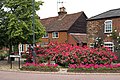
 Goldsmid Hall - geograph.org.uk - 191805.jpg 640 × 480; 167 KB
-
 Goodnestone Church, East Kent, UK.jpg 640 × 480; 101 KB
-
 Grass and Houses - geograph.org.uk - 192094.jpg 640 × 427; 82 KB
-
 Grass Field and View - geograph.org.uk - 192111.jpg 640 × 427; 92 KB
-
 Grass Fields and Valley - geograph.org.uk - 193527.jpg 640 × 427; 98 KB
-

-
 Great Orme - geograph.org.uk - 411682.jpg 640 × 426; 89 KB
-

-
 Green Lane near Bronydd - geograph.org.uk - 191988.jpg 640 × 426; 141 KB
-
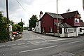
 Groomsport Road, Ballyholme - geograph.org.uk - 191404.jpg 640 × 426; 139 KB
-
 Grunty Fen Farm, Wilburton, Cambs - geograph.org.uk - 194277.jpg 640 × 473; 81 KB
-
 Guildhall and church cottage - geograph.org.uk - 998951.jpg 640 × 480; 100 KB
-
 Guillemot in the Moray Firth^^ - geograph.org.uk - 192735.jpg 640 × 480; 78 KB
-
 Gulworthy - geograph.org.uk - 192122.jpg 640 × 417; 87 KB
-
 Hartlake - geograph.org.uk - 191831.jpg 640 × 480; 124 KB
-
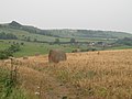
 Hay Bales at Clifford - geograph.org.uk - 191945.jpg 640 × 426; 107 KB
-
 Hayfield with view of Kings Play Hill - geograph.org.uk - 191727.jpg 640 × 480; 63 KB
-
 Headland at Eyemouth - geograph.org.uk - 191455.jpg 640 × 480; 77 KB
-
 Hedge bindweed - geograph.org.uk - 191620.jpg 640 × 426; 107 KB
-
 Herefordshire Trail near Brilley - geograph.org.uk - 193392.jpg 640 × 426; 176 KB
-
 High St Cottages and Flowers - geograph.org.uk - 191606.jpg 640 × 426; 177 KB
-
 Hill road to Carn na Seanalich - geograph.org.uk - 191679.jpg 640 × 424; 91 KB
-
 Honeytor - geograph.org.uk - 193585.jpg 640 × 427; 90 KB
-
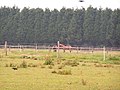 Horses in a paddock. - geograph.org.uk - 191851.jpg 640 × 480; 147 KB
-
 Houseboats at Mersea - geograph.org.uk - 217546.jpg 640 × 426; 40 KB
-

-
 Information sign - geograph.org.uk - 1237587.jpg 640 × 480; 105 KB
-
 Ironbridge - panoramio.jpg 2,592 × 1,944; 2.47 MB
-
 Joining the Main Road - geograph.org.uk - 193887.jpg 640 × 427; 136 KB
-
 Kenilworth Road, Kenilworth End.jpg 640 × 480; 82 KB
-
 Kew Palace with fountain. - geograph.org.uk - 486507.jpg 582 × 437; 78 KB
-

-
 Cottages in Kirtlingtom - geograph.org.uk - 785694.jpg 640 × 512; 104 KB
-
 Thatch Cottage Kirtlington - geograph.org.uk - 785703.jpg 640 × 475; 99 KB
-
 Knavesmire - geograph.org.uk - 878606.jpg 640 × 457; 265 KB
-
 Lamerton - geograph.org.uk - 191585.jpg 640 × 427; 108 KB
-
 Lamerton - geograph.org.uk - 191593.jpg 640 × 427; 101 KB
-
 Lamerton Back Road - geograph.org.uk - 193539.jpg 640 × 427; 105 KB
-
 Lamerton Cemetery - geograph.org.uk - 193555.jpg 640 × 441; 109 KB
-
 Lamerton Church - geograph.org.uk - 193546.jpg 640 × 496; 109 KB
-
 Lamerton Green - geograph.org.uk - 193560.jpg 640 × 427; 90 KB
-
 Lane to Tan-y-bedw - geograph.org.uk - 191712.jpg 640 × 480; 95 KB
-
 Langley Road Bridge - geograph.org.uk - 398271.jpg 640 × 480; 151 KB
-
 Legion mural - geograph.org.uk - 732037.jpg 488 × 125; 25 KB
-
 Linkim Kip - geograph.org.uk - 191575.jpg 640 × 480; 127 KB
-
 Linkim Shore - geograph.org.uk - 191571.jpg 640 × 480; 103 KB
-

-
 Little Orme - geograph.org.uk - 411657.jpg 640 × 426; 96 KB
-
 Loch Alsh - geograph.org.uk - 1229686.jpg 640 × 480; 40 KB
-
 Loch Beag - geograph.org.uk - 191533.jpg 640 × 480; 37 KB
-
 Loch Mhor no more - geograph.org.uk - 193094.jpg 640 × 424; 57 KB
-

-
 Lone Tree ridge - geograph.org.uk - 646147.jpg 480 × 640; 110 KB
-
 Long Lawford - geograph.org.uk - 192666.jpg 640 × 480; 89 KB
-
 Longfield House, Heptonstall - geograph.org.uk - 193522.jpg 640 × 477; 102 KB
-
 Longridge Court - geograph.org.uk - 191701.jpg 640 × 447; 65 KB
-
-
 Low Fen Bridge, Wilburton, Cambs - geograph.org.uk - 231581.jpg 640 × 480; 274 KB
-
 Low tide, Saundersfoot. - geograph.org.uk - 386863.jpg 640 × 480; 88 KB
-
 Lullingstone Park Golf Course - geograph.org.uk - 192206.jpg 640 × 426; 88 KB
-
 Lullingstone Park, Clubhouse - geograph.org.uk - 192199.jpg 640 × 426; 112 KB
-
 Lullingstone Paths - geograph.org.uk - 191476.jpg 640 × 426; 121 KB
-
 Luton, Beech Road - geograph.org.uk - 192300.jpg 640 × 480; 93 KB
-
 Luton, Brantwood Park - geograph.org.uk - 194092.jpg 640 × 480; 89 KB
-
 Luton, Conway Road - geograph.org.uk - 193074.jpg 640 × 480; 114 KB
-
 Luton, Disused railway - geograph.org.uk - 191357.jpg 640 × 480; 156 KB
-
 Luton, Footbridge over the ring road - geograph.org.uk - 191482.jpg 640 × 480; 75 KB
-
 Luton, Hampton Road - geograph.org.uk - 191320.jpg 640 × 480; 124 KB
-
 Luton, Hatters Way - geograph.org.uk - 193053.jpg 640 × 480; 111 KB
-
 Luton, Jamia Masjid Ghousia Mosque - geograph.org.uk - 194124.jpg 640 × 480; 92 KB
-
 Luton, Norman Road - geograph.org.uk - 193112.jpg 640 × 480; 74 KB
-
 Luton, Old Bedford Road - geograph.org.uk - 193494.jpg 640 × 480; 128 KB
-
 Luton, Runley Road - geograph.org.uk - 191344.jpg 640 × 480; 99 KB


_-_geograph.org.uk_-_191411.jpg)
_-_geograph.org.uk_-_191414.jpg)
_-_geograph.org.uk_-_191419.jpg)


