Category:United Kingdom photographs taken on 2006-07-02
Jump to navigation
Jump to search
Countries of Europe: Austria · Belgium · Czech Republic · Denmark · Estonia · Finland · France‡ · Georgia‡ · Germany · Greece · Republic of Ireland · Italy · Kazakhstan‡ · Lithuania · Netherlands‡ · Norway · Poland · Portugal‡ · Russia‡ · Slovakia · Spain‡ · Sweden · Switzerland · Turkey‡ · Ukraine · United Kingdom
‡: partly located in Europe
‡: partly located in Europe
| ← | 2 July 2006 | → | ||
| ← | July 2006 | → | ||

United Kingdom photographs taken on 2 July 2006.
Image files should be categorized here automatically using {{taken on}} template. Direct categorisation is also possible, if automatic is impossible.
Subcategories
This category has the following 2 subcategories, out of 2 total.
L
S
Media in category "United Kingdom photographs taken on 2006-07-02"
The following 200 files are in this category, out of 605 total.
(previous page) (next page)-
 A Channel in the Dee Marshes - geograph.org.uk - 196782.jpg 640 × 480; 61 KB
-

-
 Abandoned farmland, Frampton Marsh, Lincs - geograph.org.uk - 196499.jpg 640 × 480; 336 KB
-
 Afon Dwyfor in Cwm Pennant - geograph.org.uk - 197190.jpg 640 × 480; 143 KB
-
 Aircraft Crash Site, Easby Moor - geograph.org.uk - 195066.jpg 480 × 640; 121 KB
-
 Alcester Road South - geograph.org.uk - 197018.jpg 640 × 480; 45 KB
-
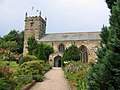 All Saints Church, Hunmanby.jpg 640 × 480; 102 KB
-
 Alpacas grazing - geograph.org.uk - 261474.jpg 640 × 480; 78 KB
-
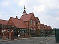 Anderton Park School - geograph.org.uk - 196974.jpg 640 × 480; 47 KB
-
 Approaching Luxulyan - geograph.org.uk - 195968.jpg 640 × 480; 125 KB
-
 Approaching Roseny Mill - geograph.org.uk - 196546.jpg 640 × 480; 124 KB
-
 Arrival in Gwytherin - geograph.org.uk - 194858.jpg 640 × 480; 90 KB
-
 Ashleigh Farm buildings - geograph.org.uk - 195007.jpg 640 × 480; 92 KB
-

-
 Bampton, at Chiltern Cross - geograph.org.uk - 195132.jpg 640 × 427; 219 KB
-
 Bampton, entrance to Westbrook Farmhouse - geograph.org.uk - 195140.jpg 640 × 427; 248 KB
-
 Bampton, near Broom Cottage - geograph.org.uk - 195145.jpg 640 × 427; 260 KB
-
 Bampton, towards the Exe valley - geograph.org.uk - 195136.jpg 640 × 427; 202 KB
-
 Basking Shark in Cornwall.jpg 1,600 × 1,200; 946 KB
-
 Bath, Bath, Bath and North East Somerset, UK - panoramio.jpg 2,816 × 2,112; 1.94 MB
-
 Bebington High School Sports College - geograph.org.uk - 196680.jpg 640 × 480; 59 KB
-
 Bessie's Cairn - geograph.org.uk - 196923.jpg 640 × 421; 94 KB
-
 Beware - urban frogs^ - geograph.org.uk - 197012.jpg 456 × 640; 41 KB
-
 Birchwood Road - geograph.org.uk - 196977.jpg 640 × 480; 69 KB
-
-
 Boats at mooring on Loch Etive. - geograph.org.uk - 195259.jpg 640 × 480; 95 KB
-

-

-

-
-
 Brander Pass the Awe Barrage. - geograph.org.uk - 195291.jpg 640 × 480; 141 KB
-
 Brander Pass, A85 Loch Awe. - geograph.org.uk - 195298.jpg 640 × 480; 109 KB
-
 Brander Pass, Cruachan. - geograph.org.uk - 195301.jpg 640 × 480; 84 KB
-
 Breney Common from Helman Tor - geograph.org.uk - 196560.jpg 640 × 480; 65 KB
-
 Bridge over Afon Dwyfor - geograph.org.uk - 197196.jpg 640 × 480; 111 KB
-

-
-
 Bridge Street, Sowerby Bridge - geograph.org.uk - 195097.jpg 477 × 640; 85 KB
-
 Bridleway Not Far From East Malling - geograph.org.uk - 194960.jpg 640 × 480; 58 KB
-

-
 Bristol Road - geograph.org.uk - 227307.jpg 640 × 480; 66 KB
-
 Brompton Regis, on Haddon Hill - geograph.org.uk - 195119.jpg 640 × 427; 218 KB
-
 Brompton Regis, trig point at Hadborough - geograph.org.uk - 195124.jpg 640 × 427; 189 KB
-
 Burnby Hall and Lake - geograph.org.uk - 238524.jpg 640 × 426; 129 KB
-
 Bus stop at Broome - geograph.org.uk - 200764.jpg 480 × 640; 75 KB
-
 Buston Manor Farm - geograph.org.uk - 194984.jpg 640 × 480; 57 KB
-
 Byker Link Cycle Path Facing North - geograph.org.uk - 197561.jpg 640 × 480; 126 KB
-
 Byker Link Cycle Path Facing South - geograph.org.uk - 197567.jpg 640 × 480; 85 KB
-
 Byker Link Near St Lawrence Square - geograph.org.uk - 197594.jpg 640 × 480; 78 KB
-
 Caisters Close - geograph.org.uk - 195053.jpg 640 × 479; 188 KB
-
 Cape Hill Brewery demolition - geograph.org.uk - 227298.jpg 640 × 480; 39 KB
-
 Carne Cottage - geograph.org.uk - 195999.jpg 640 × 480; 98 KB
-
 Castle Loch, Lochmaben - geograph.org.uk - 195879.jpg 640 × 480; 259 KB
-
 Castle Loch, Lochmaben - geograph.org.uk - 195889.jpg 640 × 480; 266 KB
-
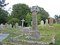
 Celtic style memorial - geograph.org.uk - 195185.jpg 427 × 640; 92 KB
-
 Changing trailers - geograph.org.uk - 197119.jpg 640 × 480; 122 KB
-
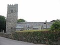
 Chelwood church.jpg 640 × 480; 102 KB
-
 Cherry Tree Cottage, Maxey, Peterborough - geograph.org.uk - 243928.jpg 640 × 480; 298 KB
-
 Chinese Supermarket - geograph.org.uk - 195159.jpg 640 × 480; 59 KB
-
 Clayton cottages - geograph.org.uk - 1566766.jpg 640 × 480; 100 KB
-

-
 Cloddfa Craig Wen Mine - geograph.org.uk - 231815.jpg 640 × 326; 74 KB
-
 Clough Bridge, Gosberton Clough, Lincs - geograph.org.uk - 259146.jpg 640 × 480; 397 KB
-
 Coal drops, Station Road, Sowerby Bridge - geograph.org.uk - 195219.jpg 640 × 474; 120 KB
-
 Cockwood , Cockwood Harbour - geograph.org.uk - 1143684.jpg 640 × 480; 36 KB
-
 Cockwood , Dawlish Warren Road - geograph.org.uk - 1143687.jpg 640 × 306; 32 KB
-
 Colcerrow - geograph.org.uk - 195959.jpg 640 × 480; 105 KB
-
 Collapsed Slate Mine Adit - geograph.org.uk - 231796.jpg 640 × 480; 120 KB
-

-
 Communication tower at Hill Top - geograph.org.uk - 227317.jpg 640 × 480; 43 KB
-

-
 Copinsay Lighthouse - geograph.org.uk - 253323.jpg 500 × 375; 41 KB
-
 Cotehill - geograph.org.uk - 195897.jpg 640 × 478; 115 KB
-
 Cotton Hall, Frampton, Lincs - geograph.org.uk - 195582.jpg 640 × 480; 294 KB
-
 Course of the Lapal Canal - geograph.org.uk - 227313.jpg 640 × 480; 112 KB
-
 Crags on summit of Mynydd Graig Goch - geograph.org.uk - 196667.jpg 640 × 480; 138 KB
-
 Cricket pitch, Horsforth Hall Park - geograph.org.uk - 195311.jpg 640 × 321; 51 KB
-
 Crift - geograph.org.uk - 195976.jpg 640 × 480; 116 KB
-
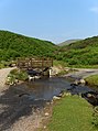
 Crook's Bridge - geograph.org.uk - 195875.jpg 640 × 478; 166 KB
-
 Crook's Bridge - geograph.org.uk - 196353.jpg 640 × 478; 221 KB
-
 Crossroads near Bodwen - geograph.org.uk - 195984.jpg 640 × 419; 51 KB
-

-
 Dawlish Warren , Coastguard Flag - geograph.org.uk - 1143679.jpg 640 × 480; 66 KB
-
 Dawlish Warren , Coastline and Beach - geograph.org.uk - 1143680.jpg 640 × 480; 64 KB
-
 Dawlish Warren , Funfair - geograph.org.uk - 1143682.jpg 640 × 480; 67 KB
-
 Dawlish Warren , Groyne - geograph.org.uk - 1143681.jpg 640 × 480; 68 KB
-
 Dawlish Warren , Pebbly Beach - geograph.org.uk - 1143676.jpg 640 × 480; 81 KB
-
 Dawlish Warren , The Sea - geograph.org.uk - 1143678.jpg 640 × 480; 53 KB
-
 Dee Marshes at Little Neston - geograph.org.uk - 196748.jpg 640 × 480; 62 KB
-
 Delph Bridge - geograph.org.uk - 1111792.jpg 640 × 480; 257 KB
-
 Denhall Quay, Little Neston - geograph.org.uk - 196738.jpg 640 × 480; 61 KB
-
 Derelict at Gwytherin - geograph.org.uk - 194861.jpg 640 × 480; 91 KB
-
 Dory and Helmsdale Bridge - geograph.org.uk - 198247.jpg 640 × 424; 72 KB
-
 Douster Pond, Buchan Country Park - geograph.org.uk - 238748.jpg 640 × 480; 342 KB
-
 Dry stone wall above Cwm Ciprwth - geograph.org.uk - 196649.jpg 640 × 480; 111 KB
-
 Dry Stone wall on Mynydd Graig Goch - geograph.org.uk - 196656.jpg 640 × 480; 131 KB
-
-
 Dryhope Tower - geograph.org.uk - 195093.jpg 640 × 476; 229 KB
-
 Dryhope Tower and Dryhope Farm - geograph.org.uk - 195095.jpg 640 × 480; 229 KB
-
 Dunham Rack - geograph.org.uk - 195211.jpg 640 × 427; 59 KB
-
 Elmer Sands - geograph.org.uk - 194961.jpg 640 × 479; 103 KB
-
 Elmer Sands, Elmer - geograph.org.uk - 194969.jpg 640 × 479; 109 KB
-
 Empty trailer arriving - geograph.org.uk - 197118.jpg 640 × 480; 107 KB
-
 Entrance to Boscastle Harbour - geograph.org.uk - 913496.jpg 640 × 480; 116 KB
-
 Entrance to Ford Airfield - geograph.org.uk - 194956.jpg 479 × 640; 136 KB
-
 Entrance to Hollingbourne Church - geograph.org.uk - 242329.jpg 640 × 480; 117 KB
-
 Extwistle Road - geograph.org.uk - 642953.jpg 640 × 427; 73 KB
-
 Factory - geograph.org.uk - 196964.jpg 640 × 480; 67 KB
-
 Falls of Dee - geograph.org.uk - 267686.jpg 640 × 480; 99 KB
-
 Falls of Shin Visitor Centre - geograph.org.uk - 198582.jpg 640 × 480; 106 KB
-
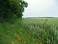 Farmland North of Rudston - geograph.org.uk - 195411.jpg 640 × 480; 135 KB
-
 Fee Burn,Clova - geograph.org.uk - 470769.jpg 640 × 482; 117 KB
-
 Felpham Beach - geograph.org.uk - 195042.jpg 640 × 530; 71 KB
-
 Fence junction, Deepslack Knowe - geograph.org.uk - 195083.jpg 640 × 480; 234 KB
-
 Fields North of Carleton - geograph.org.uk - 1253828.jpg 640 × 480; 65 KB
-
 Flooding on King Street, Mytholm - geograph.org.uk - 267977.jpg 640 × 480; 104 KB
-
 Footbridge, Southern Upland Way - geograph.org.uk - 195135.jpg 640 × 480; 266 KB
-

-
 Footpath to Denhall Lane, Ness - geograph.org.uk - 196721.jpg 640 × 480; 61 KB
-
 Ford through Carrock Beck - geograph.org.uk - 196318.jpg 478 × 640; 131 KB
-
 Forget-me-nots - geograph.org.uk - 195892.jpg 480 × 640; 203 KB
-

-
 Foxglove at Clogwyn Dirwest - geograph.org.uk - 197188.jpg 480 × 640; 138 KB
-
 Fruit shop, Bearwood - geograph.org.uk - 227301.jpg 640 × 480; 56 KB
-
 Garnedd-goch - geograph.org.uk - 196686.jpg 640 × 480; 136 KB
-
 Gate and fence, Deepslack Knowe - geograph.org.uk - 195069.jpg 640 × 480; 208 KB
-
 Gate, Hawkshaw Rig - geograph.org.uk - 195081.jpg 640 × 480; 298 KB
-
 Gates of Horsforth Hall Park - geograph.org.uk - 195307.jpg 640 × 480; 179 KB
-
 Gee Cross Fete 2006 - geograph.org.uk - 1009716.jpg 640 × 481; 115 KB
-
 Gee Cross Fete 2006 - geograph.org.uk - 1009720.jpg 640 × 481; 127 KB
-

-
 Goldstone Wharf, Market Drayton - geograph.org.uk - 280073.jpg 640 × 424; 85 KB
-

-
 Grand Union Canal, Saltley - geograph.org.uk - 195158.jpg 640 × 480; 71 KB
-
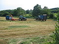
 Grass cutting at Lanlivery - geograph.org.uk - 197117.jpg 640 × 480; 91 KB
-

-
 Tin Tabernacle, Greet - geograph.org.uk - 195150.jpg 640 × 480; 63 KB
-
 Greet Primary School - geograph.org.uk - 196958.jpg 640 × 480; 49 KB
-
 Gunwen Methodist Church - geograph.org.uk - 196554.jpg 640 × 480; 61 KB
-
 Gwytherin bridge - geograph.org.uk - 194853.jpg 640 × 480; 88 KB
-
 Gwytherin cottages - geograph.org.uk - 194856.jpg 640 × 480; 63 KB
-
 Gwytherin village - geograph.org.uk - 194860.jpg 640 × 480; 88 KB
-
 Hadley Stadium - geograph.org.uk - 195189.jpg 640 × 480; 36 KB
-

-
 Hagley Road West - geograph.org.uk - 195183.jpg 640 × 480; 62 KB
-
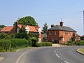
 Hanns Hall Farm, Willaston - geograph.org.uk - 196708.jpg 640 × 480; 60 KB
-
 Harborne Bridge, Selly Oak - geograph.org.uk - 227310.jpg 640 × 480; 41 KB
-
 Haycombe cemetery - geograph.org.uk - 194944.jpg 640 × 480; 69 KB
-
 Hazelwell Church - geograph.org.uk - 195163.jpg 640 × 480; 52 KB
-
 Helman Tor - geograph.org.uk - 196428.jpg 640 × 480; 106 KB
-
 Helman Tor - geograph.org.uk - 196562.jpg 480 × 640; 75 KB
-
 Helmsdale harbour - geograph.org.uk - 198262.jpg 640 × 424; 44 KB
-
 Hidden stile on A476 - geograph.org.uk - 195920.jpg 480 × 640; 135 KB
-
 Hills near Llansannan - geograph.org.uk - 194847.jpg 640 × 480; 43 KB
-
 Hinderton Hall Lodge - geograph.org.uk - 196714.jpg 640 × 480; 60 KB
-
 Hinderton Hall, Hinderton - geograph.org.uk - 196716.jpg 640 × 480; 38 KB
-
 Hobbs Farm, Bilsham - geograph.org.uk - 195029.jpg 640 × 479; 123 KB
-
 Hogweed - geograph.org.uk - 933583.jpg 640 × 480; 138 KB
-
 Holliday Road, Handsworth - geograph.org.uk - 227294.jpg 640 × 480; 49 KB
-
 Hollingbourne Village Sign - geograph.org.uk - 242323.jpg 640 × 480; 103 KB
-
 Hollybank Road, Billesley Common - geograph.org.uk - 196999.jpg 640 × 480; 46 KB
-
 HolywoodArt.jpg 605 × 957; 289 KB
-
 HolywoodFirstPres.jpg 1,051 × 711; 428 KB
-
 HolywoodFoliage.jpg 860 × 792; 379 KB
-
 HolywoodNeds.jpg 663 × 967; 276 KB
-
 HolywoodUlsterWay.jpg 462 × 1,064; 210 KB
-
 Horses on Hill Top - geograph.org.uk - 195184.jpg 640 × 480; 50 KB
-
-
 Informal Lido, Port Talbot steelworks.jpg 640 × 480; 100 KB
-
 Inside the Upper Adit of Craig Wen Mine - geograph.org.uk - 231817.jpg 640 × 480; 116 KB
-
 Isolated Cross - geograph.org.uk - 195957.jpg 640 × 480; 82 KB
-

-
-
 Kettlethorpe Hall - geograph.org.uk - 195179.jpg 640 × 427; 89 KB
-
 Kex Beck from the footbridge - geograph.org.uk - 476929.jpg 640 × 480; 100 KB
-
 Kex Beck from the Footbridge - geograph.org.uk - 476932.jpg 640 × 480; 109 KB
-
 Lime Kiln near Blasterfield Farm - geograph.org.uk - 195151.jpg 600 × 421; 129 KB
-
 Litchfield Rectory - geograph.org.uk - 374307.jpg 640 × 480; 121 KB
-
 Llanthony Priory - geograph.org.uk - 195695.jpg 1,024 × 683; 144 KB
-
 Loch Awe Hotel - geograph.org.uk - 195316.jpg 640 × 480; 99 KB
-
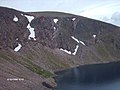 Loch Coire an Lochan Braeriach - geograph.org.uk - 267086.jpg 640 × 480; 84 KB
-
 Lochmaben Castle - geograph.org.uk - 195884.jpg 640 × 480; 336 KB
-
 Lodge Close, Ancton - geograph.org.uk - 194967.jpg 640 × 479; 147 KB
-
 Logan Rock at Helman Tor - geograph.org.uk - 196582.jpg 640 × 480; 90 KB
-
 Londonderry shops - geograph.org.uk - 227302.jpg 640 × 480; 55 KB
-
 Lonely remains of Cape Hill Brewery - geograph.org.uk - 195191.jpg 640 × 480; 44 KB
-

-

-

-

-
 Luppitt, near Hill End Farm - geograph.org.uk - 195043.jpg 640 × 427; 248 KB
-
 Luxulyan church - geograph.org.uk - 196431.jpg 640 × 480; 72 KB
-
 Luxulyan churchyard - geograph.org.uk - 196433.jpg 640 × 480; 116 KB
-
 Luxulyan Institute - geograph.org.uk - 196436.jpg 640 × 480; 94 KB
-
 M6 Toll at Weeford - geograph.org.uk - 195494.jpg 640 × 480; 70 KB
-
 Main Road, Dunsby, Lincs - geograph.org.uk - 243934.jpg 640 × 480; 284 KB
-
 Main Road, Rippingale, Lincs - geograph.org.uk - 259071.jpg 640 × 480; 341 KB
-
 Manor Farm, Frampton, Lincs - geograph.org.uk - 195577.jpg 640 × 480; 352 KB
-

-
 Marksbury Plain - geograph.org.uk - 195077.jpg 640 × 480; 80 KB


_Jul_2006_(cropped).jpg)


