Category:United Kingdom photographs taken on 2007-11-03
Jump to navigation
Jump to search
Countries of Europe: Austria · Belgium · Bulgaria · Croatia · Czech Republic · Denmark · France‡ · Germany · Greece · Hungary · Republic of Ireland · Italy · Malta · Netherlands‡ · Norway · Poland · Portugal‡ · Romania · Russia‡ · Slovakia · Spain‡ · Sweden · Switzerland · Turkey‡ · Ukraine · United Kingdom
Specific status: Isle of Man
‡: partly located in Europe
Specific status: Isle of Man
‡: partly located in Europe
| ← | 3 November 2007 | → | ||
| ← | November 2007 | → | ||

United Kingdom photographs taken on 3 November 2007.
Image files should be categorized here automatically using {{taken on}} template. Direct categorisation is also possible, if automatic is impossible.
Subcategories
This category has the following 2 subcategories, out of 2 total.
Media in category "United Kingdom photographs taken on 2007-11-03"
The following 200 files are in this category, out of 1,076 total.
(previous page) (next page)-
 "Elevenses" for the beaters at Kellas - geograph.org.uk - 602563.jpg 426 × 640; 99 KB
-
 "Picking up" on the banks of the Lossie - geograph.org.uk - 602646.jpg 640 × 426; 175 KB
-
-
 'The Imperial Bar', Bangor - geograph.org.uk - 602040.jpg 640 × 480; 73 KB
-

-
 A "Flanker" east of Bodnastalker - geograph.org.uk - 602551.jpg 640 × 426; 85 KB
-

-
 A 'keeper, a gun, and a dog at Kellas - geograph.org.uk - 602685.jpg 640 × 426; 172 KB
-
 A boulder among trees near Bruntland - geograph.org.uk - 1033766.jpg 640 × 480; 121 KB
-
 A Bruntland cottage - geograph.org.uk - 1033776.jpg 640 × 480; 139 KB
-
-
 A copse near Essie - geograph.org.uk - 1033549.jpg 640 × 480; 105 KB
-
 A disused quarry hidden by autumn leaves - geograph.org.uk - 602552.jpg 640 × 480; 136 KB
-
 A forest of signs - geograph.org.uk - 607449.jpg 429 × 640; 73 KB
-
 A glacial boulder on Moss of Essie - geograph.org.uk - 1034240.jpg 640 × 480; 84 KB
-

-
 A muddy track on Middleholm Hill - geograph.org.uk - 602571.jpg 640 × 480; 128 KB
-
 A scene on Penarth Pier - geograph.org.uk - 1234759.jpg 640 × 480; 71 KB
-
 A view down the Deveron - geograph.org.uk - 1034550.jpg 640 × 480; 114 KB
-
 A wintry scene on the Moss of Essie - geograph.org.uk - 1034223.jpg 640 × 480; 102 KB
-
 A5 Watling Street - geograph.org.uk - 606684.jpg 640 × 458; 58 KB
-
 A638 junction near Badsworth - geograph.org.uk - 601924.jpg 640 × 478; 54 KB
-
 A914 at King's Ford bridge - geograph.org.uk - 1034595.jpg 640 × 480; 115 KB
-
 A941 and Auchmair - geograph.org.uk - 1034615.jpg 640 × 480; 103 KB
-
 A941 approaching The Cabrach - geograph.org.uk - 1034403.jpg 640 × 480; 51 KB
-
 A941 near Auchmair - geograph.org.uk - 1034475.jpg 640 × 480; 73 KB
-
 A97 asdcending through a rock outcrop - geograph.org.uk - 1033757.jpg 640 × 480; 124 KB
-
 Above Loch Callater - geograph.org.uk - 603263.jpg 640 × 480; 163 KB
-
 Access to cottages at Bruntland - geograph.org.uk - 1033792.jpg 640 × 480; 135 KB
-
 Access to Newseat Farm - geograph.org.uk - 1033264.jpg 640 × 480; 157 KB
-
 Access to Scurdargue Cottages - geograph.org.uk - 1033295.jpg 640 × 480; 133 KB
-
 Adit, Glen Liath - geograph.org.uk - 621431.jpg 427 × 640; 100 KB
-
 Against the tide - geograph.org.uk - 683146.jpg 640 × 480; 46 KB
-
 Aldershot-Guildford Line - geograph.org.uk - 602115.jpg 640 × 480; 103 KB
-
 Aldwych Theatre London 2007.jpg 3,072 × 2,304; 3.26 MB
-

-
 Another entrance to Clashindarroch - geograph.org.uk - 1034322.jpg 640 × 480; 129 KB
-
 Approach to Cowford Bridge - geograph.org.uk - 1034250.jpg 640 × 480; 95 KB
-
 Arable land at Hall Farm - geograph.org.uk - 602214.jpg 640 × 480; 214 KB
-
 Arriva heads south - geograph.org.uk - 684418.jpg 640 × 480; 66 KB
-
 Ashton Methodist Church - geograph.org.uk - 602956.jpg 640 × 512; 64 KB
-
 Auchallater - geograph.org.uk - 603209.jpg 640 × 358; 145 KB
-
 Autumn at Tyrone County Hospital - geograph.org.uk - 602192.jpg 640 × 257; 49 KB
-

-
 Autumn Cherry at Balnaknock - geograph.org.uk - 602090.jpg 640 × 480; 158 KB
-

-
 Autumn Colours - geograph.org.uk - 602744.jpg 640 × 480; 103 KB
-
 Autumn farmland - geograph.org.uk - 615419.jpg 640 × 480; 95 KB
-
 Autumn in Lorne Road Forest Gate - geograph.org.uk - 609338.jpg 480 × 640; 56 KB
-
 Autumn sunshine - geograph.org.uk - 667681.jpg 640 × 480; 93 KB
-

-
 Badger Edge Lane - geograph.org.uk - 602687.jpg 640 × 451; 119 KB
-
 Badger Edge Lane - geograph.org.uk - 602698.jpg 640 × 480; 96 KB
-
 Badsworth dawn - geograph.org.uk - 601922.jpg 640 × 323; 26 KB
-

-
 Baldwin Lane - geograph.org.uk - 602897.jpg 640 × 397; 26 KB
-
 Balmoral Avenue, Belfast - geograph.org.uk - 602093.jpg 640 × 426; 76 KB
-
 Balmoral railway station in 2007.jpg 640 × 380; 85 KB
-
 Balmoral station, Belfast (1) - geograph.org.uk - 602081.jpg 640 × 388; 85 KB
-
 Balmoral station, Belfast (2) - geograph.org.uk - 602085.jpg 640 × 394; 73 KB
-
 Bandlay junction. - geograph.org.uk - 1032143.jpg 480 × 640; 123 KB
-
 Baptist Church, Whitchurch - geograph.org.uk - 602770.jpg 640 × 480; 64 KB
-
 Barmouth Beach MotoCross Weekend - geograph.org.uk - 603641.jpg 640 × 480; 80 KB
-

-
 Barmouth Harbour - geograph.org.uk - 603773.jpg 640 × 480; 57 KB
-
 Barmouth harbour - geograph.org.uk - 683122.jpg 640 × 480; 36 KB
-
 Barmouth Harbour and Dinas Oleu - geograph.org.uk - 603763.jpg 640 × 480; 75 KB
-
-
 Beach near Inver, at low tide - geograph.org.uk - 602507.jpg 640 × 480; 94 KB
-
 Beacon Road - geograph.org.uk - 603322.jpg 640 × 480; 26 KB
-

-
 Beechwoods Nature Reserve - geograph.org.uk - 604834.jpg 640 × 480; 106 KB
-
 Beechwoods Nature Reserve - geograph.org.uk - 730155.jpg 640 × 480; 99 KB
-
 Before the bridge. - geograph.org.uk - 683155.jpg 640 × 480; 27 KB
-
 Bell Street, Whitchurch - geograph.org.uk - 604190.jpg 640 × 480; 71 KB
-
 Bell tower, Chester Cathedral - geograph.org.uk - 602586.jpg 480 × 640; 74 KB
-
 Bench at the five roads junction - geograph.org.uk - 603767.jpg 640 × 480; 87 KB
-
 Benchmark at Bell's Bridge, Omagh - geograph.org.uk - 602287.jpg 640 × 480; 46 KB
-
 Benchmark, Omagh - geograph.org.uk - 602294.jpg 640 × 480; 103 KB
-
 Bend in Road near Dawsmere - geograph.org.uk - 602226.jpg 640 × 480; 105 KB
-
-
 Bentall Centre - geograph.org.uk - 664187.jpg 480 × 640; 103 KB
-
 Berry Hillock - geograph.org.uk - 1034558.jpg 640 × 480; 90 KB
-
 Bethlehem Baptist chapel, front view - geograph.org.uk - 699678.jpg 640 × 480; 82 KB
-
 Between the tides. - geograph.org.uk - 683082.jpg 480 × 640; 38 KB
-
 Bike Trail by Muckle Ord - geograph.org.uk - 602673.jpg 640 × 480; 91 KB
-
 Blackmiddens entrance to Clashindarroch - geograph.org.uk - 1034339.jpg 640 × 480; 133 KB
-
 Blackpool icons - geograph.org.uk - 1723260.jpg 640 × 480; 73 KB
-
 Blackpool North Shore - geograph.org.uk - 1723270.jpg 640 × 480; 89 KB
-
 Blackpool North station - geograph.org.uk - 1724699.jpg 640 × 480; 98 KB
-
 Blackpool tower - geograph.org.uk - 602439.jpg 640 × 425; 71 KB
-
 Blackpool tower from Central pier - geograph.org.uk - 602729.jpg 425 × 640; 56 KB
-
 Boathouse on Blelham Tarn - geograph.org.uk - 617279.jpg 640 × 480; 101 KB
-
 Bockmer End - geograph.org.uk - 605052.jpg 640 × 480; 136 KB
-
 Bonfire Construction, Skinningrove - geograph.org.uk - 602469.jpg 640 × 426; 70 KB
-
 Bottom view of the Devils Dyke - geograph.org.uk - 1067309.jpg 640 × 480; 94 KB
-
 Bournemouth East Cliff Railway 2.jpg 640 × 480; 88 KB
-
 Bournemouth East Cliff Railway 3.jpg 480 × 640; 98 KB
-
 Bournemouth, prom lamppost and bin - geograph.org.uk - 602460.jpg 477 × 640; 52 KB
-
 Bourton On Dunsmore - geograph.org.uk - 603192.jpg 640 × 480; 68 KB
-
 Bow Lock - geograph.org.uk - 722880.jpg 640 × 480; 59 KB
-
 Ornamental bracket and lamp at Langholm - geograph.org.uk - 603833.jpg 480 × 640; 115 KB
-

-

-
 Bradford on Avon Cemetery - geograph.org.uk - 602112.jpg 640 × 435; 82 KB
-

-
 Brae of Scurdargue - geograph.org.uk - 1033357.jpg 640 × 480; 67 KB
-
 Branch Line - geograph.org.uk - 602080.jpg 640 × 555; 115 KB
-
 Bridge in Glen Callater - geograph.org.uk - 603225.jpg 640 × 480; 161 KB
-
 Bridge nursery and tea room - geograph.org.uk - 1211015.jpg 640 × 429; 89 KB
-
 Bridge over Burn of Bank - geograph.org.uk - 1034486.jpg 640 × 480; 72 KB
-
 Bridge over Burn of Redford - geograph.org.uk - 1034465.jpg 640 × 480; 86 KB
-
 Bridge over stream at Test Road - geograph.org.uk - 603574.jpg 640 × 480; 120 KB
-
 Bridge over the Lossie by Mains of Kellas - geograph.org.uk - 602579.jpg 640 × 426; 146 KB
-
 Bridge over the Milltown Burn - geograph.org.uk - 1034780.jpg 640 × 480; 79 KB
-
 Bridge over Water of Bogie - geograph.org.uk - 1033128.jpg 640 × 480; 132 KB
-
 Bridge Street, Chester - geograph.org.uk - 602609.jpg 480 × 640; 92 KB
-
 Bridleway and power lines at dawn - geograph.org.uk - 601926.jpg 640 × 480; 55 KB
-
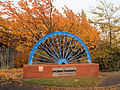 Brierley - Mining Wheel.jpg 640 × 480; 201 KB
-
 Bright Street - Scarlet Heights - geograph.org.uk - 602894.jpg 589 × 640; 35 KB
-
 Broadbent Geograph-602171-by-Eirian-Evans.jpg 480 × 640; 76 KB
-
 Brockhampton House - geograph.org.uk - 621473.jpg 640 × 480; 78 KB
-
 Brockhampton Park and Church - geograph.org.uk - 621484.jpg 640 × 480; 95 KB
-

-
 Buildings looking for a new use - geograph.org.uk - 603565.jpg 640 × 480; 86 KB
-
 Burdale North Wold Farm. - geograph.org.uk - 1037186.jpg 640 × 480; 103 KB
-
 Burgers and Butties. - geograph.org.uk - 654880.jpg 640 × 480; 90 KB
-
 Burn flowing into Glen Callater - geograph.org.uk - 603230.jpg 640 × 480; 162 KB
-
 Burn near Wester Arboll - geograph.org.uk - 602514.jpg 640 × 480; 79 KB
-
 Bus stop at Derwentwater Youth Hostel - geograph.org.uk - 618828.jpg 640 × 480; 97 KB
-
-
 Byford Church - geograph.org.uk - 604817.jpg 426 × 640; 110 KB
-
 Cabin Lift, Blackpool.jpg 425 × 640; 42 KB
-
 Cairn on Carn an Tuirc - geograph.org.uk - 603819.jpg 640 × 480; 81 KB
-
 Cambridge Water Company building - geograph.org.uk - 615411.jpg 640 × 480; 57 KB
-
 Campsie Road, Omagh - geograph.org.uk - 602340.jpg 640 × 259; 41 KB
-
 Capel Pendref, Rhuthun - geograph.org.uk - 601977.jpg 480 × 588; 164 KB
-
 Capel y Tabernacle, Rhuthun - geograph.org.uk - 601969.jpg 480 × 640; 129 KB
-
 Carnaby Street - geograph.org.uk - 604100.jpg 640 × 480; 75 KB
-
 Castle Ewen - geograph.org.uk - 602162.jpg 640 × 496; 66 KB
-
 Cattle grid on track to Old Merdrum - geograph.org.uk - 1033513.jpg 640 × 480; 122 KB
-
 Cattle on Bloch Hill - geograph.org.uk - 602474.jpg 640 × 480; 126 KB
-
-
 Cemetery entrance - geograph.org.uk - 639502.jpg 480 × 640; 96 KB
-
 Central pier - geograph.org.uk - 602446.jpg 640 × 425; 57 KB
-
 Cera's Flowers, Bridge Street, Omagh - geograph.org.uk - 602327.jpg 640 × 448; 65 KB
-

-
 Christ Church, Silloth - geograph.org.uk - 618814.jpg 640 × 480; 31 KB
-

-
 Church Street, Hereford - geograph.org.uk - 639524.jpg 640 × 480; 85 KB
-
 Circular seat by Whitchurch Town Hall - geograph.org.uk - 602785.jpg 640 × 480; 71 KB
-
 Cisne no Hyde Park (1878810064).jpg 1,280 × 960; 549 KB
-
 Clashindarroch car park sign - geograph.org.uk - 1034305.jpg 640 × 480; 98 KB
-

-
 Clearing scrub from the derelict canal - geograph.org.uk - 602258.jpg 640 × 480; 119 KB
-

-
 Coldham's Business Park - geograph.org.uk - 604810.jpg 640 × 480; 41 KB
-
 Coldham's Business Park - geograph.org.uk - 604814.jpg 640 × 480; 44 KB
-
 Commercial Road, Hereford - geograph.org.uk - 639506.jpg 640 × 480; 91 KB
-

-
 Corner drop, River Kent - geograph.org.uk - 1195996.jpg 640 × 480; 89 KB
-
 Coronation Stone - geograph.org.uk - 664311.jpg 640 × 480; 126 KB
-
 Cot-town wood - geograph.org.uk - 617648.jpg 640 × 480; 153 KB
-
 Cotesbach Manor House - geograph.org.uk - 606700.jpg 640 × 454; 94 KB
-
 Cottage at Staunton on Wye - geograph.org.uk - 604824.jpg 640 × 426; 142 KB
-
 Cottage at Whitchurch - geograph.org.uk - 602766.jpg 640 × 480; 87 KB
-
 Cottage by Baldyvin road - geograph.org.uk - 1032388.jpg 640 × 480; 96 KB
-
 Cottages on the lane to Hammill Farm - geograph.org.uk - 602873.jpg 640 × 480; 44 KB
-
 Croftland at Balnaknock - geograph.org.uk - 602096.jpg 640 × 480; 96 KB
-
 Croftland in Glen Uig - geograph.org.uk - 602183.jpg 640 × 480; 126 KB
-
 Crowtrees Park - geograph.org.uk - 605566.jpg 640 × 480; 208 KB
-
 Cutter from a Combine Harvester - geograph.org.uk - 602470.jpg 640 × 480; 81 KB
-
 Cycle path, Stanground to Whittlesey - geograph.org.uk - 603037.jpg 640 × 428; 116 KB
-
 Dalriach - geograph.org.uk - 1034566.jpg 640 × 480; 124 KB
-
 Darent Valley Path - geograph.org.uk - 609456.jpg 640 × 427; 98 KB
-
 Darfield Sunset - geograph.org.uk - 602262.jpg 640 × 426; 37 KB
-
 David Street, Langholm - geograph.org.uk - 603810.jpg 480 × 640; 116 KB
-
 Deadly ford - geograph.org.uk - 602354.jpg 640 × 480; 337 KB
-
 Decaying log - geograph.org.uk - 602462.jpg 640 × 480; 156 KB
-

-
 Delph New Road, Dobcross - geograph.org.uk - 602405.jpg 640 × 464; 149 KB
-
 Derelict buildings, Thornton Road - geograph.org.uk - 605815.jpg 640 × 556; 108 KB
-
 Derelict cottage by Auchmair - geograph.org.uk - 1034480.jpg 640 × 480; 109 KB
-
 Derelict cottages at Nether Ardwell - geograph.org.uk - 1034564.jpg 640 × 480; 122 KB
-
 Derwentwater Youth Hostel - geograph.org.uk - 618823.jpg 640 × 480; 60 KB
-
 Development site, Balmoral, Belfast - geograph.org.uk - 602111.jpg 640 × 426; 61 KB
-
 Devils Dyke - geograph.org.uk - 1061666.jpg 640 × 480; 91 KB
-
 Dipper in Callater Burn - geograph.org.uk - 605715.jpg 640 × 480; 83 KB
-
 Discharge pipe and gulley - geograph.org.uk - 1034718.jpg 640 × 480; 120 KB
-
 Displaced sign - geograph.org.uk - 604210.jpg 640 × 480; 136 KB
-
 Distant deer (1) - geograph.org.uk - 604812.jpg 600 × 450; 146 KB
-
 Distant deer (2) - geograph.org.uk - 604816.jpg 600 × 450; 148 KB
-
 Disused quarry - geograph.org.uk - 1033733.jpg 640 × 480; 105 KB
-
 Disused railway line - geograph.org.uk - 604567.jpg 640 × 480; 93 KB
-
 Dolphin Square, Weston-super-Mare (2007).jpg 1,366 × 1,024; 348 KB
-
 Downstream Burn of Balhinny glen - geograph.org.uk - 1033746.jpg 640 × 480; 115 KB
-
 Downstream Burn of Bank - geograph.org.uk - 1034491.jpg 640 × 480; 138 KB
-
 Downstream Burn of Longley - geograph.org.uk - 1034284.jpg 480 × 640; 93 KB
-
 Downstream Burn of Redford - geograph.org.uk - 1034467.jpg 480 × 640; 95 KB
-
 Downstream Water of Bogie - geograph.org.uk - 1033124.jpg 640 × 480; 126 KB


_-_geograph.org.uk_-_602081.jpg)
_-_geograph.org.uk_-_602085.jpg)


.jpg)


_-_geograph.org.uk_-_604812.jpg)
_-_geograph.org.uk_-_604816.jpg)


.jpg)


