Category:United Kingdom photographs taken on 2007-11-04
Jump to navigation
Jump to search
Countries of Europe: Austria · Belarus · Belgium · Bulgaria · Croatia · Denmark · Finland · France‡ · Germany · Greece · Italy · Malta · Netherlands‡ · Norway · Poland · Portugal‡ · Russia‡ · Spain‡ · Sweden · Switzerland · Turkey‡ · Ukraine · United Kingdom
‡: partly located in Europe
‡: partly located in Europe
| ← | 4 November 2007 | → | ||
| ← | November 2007 | → | ||

United Kingdom photographs taken on 4 November 2007.
Image files should be categorized here automatically using {{taken on}} template. Direct categorisation is also possible, if automatic is impossible.
Subcategories
This category has the following 3 subcategories, out of 3 total.
Media in category "United Kingdom photographs taken on 2007-11-04"
The following 200 files are in this category, out of 1,114 total.
(previous page) (next page)-
 "Irongate", private bridge in marshland - geograph.org.uk - 603386.jpg 640 × 480; 158 KB
-
 "Top of the Town" - geograph.org.uk - 603529.jpg 640 × 426; 77 KB
-
 (The line of the) lead smelting flue - geograph.org.uk - 603865.jpg 640 × 480; 80 KB
-
 142094 at York.jpg 1,944 × 1,296; 1.46 MB
-
 150268 at York.jpg 1,944 × 1,296; 1.35 MB
-
 150271 at York (1).jpg 1,944 × 1,296; 1.46 MB
-
 150271 at York.jpg 1,944 × 1,296; 1.44 MB
-
 1968 Daimler Sovereign on the A23 in Merstham.jpg 3,872 × 2,592; 4.9 MB
-
 2HAP 414308 at the NRM.jpg 3,888 × 2,592; 2.5 MB
-

-
 A herb flowering in November - geograph.org.uk - 603262.jpg 640 × 480; 126 KB
-
 A new carpark^ - geograph.org.uk - 603536.jpg 640 × 480; 78 KB
-
 A Passing Train - geograph.org.uk - 610436.jpg 640 × 426; 90 KB
-
 A Roundabout - geograph.org.uk - 603513.jpg 640 × 426; 92 KB
-
 A Stone Carr Field - geograph.org.uk - 603555.jpg 640 × 480; 90 KB
-
 A tasteful restoration - geograph.org.uk - 610515.jpg 640 × 480; 66 KB
-
 A388 south of Chapman's Well - geograph.org.uk - 603465.jpg 640 × 427; 162 KB
-
 Afon Dwyfach Bryncir - geograph.org.uk - 603123.jpg 640 × 428; 105 KB
-
 Afon Troddi-River Trothy - geograph.org.uk - 606762.jpg 426 × 640; 142 KB
-
 Albany Court, Crail - geograph.org.uk - 604073.jpg 640 × 430; 68 KB
-
 Albury View - geograph.org.uk - 710295.jpg 640 × 425; 73 KB
-
 All Saints Church, Strelley - geograph.org.uk - 604297.jpg 480 × 640; 143 KB
-

-
 Alpacas - geograph.org.uk - 603994.jpg 640 × 428; 96 KB
-
 Andrew Marr International - geograph.org.uk - 604187.jpg 640 × 480; 57 KB
-
 Angler, Coate Water country park, Swindon - geograph.org.uk - 603035.jpg 640 × 480; 119 KB
-
 Antrim Station - geograph.org.uk - 603505.jpg 640 × 426; 82 KB
-
 Arnison Crag Summit - geograph.org.uk - 648646.jpg 640 × 480; 66 KB
-

-
 Aucharroch - geograph.org.uk - 606397.jpg 480 × 640; 100 KB
-
 Auldallan - geograph.org.uk - 605717.jpg 480 × 640; 100 KB
-
 Auldallan - geograph.org.uk - 606371.jpg 640 × 480; 112 KB
-
 Autumn acers - geograph.org.uk - 611584.jpg 640 × 427; 159 KB
-
 Autumn Beech leaves in Hen Wood - geograph.org.uk - 604394.jpg 640 × 448; 322 KB
-
 Autumn Beech trees in Hen Wood - geograph.org.uk - 604401.jpg 438 × 640; 213 KB
-

-
 Autumn Beech, Churchyard, Hope Mansell - geograph.org.uk - 603668.jpg 480 × 640; 179 KB
-
 Autumn Colour - geograph.org.uk - 604499.jpg 426 × 640; 135 KB
-

-
-
 Autumn countryside near Cossall - geograph.org.uk - 611577.jpg 640 × 427; 67 KB
-
 Autumn countryside near Cossall - geograph.org.uk - 611580.jpg 640 × 427; 80 KB
-
 Autumn Gold - geograph.org.uk - 604313.jpg 640 × 427; 116 KB
-

-
 Autumn Lane - geograph.org.uk - 992055.jpg 640 × 455; 270 KB
-
 Autumn Leaves - geograph.org.uk - 876879.jpg 640 × 457; 145 KB
-
 Autumn leaves at Rosedale Drive - geograph.org.uk - 612622.jpg 640 × 480; 145 KB
-
 Autumn leaves in Cornwell Road - geograph.org.uk - 603800.jpg 640 × 480; 125 KB
-
 Autumn leaves on The Forest - geograph.org.uk - 604537.jpg 640 × 480; 79 KB
-
 Autumn leaves on The Forest - geograph.org.uk - 604538.jpg 480 × 640; 101 KB
-
 Autumn light - geograph.org.uk - 604005.jpg 480 × 640; 130 KB
-
 Autumnal Ivy Lane near Market Hill - geograph.org.uk - 603624.jpg 640 × 480; 139 KB
-
 Autumnal Trees on Far Bank - geograph.org.uk - 603605.jpg 640 × 480; 142 KB
-
 Axdane, Hull - geograph.org.uk - 603053.jpg 640 × 463; 186 KB
-

-
 Bales at the top of the hill - geograph.org.uk - 603554.jpg 640 × 427; 109 KB
-
 Bandstand at Walmer - geograph.org.uk - 603930.jpg 640 × 480; 38 KB
-
 Barkingside full stn building.JPG 1,280 × 960; 348 KB
-
 Barkingside stn north.JPG 1,280 × 960; 330 KB
-
 Baron's Hill - geograph.org.uk - 606400.jpg 640 × 480; 74 KB
-
 Beech and bracken - geograph.org.uk - 603896.jpg 480 × 640; 343 KB
-
 Beeston Bump 4 November 2007 (14).jpg 800 × 600; 175 KB
-
 Beside The Forest fence - geograph.org.uk - 604554.jpg 480 × 640; 151 KB
-

-
 Biallibeg cottage from A86 - geograph.org.uk - 1573369.jpg 640 × 457; 33 KB
-
 Birches amongst the pines - geograph.org.uk - 603882.jpg 480 × 640; 329 KB
-

-
-
 Black and White reflections, Eardisland - geograph.org.uk - 635041.jpg 640 × 480; 107 KB
-

-
 Bole stile - geograph.org.uk - 607905.jpg 427 × 640; 114 KB
-

-
 Bow Bridge - geograph.org.uk - 705432.jpg 640 × 425; 118 KB
-
 Bridge on the "Cement Road" - geograph.org.uk - 603327.jpg 640 × 552; 118 KB
-
 Bridge over the Tamar near Poole Farm - geograph.org.uk - 603472.jpg 640 × 427; 332 KB
-
 Bridgeman House, Hull - geograph.org.uk - 603067.jpg 501 × 640; 161 KB
-
 Bridlepath in autumn - geograph.org.uk - 1126851.jpg 640 × 480; 168 KB
-
 Bridleway near Turkey Farm - geograph.org.uk - 604252.jpg 640 × 427; 126 KB
-
 Bridleway towards Strelley - geograph.org.uk - 611567.jpg 640 × 427; 148 KB
-
 Brookcot Road, Baguley - panoramio.jpg 2,048 × 1,536; 846 KB
-
 Brookway Court, Baguley - panoramio - WythenshaweMike.jpg 1,536 × 2,048; 801 KB
-
 Brookway Court, Baguley - panoramio.jpg 1,536 × 2,048; 960 KB
-
 Brothers' Parting Stone - geograph.org.uk - 648722.jpg 640 × 480; 88 KB
-
 Brunswick Street West - geograph.org.uk - 603411.jpg 463 × 640; 75 KB
-
 Brunswick Street West - geograph.org.uk - 603421.jpg 429 × 640; 66 KB
-

-
 Burnthouse Hill - geograph.org.uk - 607093.jpg 515 × 640; 141 KB
-
 Burton Court, near Eardisland - geograph.org.uk - 635065.jpg 640 × 424; 78 KB
-
 Bury St.Edmunds library - geograph.org.uk - 603440.jpg 640 × 480; 93 KB
-
 Butler's Wharf - geograph.org.uk - 605087.jpg 640 × 480; 71 KB
-
 Canal boats at Sawley Marina - geograph.org.uk - 604848.jpg 482 × 640; 40 KB
-
 Canal boats at Sawley Marina - geograph.org.uk - 604854.jpg 640 × 482; 71 KB
-
 Canolfan Arddio Bryncir Garden Centre - geograph.org.uk - 603158.jpg 640 × 428; 109 KB
-
 Cantilever Bridge - geograph.org.uk - 625001.jpg 640 × 449; 70 KB
-
 Capel Soar Bryncir - geograph.org.uk - 603085.jpg 640 × 428; 67 KB
-
 Capel Soar Bryncir - geograph.org.uk - 603091.jpg 640 × 428; 96 KB
-
 Carr Lane west of Arnold - geograph.org.uk - 603566.jpg 480 × 640; 71 KB
-
 Cat Law - geograph.org.uk - 605666.jpg 638 × 437; 43 KB
-
 Cattle, Westerton - geograph.org.uk - 604560.jpg 640 × 480; 122 KB
-
 Centre for Biomolecular Sciences - geograph.org.uk - 603849.jpg 427 × 640; 95 KB
-
 Centre for Biomolecular Sciences - geograph.org.uk - 603860.jpg 640 × 427; 69 KB
-
 Centre for Rural Innovation, Edgmond - geograph.org.uk - 603092.jpg 640 × 480; 60 KB
-
 Chalybeate Close Southampton - geograph.org.uk - 603658.jpg 640 × 480; 117 KB
-
 Cherry Trees Club in Autumn - geograph.org.uk - 602961.jpg 640 × 473; 129 KB
-
 Chestnut tree, Rassler Wood - geograph.org.uk - 605773.jpg 480 × 640; 196 KB
-
 Cheswell Manor - geograph.org.uk - 603126.jpg 640 × 480; 101 KB
-
 Cheswellhill - geograph.org.uk - 603130.jpg 640 × 480; 75 KB
-
 Chinese Bridge - geograph.org.uk - 605046.jpg 640 × 427; 70 KB
-
 Church Cottage, Cossall - geograph.org.uk - 604236.jpg 640 × 427; 120 KB
-
 Church Lane, Cossall - geograph.org.uk - 607916.jpg 640 × 427; 105 KB
-
 Church of the Sacred Heart - geograph.org.uk - 603004.jpg 640 × 480; 85 KB
-
 Church Ruins - geograph.org.uk - 605355.jpg 640 × 480; 72 KB
-
 Church Street - geograph.org.uk - 609033.jpg 640 × 478; 176 KB
-
 Church Thorns, near Belvoir - geograph.org.uk - 604044.jpg 640 × 427; 117 KB
-
 Church Wood Avenue - geograph.org.uk - 604167.jpg 640 × 480; 90 KB
-
 Churchyard at St Andrew's Church, Denton - geograph.org.uk - 603696.jpg 640 × 427; 103 KB
-
 City Hall, London - geograph.org.uk - 605083.jpg 640 × 480; 64 KB
-
 Clearance work on the Wendover Arm - geograph.org.uk - 603873.jpg 640 × 477; 114 KB
-
 Cleddans Bar, Clydebank - geograph.org.uk - 603746.jpg 640 × 480; 93 KB
-
 Cliff Road Car Park - geograph.org.uk - 604204.jpg 640 × 461; 51 KB
-
 Cliff Road, Hessle - geograph.org.uk - 604208.jpg 640 × 480; 81 KB
-
 Climbing Stickle Ghyll - geograph.org.uk - 622453.jpg 640 × 427; 323 KB
-
 Close up of para-glider, Omagh - geograph.org.uk - 604241.jpg 480 × 610; 45 KB
-
 Closer view of old Clydebank College - geograph.org.uk - 603744.jpg 640 × 480; 73 KB
-
 Clydebank Blitz memorial - geograph.org.uk - 603726.jpg 640 × 480; 93 KB
-
 Clydebank College old buildings - geograph.org.uk - 603751.jpg 640 × 480; 63 KB
-
 Coach and Horses Dunswell.jpg 640 × 389; 188 KB
-
 Coastline of the Inner Sound - geograph.org.uk - 605296.jpg 640 × 425; 90 KB
-
 Collier Street - geograph.org.uk - 626186.jpg 640 × 532; 74 KB
-
 Compton Mill valley - geograph.org.uk - 607286.jpg 640 × 468; 68 KB
-
 Corbel, Bilborough Church - geograph.org.uk - 606888.jpg 480 × 640; 106 KB
-

-
 Sundial on Willoughby Almshouses, Cossall, Nottinghamshire.jpg 640 × 427; 121 KB
-
 Cossall Churchyard - geograph.org.uk - 607925.jpg 640 × 427; 147 KB
-
 Cossall Postbox - geograph.org.uk - 607924.jpg 427 × 640; 116 KB
-
 Cottage, Harleyford - geograph.org.uk - 605765.jpg 640 × 480; 188 KB
-
 Cottages and church - geograph.org.uk - 625041.jpg 640 × 478; 114 KB
-
 Country crossways - geograph.org.uk - 604242.jpg 640 × 427; 98 KB
-
 Country crossways - geograph.org.uk - 604244.jpg 640 × 427; 106 KB
-
 Country crossways - which way now^ (1) - geograph.org.uk - 604245.jpg 640 × 427; 100 KB
-

-
 Countryside near Cossall - geograph.org.uk - 610590.jpg 640 × 427; 63 KB
-
 Countryside near Cossall - geograph.org.uk - 611570.jpg 640 × 427; 64 KB
-
 Covent Garden Market - geograph.org.uk - 604130.jpg 640 × 480; 68 KB
-
 Crail from Sypsies - geograph.org.uk - 604067.jpg 640 × 424; 110 KB
-
 Crail harbour - geograph.org.uk - 604074.jpg 467 × 640; 109 KB
-
 Crail's crest - geograph.org.uk - 603170.jpg 386 × 640; 106 KB
-
 Crescent House Angel Hill - geograph.org.uk - 604502.jpg 640 × 480; 93 KB
-
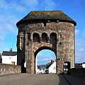
 Cross by the Monnow Bridge, Monmouth - geograph.org.uk - 606045.jpg 426 × 640; 65 KB
-

-

-
 Dawford Brook - geograph.org.uk - 603148.jpg 640 × 480; 139 KB
-
 Dedication on bandstand, Walmer - geograph.org.uk - 603936.jpg 640 × 480; 185 KB
-
 Deep Dale - geograph.org.uk - 1035160.jpg 640 × 480; 109 KB
-
 Deep Dale - geograph.org.uk - 1035174.jpg 640 × 480; 83 KB
-
 Deep Dale - Whitekeld Dale - geograph.org.uk - 1035211.jpg 640 × 480; 90 KB
-
 Deer near Powderham Castle - panoramio.jpg 2,048 × 1,536; 793 KB
-
 Defaid ym Mryncir - Sheep at Bryncir - geograph.org.uk - 603133.jpg 640 × 428; 82 KB
-

-

-
 St Andrew's Church, Denton - geograph.org.uk - 603682.jpg 455 × 640; 85 KB
-
 St Andrew's Church, Denton - geograph.org.uk - 603716.jpg 422 × 640; 92 KB
-

-
-
 Derwenthaugh Staithes - geograph.org.uk - 724114.jpg 640 × 427; 58 KB
-
 Derwentwater at dawn - geograph.org.uk - 618796.jpg 640 × 480; 59 KB
-
 Detail of grave stone - geograph.org.uk - 604590.jpg 640 × 480; 56 KB
-

-
 Dixton Church, Monmouth - geograph.org.uk - 604133.jpg 426 × 640; 95 KB
-
 Double Decker Bus (1878656328).jpg 640 × 480; 97 KB
-
 Down by the river, Cranny, Omagh - geograph.org.uk - 604324.jpg 640 × 548; 108 KB
-
 Drainage dyke, Cottingham - geograph.org.uk - 603912.jpg 480 × 640; 165 KB
-
 Draycote Water - geograph.org.uk - 603568.jpg 640 × 428; 79 KB
-
 Draycote Water - geograph.org.uk - 603583.jpg 640 × 429; 46 KB
-
 Draycote Water - geograph.org.uk - 603602.jpg 640 × 428; 84 KB
-
 Draycote Water - geograph.org.uk - 603923.jpg 640 × 428; 125 KB
-
 Draycote Water - geograph.org.uk - 603935.jpg 640 × 428; 133 KB
-
 Drayton, nr East Meon - geograph.org.uk - 604370.jpg 640 × 434; 63 KB
-
 Driffield's Farm , Upper Redbrook - geograph.org.uk - 607602.jpg 640 × 426; 80 KB
-
 Driffield's lane, near Redbrook - geograph.org.uk - 606884.jpg 426 × 640; 109 KB
-
 Dromore war memorial - geograph.org.uk - 603193.jpg 640 × 449; 41 KB
-

-
 Duffield's lane, near Redbrook - geograph.org.uk - 606533.jpg 640 × 426; 87 KB
-
 Dundonald Road tramstop, Wimbledon - geograph.org.uk - 608368.jpg 640 × 480; 79 KB
-
 Dunswell Lane chicane - geograph.org.uk - 603214.jpg 640 × 628; 204 KB
-
 Dunswell roundabout - geograph.org.uk - 603072.jpg 640 × 402; 148 KB
-
 DYKGatehouse.jpg 426 × 425; 71 KB
-
 Eardisland Dovecote - geograph.org.uk - 635034.jpg 470 × 640; 93 KB
-
 Earsham Church - geograph.org.uk - 727680.jpg 640 × 480; 123 KB
-
 East Field - geograph.org.uk - 609039.jpg 640 × 478; 115 KB
-
 Edge of large plantation on Denton Fell - geograph.org.uk - 603283.jpg 640 × 480; 172 KB
-
 Electricity Pylons by Baker's Spinney - geograph.org.uk - 708960.jpg 640 × 425; 51 KB
-
 End of the road^ - geograph.org.uk - 603481.jpg 640 × 427; 222 KB
-

-
 Entering Scrayingham - geograph.org.uk - 647933.jpg 640 × 478; 122 KB
-

-
 Exe Estury at high tide - panoramio.jpg 2,048 × 1,536; 896 KB
-
 Farm drove near Cossall - geograph.org.uk - 611601.jpg 640 × 427; 87 KB
-
 Farm drove near Cossall - geograph.org.uk - 611604.jpg 640 × 427; 101 KB
-
 Farm Track at Holderness Drain side - geograph.org.uk - 603558.jpg 640 × 480; 102 KB


_lead_smelting_flue_-_geograph.org.uk_-_603865.jpg)


.jpg)


.jpg)


_-_geograph.org.uk_-_604245.jpg)
_-_geograph.org.uk_-_604247.jpg)


.jpg)


