Category:United Kingdom photographs taken on 2010-03-21
Jump to navigation
Jump to search
Countries of Europe: Austria · Belarus · Belgium · Croatia · Czech Republic · Denmark · Finland · France‡ · Germany · Greece · Hungary · Italy · Latvia · Luxembourg · Malta · Netherlands‡ · Norway · Poland · Portugal‡ · Romania · Russia‡ · Serbia · Slovakia · Spain‡ · Sweden · Switzerland · Turkey‡ · Ukraine · United Kingdom
‡: partly located in Europe
‡: partly located in Europe
| ← | 21 March 2010 | → | ||
| ← | March 2010 | → | ||

United Kingdom photographs taken on 21 March 2010.
Image files should be categorized here automatically using {{taken on}} template. Direct categorisation is also possible, if automatic is impossible.
Subcategories
This category has the following 3 subcategories, out of 3 total.
Media in category "United Kingdom photographs taken on 2010-03-21"
The following 200 files are in this category, out of 1,972 total.
(previous page) (next page)-
 "Out of commission" at Killyreavy - geograph.org.uk - 1764493.jpg 3,648 × 2,736; 2.62 MB
-

-

-

-
 43043 , North Wingfield (4451890412).jpg 2,500 × 1,717; 3.41 MB
-
 43045 , North Wingfield (4451149079).jpg 2,447 × 1,684; 1.48 MB
-
 43052 , Claycross. (4463514786).jpg 3,000 × 2,122; 5.47 MB
-
 A compound of barns at Frenze Hall - geograph.org.uk - 1765349.jpg 640 × 468; 108 KB
-
 A folly at Bridgemere Garden World - geograph.org.uk - 1773959.jpg 993 × 1,500; 383 KB
-
 A fountain in Stapeley Water Gardens - geograph.org.uk - 1777475.jpg 1,000 × 1,500; 336 KB
-
 A friendly satellite dish in Stow - geograph.org.uk - 1767605.jpg 640 × 469; 159 KB
-
 A gazebo at Bridgemere Garden World - geograph.org.uk - 1773955.jpg 1,500 × 980; 361 KB
-
 A gazebo at Bridgemere Garden World - geograph.org.uk - 1773956.jpg 1,500 × 978; 405 KB
-
 A green lane near Forge Farm - geograph.org.uk - 1766854.jpg 640 × 430; 184 KB
-
 A k Clinics - Stanningley Road - geograph.org.uk - 1765128.jpg 480 × 640; 58 KB
-
 A line of trees - geograph.org.uk - 1767010.jpg 640 × 430; 135 KB
-
 A line of trees near Pattenden Farm - geograph.org.uk - 1767001.jpg 640 × 430; 128 KB
-
 A Standing Stone or a Big Boulder^ - geograph.org.uk - 1774569.jpg 426 × 640; 112 KB
-
 A stile in the hedge - geograph.org.uk - 1764739.jpg 480 × 640; 162 KB
-
 A True Highlander - geograph.org.uk - 1774583.jpg 640 × 480; 126 KB
-
 A very clear day across North Cumbria - geograph.org.uk - 1779305.jpg 1,024 × 768; 139 KB
-
 A28 Canterbury Road bridge over the Great Stour River - geograph.org.uk - 1773045.jpg 3,072 × 2,304; 1.61 MB
-
 A28 Road bridge and footbridge over the Great Stour River - geograph.org.uk - 1773051.jpg 3,072 × 2,304; 2.07 MB
-
 A303 flyover - geograph.org.uk - 1775891.jpg 640 × 425; 151 KB
-
 A33 and M3 - geograph.org.uk - 1770868.jpg 640 × 427; 176 KB
-
 A33 and M3 - geograph.org.uk - 1770871.jpg 640 × 428; 145 KB
-
 A33 and M3 - geograph.org.uk - 1770876.jpg 640 × 425; 180 KB
-
 A33 and M3 - geograph.org.uk - 1770883.jpg 640 × 426; 163 KB
-
 A33 at London Lodge - geograph.org.uk - 1772407.jpg 640 × 426; 161 KB
-
 A4177 approaching Honiley - geograph.org.uk - 1766559.jpg 640 × 480; 376 KB
-
 A950 (Mintlaw to New Pitsligo road) - geograph.org.uk - 1775119.jpg 1,600 × 1,064; 678 KB
-
 Above Micheldever station - geograph.org.uk - 1775901.jpg 640 × 427; 188 KB
-
 Above Micheldever tunnel - geograph.org.uk - 1775912.jpg 640 × 426; 220 KB
-
 Above the Trough - geograph.org.uk - 1768997.jpg 640 × 480; 66 KB
-
 Above Tower Plantation - geograph.org.uk - 1768985.jpg 640 × 480; 46 KB
-
 Access road to Frenze Hall - geograph.org.uk - 1765384.jpg 640 × 480; 130 KB
-
 Access road to Hall Farm - geograph.org.uk - 1769229.jpg 640 × 481; 92 KB
-

-
 Across The River Leoig - geograph.org.uk - 1774590.jpg 640 × 426; 113 KB
-
 Across the Upper Test Valley - geograph.org.uk - 1767702.jpg 640 × 427; 170 KB
-

-
 African spotted Eagle Owl (4451301502).jpg 2,976 × 2,916; 4.19 MB
-
 Aikey Brae - geograph.org.uk - 1774984.jpg 1,600 × 1,064; 657 KB
-
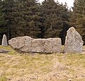
 Aikey Brae Stone Circle - geograph.org.uk - 1774962 (cropped).jpg 1,286 × 851; 430 KB
-
 Aikey Brae Stone Circle - geograph.org.uk - 1774962.jpg 1,600 × 1,064; 717 KB
-
-
 Alders by Inchford Brook - geograph.org.uk - 1767911.jpg 640 × 480; 424 KB
-

-
 All Saints church in Thorpe Abbotts - geograph.org.uk - 1767787.jpg 640 × 480; 111 KB
-
 All Saints church in Thorpe Abbotts - geograph.org.uk - 1767792.jpg 640 × 480; 153 KB
-

-
 All that remains of Jackfield Station - geograph.org.uk - 1766413.jpg 640 × 480; 105 KB
-

-
 An alleyway of trees - geograph.org.uk - 1764756.jpg 480 × 640; 220 KB
-
 An assortment of vehicles at Butterstone - geograph.org.uk - 1768605.jpg 640 × 480; 148 KB
-
-
 An open and shut case - geograph.org.uk - 1763548.jpg 640 × 480; 126 KB
-
 Ancient and modern - geograph.org.uk - 1779504.jpg 1,024 × 768; 149 KB
-
 Ancient and modern at Calshot - geograph.org.uk - 1778473.jpg 768 × 1,024; 190 KB
-
 Anglers' facility on the Eden - geograph.org.uk - 1767026.jpg 2,880 × 2,250; 1.51 MB
-
 Anglesey Abbey - geograph.org.uk - 1764784.jpg 3,264 × 2,448; 2.52 MB
-
 Angling hut on the River Eden - geograph.org.uk - 1767114.jpg 3,072 × 2,304; 2.98 MB
-
 Animal head - geograph.org.uk - 1773943.jpg 683 × 1,024; 236 KB
-

-
 Another sign of Spring - geograph.org.uk - 1767104.jpg 3,072 × 2,304; 2.44 MB
-
 Anvil-shaped rock by the beach - geograph.org.uk - 1771647.jpg 640 × 480; 233 KB
-
 Anybody want to buy a wood^ - geograph.org.uk - 1765244.jpg 640 × 430; 189 KB
-
 Approaching the A33 - geograph.org.uk - 1770863.jpg 640 × 426; 161 KB
-
-
 Approaching Waterlooville on B2150 - geograph.org.uk - 1763909.jpg 640 × 426; 181 KB
-
 Approaching Woodcombe Point - geograph.org.uk - 1767350.jpg 640 × 426; 95 KB
-
 Arable land and woodland - geograph.org.uk - 1772366.jpg 640 × 427; 199 KB
-
 Archway in King Charles Street, London - geograph.org.uk - 1765904.jpg 3,872 × 2,592; 4.26 MB
-
-
 Armaghbrague Road, Keady - geograph.org.uk - 1767211.jpg 3,648 × 2,736; 2.77 MB
-
 Armaghbrague Road, Tassagh - geograph.org.uk - 1767216.jpg 3,648 × 2,736; 3.59 MB
-
 Armaghbrague Townland - geograph.org.uk - 1767206.jpg 3,648 × 2,736; 2.43 MB
-
 Ashfield House, Standish - geograph.org.uk - 1764109.jpg 600 × 400; 55 KB
-
 Ashford pressure reducing station - geograph.org.uk - 1763491.jpg 640 × 428; 139 KB
-
 Ashleworth Court and Church - geograph.org.uk - 1778489.jpg 1,200 × 799; 944 KB
-
 At Steps Bridge - geograph.org.uk - 1772762.jpg 480 × 640; 145 KB
-
 Avenue approaching Woodmancott - geograph.org.uk - 1772252.jpg 640 × 426; 156 KB
-
 Avenue of trees, Hale House - geograph.org.uk - 1764062.jpg 640 × 480; 139 KB
-
 B2150 Hambledon Road at Soake - geograph.org.uk - 1763765.jpg 640 × 426; 188 KB
-
-
 Bailey's Tump - geograph.org.uk - 1771893.jpg 2,048 × 1,536; 1.73 MB
-
 Bali Memorial, London - geograph.org.uk - 1765004.jpg 3,872 × 2,592; 3.72 MB
-
 Ballybrolly Road, Tanderagee - geograph.org.uk - 1764421.jpg 3,648 × 2,736; 3.49 MB
-
 Balwen Black Mountain ewe and lamb - Frampton - geograph.org.uk - 1763400.jpg 1,600 × 925; 389 KB
-
 Bank and ditch, Moat House, Honiley - geograph.org.uk - 1766571.jpg 480 × 640; 626 KB
-

-
 Baptist Chapel on Brookfield Road - geograph.org.uk - 1764389.jpg 640 × 427; 68 KB
-
 Barges Moored Near St.Saviour's Dock, London - geograph.org.uk - 1771227.jpg 3,872 × 2,592; 2.89 MB
-
 Bark House Hotel, Oakfordbridge - geograph.org.uk - 1765152.jpg 1,600 × 1,165; 591 KB
-
 Barn by the Borough Beck, Helmsley - geograph.org.uk - 1767191.jpg 1,280 × 844; 475 KB
-
 Barn conversion at Grange Farm - geograph.org.uk - 1765298.jpg 640 × 480; 133 KB
-
 Barn conversion in Pettits Lane, Frenze - geograph.org.uk - 1765327.jpg 640 × 480; 146 KB
-
 Barn Field Meadow - geograph.org.uk - 1765447.jpg 1,024 × 768; 236 KB
-
 Barn in Pett Street Farm - geograph.org.uk - 1765748.jpg 3,072 × 2,304; 2.02 MB
-
 Barn under the Hillside - geograph.org.uk - 1768935.jpg 1,024 × 706; 188 KB
-
 Barn, Chicks Farm, Chicks Lane - geograph.org.uk - 1765220.jpg 640 × 370; 97 KB
-
 Barns at Frenze Hall - geograph.org.uk - 1765344.jpg 640 × 432; 86 KB
-
 Barns at Quidhampton - geograph.org.uk - 1767677.jpg 640 × 426; 191 KB
-
 Bartlow Hills - geograph.org.uk - 1764122.jpg 640 × 427; 76 KB
-
 Baughton Lane - geograph.org.uk - 1765469.jpg 640 × 427; 299 KB
-
 Beach at Calshot - geograph.org.uk - 1777748.jpg 640 × 436; 95 KB
-
 Beach Green - Lancing - geograph.org.uk - 1764074.jpg 1,600 × 1,200; 498 KB
-
 Beach hut, Broadsands beach - geograph.org.uk - 1767644.jpg 1,600 × 1,187; 219 KB
-
 Beach huts and houses, Broadsands beach - geograph.org.uk - 1767696.jpg 1,600 × 1,174; 389 KB
-
 Beach huts, Broadsands beach - geograph.org.uk - 1767618.jpg 1,600 × 1,285; 310 KB
-
 Beach huts, Broadsands beach - geograph.org.uk - 1767661.jpg 1,600 × 1,113; 306 KB
-
 Beach stones, Geanies - geograph.org.uk - 1771920.jpg 640 × 480; 266 KB
-

-
 Beausale House from the southeast - geograph.org.uk - 1768189.jpg 640 × 480; 379 KB
-
 Beausale main street - geograph.org.uk - 1769607.jpg 640 × 480; 400 KB
-
 Bedford Street, Egerton - geograph.org.uk - 1770917.jpg 602 × 450; 106 KB
-
 Bedgebury Rd (B2079) - geograph.org.uk - 1766898.jpg 640 × 430; 153 KB
-
 Bedgebury Rd (B2079) - geograph.org.uk - 1766900.jpg 640 × 430; 157 KB
-
 Bedgebury Rd (B2079) - geograph.org.uk - 1766914.jpg 640 × 430; 156 KB
-
 Beech hedge, Meikleour - geograph.org.uk - 1768804.jpg 480 × 640; 153 KB
-
 Beehives in the woods - geograph.org.uk - 1766777.jpg 640 × 430; 201 KB
-
 Behind the hoarding at Dukes Meadow - geograph.org.uk - 1763618.jpg 640 × 426; 77 KB
-
 Bell Bedgebury School - geograph.org.uk - 1765984.jpg 640 × 430; 175 KB
-
 Bell Bedgebury School through the trees - geograph.org.uk - 1765965.jpg 640 × 430; 160 KB
-
 Bell Bedgebury School through the trees - geograph.org.uk - 1765975.jpg 640 × 430; 194 KB
-
 Bench and North Downs Way Marker above the Memorial Crown - geograph.org.uk - 1772838.jpg 3,072 × 2,304; 2.16 MB
-
 Bench Mark, Bangor - geograph.org.uk - 1767034.jpg 640 × 480; 507 KB
-
 Bench mark, Groomsport - geograph.org.uk - 1770109.jpg 640 × 462; 309 KB
-
 Bench Mark, Groomsport - geograph.org.uk - 1770113.jpg 640 × 486; 337 KB
-
 Bench with a view on the Broad Downs - geograph.org.uk - 1772085.jpg 3,072 × 2,304; 1.84 MB
-
 Benches and beach huts, Broadsands beach - geograph.org.uk - 1767679.jpg 1,600 × 1,173; 486 KB
-
 Bend in Roger's Rough Rd, Park Wood - geograph.org.uk - 1765660.jpg 640 × 430; 204 KB
-
 Bend on Brabourne Lane - geograph.org.uk - 1767295.jpg 3,072 × 2,304; 2.98 MB
-
 Bend to the A44 - geograph.org.uk - 1780032.jpg 1,024 × 768; 147 KB
-
 Beresford Close, Kilndown - geograph.org.uk - 1765202.jpg 640 × 391; 67 KB
-
 Berrydown Copse - geograph.org.uk - 1767748.jpg 640 × 426; 176 KB
-
 Berrydown Farm - geograph.org.uk - 1767739.jpg 640 × 427; 159 KB
-
 Berrydown Farm - geograph.org.uk - 1767744.jpg 640 × 427; 191 KB
-

-

-
-
 Beth's Arch, Bilston, Wolverhampton - geograph.org.uk - 1800709.jpg 640 × 480; 153 KB
-
 Beth's Arch, Bilston, Wolverhampton - geograph.org.uk - 1801162.jpg 502 × 640; 148 KB
-
 Beth's Arch, Bilston, Wolverhampton - geograph.org.uk - 1801209.jpg 489 × 640; 153 KB
-
 Beth's Arch, Bilston, Wolverhampton - geograph.org.uk - 1801816.jpg 470 × 640; 155 KB
-
 Beth's Arch, Bilston, Wolverhampton - geograph.org.uk - 1801822.jpg 456 × 640; 149 KB
-
 Big Coombe Cottages - geograph.org.uk - 1765862.jpg 3,072 × 2,304; 1.91 MB
-
 Big new houses south of Honiley - geograph.org.uk - 1769675.jpg 640 × 480; 526 KB
-
 Big old houses at Honiley - geograph.org.uk - 1770902.jpg 640 × 480; 483 KB
-
 Bikers on the byway - geograph.org.uk - 1765728.jpg 3,072 × 1,728; 1.16 MB
-

-
 Black Cat Garage - geograph.org.uk - 1765016.jpg 1,024 × 763; 235 KB
-
 Black sheep on the run - Frampton - geograph.org.uk - 1763392.jpg 1,200 × 762; 929 KB
-
 Blackburn Road, Egerrton - geograph.org.uk - 1770682.jpg 640 × 480; 140 KB
-
 Blackwall Bridge - geograph.org.uk - 1763358.jpg 1,600 × 1,061; 430 KB
-
 Blackwood Cottage - geograph.org.uk - 1772440.jpg 640 × 427; 179 KB
-
 Blackwood Cottage - geograph.org.uk - 1772447.jpg 640 × 426; 164 KB
-
 Blakenhall Crocuses - geograph.org.uk - 1779339.jpg 640 × 480; 122 KB
-
 Blakenhall Verge - geograph.org.uk - 1779341.jpg 640 × 480; 155 KB
-
 Blease Gill, Blencathra - geograph.org.uk - 1766509.jpg 640 × 425; 128 KB
-
 Blue Anchor level crossing - gate stop lowered.jpg 1,366 × 1,024; 568 KB
-
 Blue Anchor level crossing - gate stop raised.jpg 1,366 × 1,024; 442 KB
-
 Blue Anchor level crossing - gate stop rodding.jpg 1,366 × 1,024; 432 KB
-
 Blue Anchor level crossing - wicket gate.jpg 1,366 × 1,024; 433 KB
-
 Blyth Wood old and new - geograph.org.uk - 1777073.jpg 2,048 × 1,536; 1,020 KB
-

-
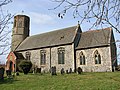
 St Michael and All Angels, Bodenham - geograph.org.uk - 1764597.jpg 3,439 × 2,227; 4.68 MB
-
 St Michael and All Angels, Bodenham - geograph.org.uk - 1764603.jpg 3,300 × 2,233; 5.08 MB
-
 Bolton Road, Kearsley - geograph.org.uk - 1765597.jpg 2,816 × 2,112; 1.09 MB
-
 Bomb Shelter ^ - geograph.org.uk - 1764073.jpg 600 × 400; 76 KB
-
 Borough Beck, Helmsley - geograph.org.uk - 1764646.jpg 852 × 1,280; 359 KB
-
 Bottom Of Hascot Hill - geograph.org.uk - 1763738.jpg 1,600 × 1,200; 758 KB
-

-

-
 Boundary bridge - geograph.org.uk - 1764138.jpg 640 × 427; 70 KB
-
 Bourne Mill.jpg 3,150 × 2,280; 7.43 MB
-
 Brabourne Lane - geograph.org.uk - 1767276.jpg 2,304 × 3,072; 2.72 MB
-

-

-

-
 Bramley Road - geograph.org.uk - 1766259.jpg 800 × 600; 198 KB
-

-
 Brass in Wittersham Church - geograph.org.uk - 1763349.jpg 1,061 × 1,600; 451 KB
-
 Brentford, UK - panoramio (1).jpg 3,648 × 2,736; 2.43 MB
-

-
 Bridge And Services Pipe - geograph.org.uk - 1765791.jpg 1,600 × 1,200; 643 KB
-
 Bridge on Avon Valley Railway - geograph.org.uk - 1763769.jpg 1,024 × 766; 239 KB
-
 Bridlepath Sign - geograph.org.uk - 1766070.jpg 1,200 × 1,600; 663 KB
-
 Bridleway and footpath on Hassell Street - geograph.org.uk - 1765767.jpg 3,072 × 2,304; 2.75 MB
-
 Bridleway beside earthwork. - geograph.org.uk - 1763684.jpg 480 × 640; 75 KB
-
 Bridleway by the Teign - geograph.org.uk - 1774034.jpg 640 × 480; 144 KB
-
 Bridleway from Woods farm. - geograph.org.uk - 1763573.jpg 640 × 480; 43 KB
-
 Bridleway in Hurst Wood (2) - geograph.org.uk - 1765782.jpg 2,304 × 3,072; 3.39 MB
-
 Bridleway in Hurst Wood - geograph.org.uk - 1765777.jpg 2,304 × 3,072; 3.05 MB
-
 Bridleway to Wye - geograph.org.uk - 1772865.jpg 3,072 × 2,304; 2.17 MB
-
 Bright Green Field in Pett Valley - geograph.org.uk - 1767217.jpg 3,072 × 2,304; 1.61 MB
-
 Brislington old fire station - geograph.org.uk - 1774388.jpg 640 × 427; 252 KB
-
 Britannia, Shadwell, E1 (4570454133).jpg 3,450 × 2,301; 3.05 MB
-
 Britannia, Shadwell, E1 (4571093222).jpg 2,283 × 3,424; 2.96 MB
-
 British Red Cross - Stanningley Road - geograph.org.uk - 1764661.jpg 640 × 480; 59 KB


.jpg)
.jpg)
.jpg)


_-_geograph.org.uk_-_1775119.jpg)


.jpg)

.jpg)

.jpg)


_-_geograph.org.uk_-_1766898.jpg)
_-_geograph.org.uk_-_1766900.jpg)
_-_geograph.org.uk_-_1766914.jpg)


,_Bilston,_Wolverhampton_-_geograph.org.uk_-_1801824.jpg)


.jpg)


_-_geograph.org.uk_-_1765782.jpg)


.jpg)
.jpg)
