Category:Utah State Route 190 (1935-1969)
Jump to navigation
Jump to search
former state highway in Ceder City, Utah, United States  | |||||
| Upload media | |||||
| Instance of | |||||
|---|---|---|---|---|---|
| Location | Cedar City, Iron County, Utah | ||||
| Transport network | |||||
| Owned by |
| ||||
| Maintained by |
| ||||
| Inception |
| ||||
| Dissolved, abolished or demolished date |
| ||||
| Length |
| ||||
| Terminus | |||||
| Replaced by | |||||
 | |||||
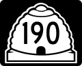
English: Media related to Utah State Route 190 (1935-1969 (SR-190), a 1.5 miles (2.4 km) state highway in western Cedar City, Utah, United States, that formed a loop around Southern Utah University. It began at the intersection of West Center Street (SR-190) and 300 West and ran south along South 300 West to West 200 South, then ran west along West 200 South to South 800 West, then runs north along South 800 West to West Center Street, and finally east along West Center Street to connects with its (SR-190) western terminus before ending at the intersection of Main Street (U.S. Route 91) and the western end of Utah State Route 14 (East Center Street). In 1969 the route was renumbered as State Route 289 (SR-289). However, instead of running north along South 800 west (as its western edge), SR-289 extended farther west to run north along South 1150 West (as its western edge).
Subcategories
This category has only the following subcategory.
Media in category "Utah State Route 190 (1935-1969)"
The following 2 files are in this category, out of 2 total.
-
 Utah 190.svg 750 × 600; 73 KB
-
 Utah SR 190.svg 385 × 385; 9 KB
