Category:Wallrafplatz (Köln)
Jump to navigation
Jump to search
| Object location | | View all coordinates using: OpenStreetMap |
|---|
square and street in district Altstadt/Nord, Cologne, NRW, Germany   | |||||
| Upload media | |||||
| Instance of | |||||
|---|---|---|---|---|---|
| Named after | |||||
| Location | Cologne, Cologne Government Region, North Rhine-Westphalia, Germany | ||||
| Connects with | |||||
 | |||||
Subcategories
This category has the following 3 subcategories, out of 3 total.
Media in category "Wallrafplatz (Köln)"
The following 40 files are in this category, out of 40 total.
-
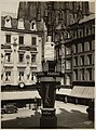 1925-Wallrafplatz.jpg 1,992 × 2,688; 4.37 MB
-
 Bundesarchiv B 145 Bild-F003812-0007, Köln, WDR Funkhaus.jpg 800 × 776; 109 KB
-
 Bundesarchiv B 145 Bild-F003815-0001, Köln, WDR Funkhaus.jpg 653 × 799; 99 KB
-
 Cafe Merzenich Wallrafplatz, Köln - Samstagnachmittag während der COVID-19-Pandemie-5857.jpg 6,720 × 3,780; 15.23 MB
-
 Cafe Merzenich Wallrafplatz, Köln - Samstagnachmittag während der COVID-19-Pandemie-5858.jpg 6,720 × 3,780; 18.12 MB
-
 Cologne (51724682839).jpg 4,044 × 2,888; 8.54 MB
-
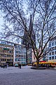
 Cologne Wallrafplatz (53441463297).jpg 4,370 × 2,622; 8.18 MB
-
 Wallrafplatz, háttérben a Dóm tornya. Fortepan 73103.jpg 6,800 × 5,191; 8.99 MB
-
 GraphyArchy - Wikipedia 00277.jpg 5,000 × 7,500; 22.85 MB
-
 GraphyArchy - Wikipedia 00280.jpg 4,000 × 6,000; 23.4 MB
-
 Hohe-Straße-Köln-G-Anfang-am-Wallrafplatz-035.JPG 1,536 × 2,048; 1.21 MB
-
 Johann Peter Weyer - Wallraf-Platz in Köln.jpg 600 × 368; 34 KB
-
 Köln (Germany) (19732049521).jpg 4,000 × 3,000; 4.74 MB
-
 Köln (Germany) (23573767200).jpg 4,000 × 3,000; 5.26 MB
-
 Köln (Germany) (23869466095).jpg 3,000 × 4,000; 5.49 MB
-
 Köln (Germany) (23869528015).jpg 3,000 × 4,000; 5.03 MB
-
 Köln - Domgasse 01 ies.jpg 5,616 × 3,744; 10.23 MB
-
 Köln - Domgasse 02 ies.jpg 5,616 × 3,744; 6.01 MB
-
 Köln - Domgasse 03 ies.jpg 5,616 × 3,744; 7.73 MB
-
 Köln - Wallrafplatz-Domgasse 01 ies.jpg 5,616 × 3,744; 9.32 MB
-
 Köln - Wallrafplatz-Hohe Straße 01 ies.jpg 5,616 × 3,744; 10.59 MB
-
 Köln stellt sich quer – nokögida 14. Januar 2015-4097.jpg 4,644 × 2,612; 7.53 MB
-
 Köln stellt sich quer – nokögida 14. Januar 2015-4100.jpg 2,163 × 1,217; 1.74 MB
-
 Köln Wallrafplatz 1907.jpg 1,896 × 1,134; 460 KB
-
 Köln Wallrafplatz 7 ca. 1905.jpg 588 × 1,132; 142 KB
-
 Köln-Wallrafplatz-052.JPG 1,536 × 2,048; 1.58 MB
-
 Street musicians in Clogne..jpg 3,264 × 2,448; 1.77 MB
-
 Wallrafplatz Köln - Luftaufnahme-0261.jpg 5,464 × 3,640; 17.2 MB
-
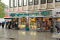
 Wallrafplatz Köln - Reklame-7895.jpg 3,397 × 3,374; 7.46 MB
-
 Wallrafplatz Köln - Reklame-7897.jpg 2,409 × 3,812; 4.16 MB
-
 Wallrafplatz Köln - Reklame-7898.jpg 4,728 × 2,895; 6.07 MB
-
 Wallrafplatz Köln von oben.jpg 1,700 × 1,700; 1.81 MB
-
 Wallrafplatz Köln, Blickrichtung Norden-1270.jpg 4,378 × 2,463; 7.72 MB
-
 Wallrafplatz Köln, Blickrichtung Süden-1267.jpg 5,184 × 2,916; 10.9 MB
-
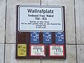 Wallrafplatz-Schild.jpg 2,592 × 1,944; 195 KB
-
 Wallrafplatz-sommer.jpg 3,072 × 2,048; 2.39 MB
-
 Wallrafplatz.jpg 3,110 × 3,647; 4.36 MB
-

-
 Wohn- und Geschäftshaus Wallrafplatz 7, Köln (2407-09).jpg 1,500 × 2,400; 2.13 MB
-
 Wohn- und Geschäftshaus Wallrafplatz 9, Köln (2404-06).jpg 1,600 × 2,400; 1.65 MB


.jpg)
.jpg)


_(19732049521).jpg)
_(23573767200).jpg)
_(23869466095).jpg)
_(23869528015).jpg)


.jpg)
.jpg)