File:1799 Clement Cruttwell Map of Sweden, Denmark and Norway - Geographicus - Scandanavia-cruttwell-1799.jpg
Jump to navigation
Jump to search
Size of this preview: 475 × 600 pixels. Other resolutions: 190 × 240 pixels | 380 × 480 pixels | 608 × 768 pixels | 811 × 1,024 pixels | 1,622 × 2,048 pixels | 2,773 × 3,500 pixels.
Original file (2,773 × 3,500 pixels, file size: 2.64 MB, MIME type: image/jpeg)
Captions
Captions
Add a one-line explanation of what this file represents
| Sweden, Denmark and Norway. | ||||||
|---|---|---|---|---|---|---|
| Artist | ||||||
| Title |
Sweden, Denmark and Norway. |
|||||
| Description |
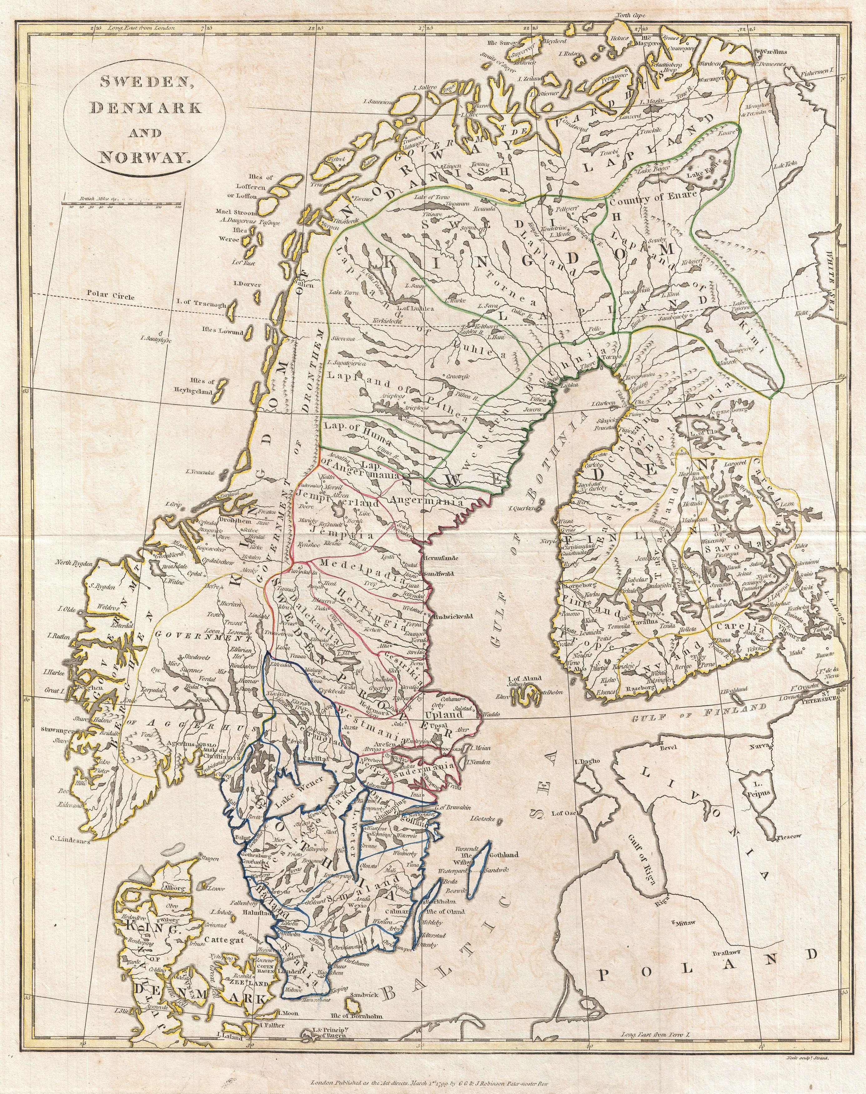
English: A fine 1799 map of Sweden, Denmark and Norway by the English map publisher Clement Cruttwell. Map includes the Kingdom of Norway, Denmark, Sweden, and Finland. Includes the 25 provinces of Sweden, which have no administrative function, but remain historical legacies and the means of cultural identification. Features the Lapland region as a whole, including its provinces in Finland and Sweden. Shows the adjacent countries of Poland and Livonia, as well as the Baltic Sea, Gulf of Bothnia, and Gulf of Finland. Includes rivers, political boundaries, important cities, and ports. Mountains and other topographical features shown by profile. Outline color and fine copper plate engraving in the minimalist English style prevalent in the late 18th and early 19th centuries. Drawn by Clement Cruttwell and published in the 1799 Atlas to Cruttwell's Gazetteer. |
|||||
| Date | 1799 (dated) | |||||
| Dimensions | height: 17.5 in (44.4 cm); width: 14 in (35.5 cm) | |||||
| Accession number |
Geographicus link: Scandanavia-cruttwell-1799 |
|||||
| Source/Photographer |
Cruttwell, C., Atlas to Cruttwell's Gazetteer, 1799.
|
|||||
| Permission (Reusing this file) |
|
|||||
File history
Click on a date/time to view the file as it appeared at that time.
| Date/Time | Thumbnail | Dimensions | User | Comment | |
|---|---|---|---|---|---|
| current | 13:55, 24 March 2011 | | 2,773 × 3,500 (2.64 MB) | BotMultichillT (talk | contribs) | {{subst:User:Multichill/Geographicus |link=http://www.geographicus.com/P/AntiqueMap/Scandanavia-cruttwell-1799 |product_name=1799 Clement Cruttwell Map of Sweden, Denmark and Norway |map_title=Sweden, Denmark and Norway. |description=A fine 1799 map of Sw |
You cannot overwrite this file.
File usage on Commons
The following page uses this file: