File:1841 map of Lowell, Massachusetts.tiff
Jump to navigation
Jump to search

Size of this JPG preview of this TIF file: 800 × 532 pixels. Other resolutions: 320 × 213 pixels | 640 × 425 pixels | 1,024 × 680 pixels | 1,280 × 850 pixels | 2,560 × 1,701 pixels | 5,000 × 3,322 pixels.
Original file (5,000 × 3,322 pixels, file size: 15.84 MB, MIME type: image/tiff)
Captions
Captions
Add a one-line explanation of what this file represents
Summary[edit]
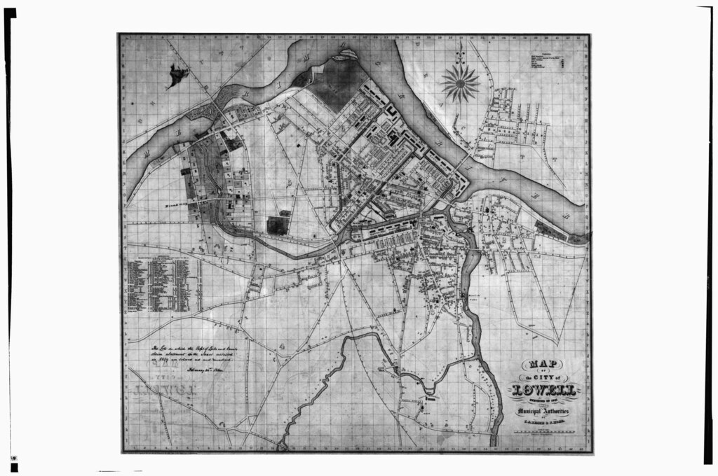
| Title |
Map of the City of Lowell Surveyed in 1841 By Order of the Municipal Authorities |
|||||||||
| Description |
English: Photocopy of a drawing (original in the Collection of the PLandC, Shelf 124, Drawing 2947) MAP OF THE CITY OF LOWELL, SURVEYED IN 1841 - Lowell Canal System, Merrimack and Concord Rivers, Lowell, Middlesex County, MA |
|||||||||
| Date | Documentation compiled after 1968 | |||||||||
| Source | https://www.loc.gov/pictures/item/ma0543.photos.080739p | |||||||||
| Creator |
I. A. Beard and J. Hoar |
|||||||||
| Credit line |
|
|||||||||
| Permission (Reusing this file) |
|
|||||||||
| Geotemporal data | ||||||||||
| Date depicted | ||||||||||
| Map location | Lowell, Massachusetts | |||||||||
| Map type | city map | |||||||||
| Heading |
 |
|||||||||
| Bounding box |
|
|||||||||
| Georeferencing | ||||||||||
| Bibliographic data | ||||||||||
| Printed by |
G.W. Boynson, Boston |
|||||||||
| Archival data | ||||||||||
| Accession number |
HAER MASS,9-LOW,8-13 |
|||||||||
| Dimensions | 4 x 5 in. | |||||||||
| Notes |
|
|||||||||

- Error in {{Map}} template: unknown parameter "department".
File history
Click on a date/time to view the file as it appeared at that time.
| Date/Time | Thumbnail | Dimensions | User | Comment | |
|---|---|---|---|---|---|
| current | 22:58, 20 July 2014 |  | 5,000 × 3,322 (15.84 MB) | Fæ (talk | contribs) | GWToolset: Creating mediafile for Fæ. HABS 20 July 2014 (1401:1600) |
You cannot overwrite this file.
File usage on Commons
The following 3 pages use this file:
- File:Map of Lowell, Massachusetts; 1841.tiff (file redirect)
- File:Map of Lowell Canal System, Merrimack and Concord; HAER MASS.tiff (file redirect)
- File:Photocopy of a drawing (original in the Collection of the PLandC, Shelf 124, Drawing 2947) MAP OF THE CITY OF LOWELL, SURVEYED IN 1841 - Lowell Canal System, Merrimack and Concord HAER MASS,9-LOW,8-13.tif (file redirect)