File:AERIAL VIEW, LOOKING WNW. - Chicago, Milwaukee and St. Paul Railway, Bridge No. Z-6, Spanning North Branch of Chicago River, South of Cortland Street, Chicago, Cook County, IL HAER ILL, 16-CHIG, 120-4.tif
Jump to navigation
Jump to search
Size of this JPG preview of this TIF file: 750 × 600 pixels. Other resolutions: 300 × 240 pixels | 600 × 480 pixels | 960 × 768 pixels | 1,280 × 1,024 pixels | 2,560 × 2,048 pixels | 5,000 × 4,000 pixels.
Original file (5,000 × 4,000 pixels, file size: 19.08 MB, MIME type: image/tiff)
Captions
Captions
Add a one-line explanation of what this file represents
Summary[edit]
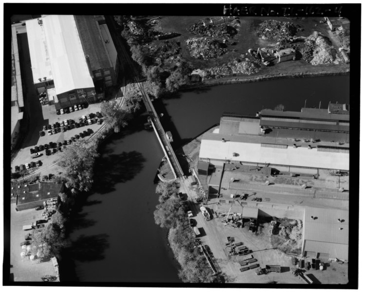
| AERIAL VIEW, LOOKING WNW. - Chicago, Milwaukee and St. Paul Railway, Bridge No. Z-6, Spanning North Branch of Chicago River, South of Cortland Street, Chicago, Cook County, IL | ||||
|---|---|---|---|---|
| Title |
AERIAL VIEW, LOOKING WNW. - Chicago, Milwaukee and St. Paul Railway, Bridge No. Z-6, Spanning North Branch of Chicago River, South of Cortland Street, Chicago, Cook County, IL |
|||
| Description |
Bates, Onward; American Bridge Works; Chicago, Milwaukee and St. Paul Railway; Canadian Pacific Railroad; Chicago Department of Transportation, sponsor; DeLony, Eric N, project manager; Daley, Richard M, sponsor; Walker, Thomas R, sponsor; Kaderbek, S L, sponsor; Sears, Hannah, transmitter; Spivey, Justin M, historian; Lowe, Jet, photographer |
|||
| Depicted place | Illinois; Cook County; Chicago | |||
| Date | Documentation compiled after 1968 | |||
| Dimensions | 4 x 5 in. | |||
| Current location |
Library of Congress Prints and Photographs Division Washington, D.C. 20540 USA http://hdl.loc.gov/loc.pnp/pp.print |
|||
| Accession number |
HAER ILL, 16-CHIG, 120-4 |
|||
| Credit line |
|
|||
| Notes |
|
|||
| Source | https://www.loc.gov/pictures/item/il0842.photos.318242p | |||
| Permission (Reusing this file) |
|
|||

| Object location | | View this and other nearby images on: OpenStreetMap |
|---|
File history
Click on a date/time to view the file as it appeared at that time.
| Date/Time | Thumbnail | Dimensions | User | Comment | |
|---|---|---|---|---|---|
| current | 15:35, 17 July 2014 |  | 5,000 × 4,000 (19.08 MB) | Fæ (talk | contribs) | GWToolset: Creating mediafile for Fæ. HABS 16 July 2014 (1201:1400) |
You cannot overwrite this file.
File usage on Commons
The following page uses this file: