File:A correct chart of the Baltick or East Sea from ye Sound to Petersburg from the latest and best observations for Mr Tindal's continuation of Mr Rapin's history. RMG F0336.tiff

Original file (6,712 × 5,345 pixels, file size: 102.64 MB, MIME type: image/tiff)
Captions
Captions
Summary[edit]
| Author |
Seale, R W; [John & Paul Knapton] |
| Description |
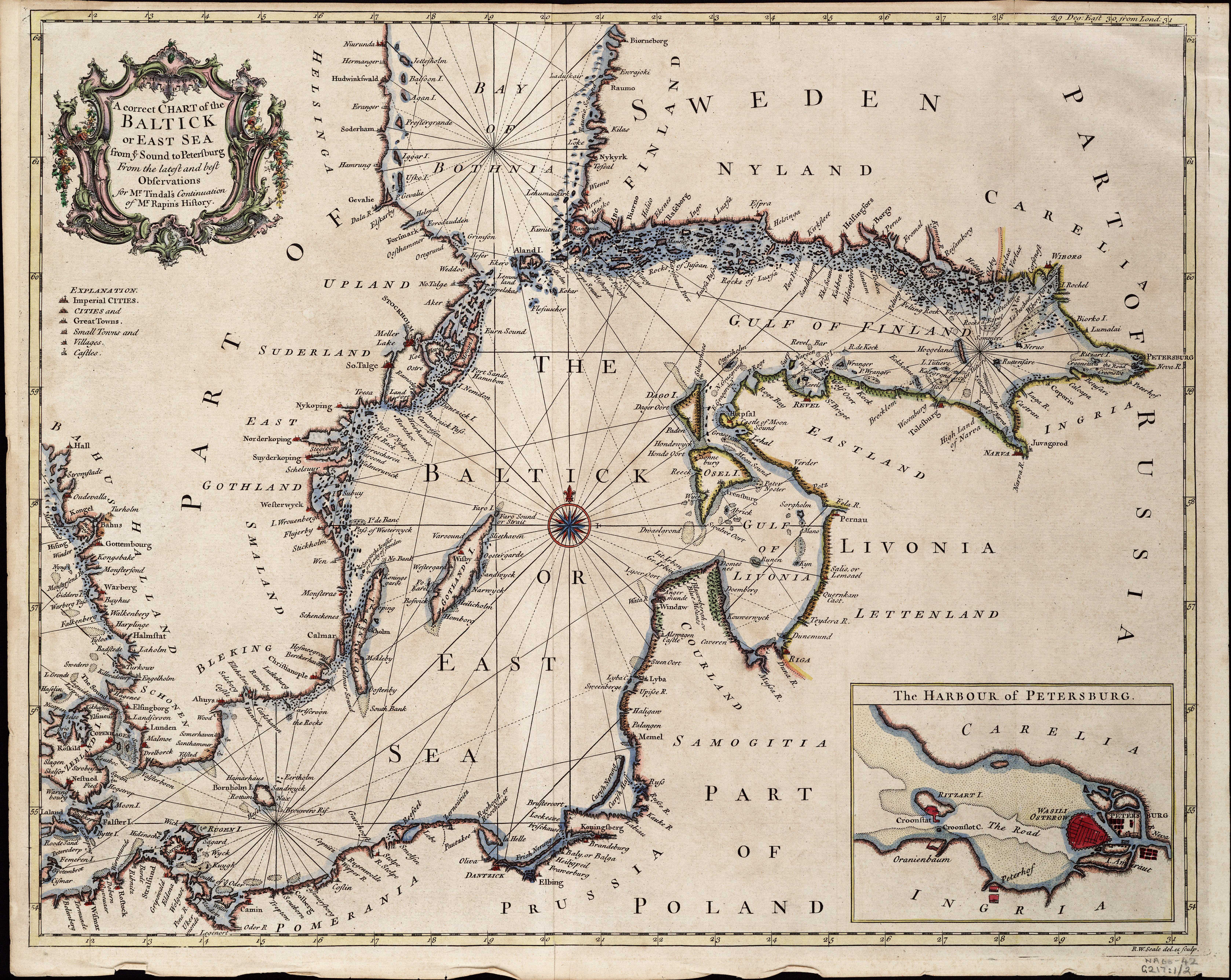
English: A correct chart of the Baltick or East Sea from ye Sound to Petersburg from the latest and best observations for Mr Tindal's continuation of Mr Rapin's history.Single sheet. Hand coloured engraving. Scale [circa 1:2,500,000 (lat)]. The borders are graduated for latitude and longitude and the chart contains rhumb lines. There is an inset chart of the harbour of Petersburg, scale [circa 1:600,000].
From the 3rd edition (1743-1747) of Nicolas Tindal's translation of Rapin's History of England, which included a continuation from the revolution to the accession of George II. |
| Date | 1744 |
| Dimensions | Printed area 38 x 48cm, on sheet 40 x 50 cm. |
| Source/Photographer | http://collections.rmg.co.uk/collections/objects/540255 |
| Permission (Reusing this file) |
The original artefact or artwork has been assessed as public domain by age, and faithful reproductions of the two dimensional work are also public domain. No permission is required for reuse for any purpose. The text of this image record has been derived from the Royal Museums Greenwich catalogue and image metadata. Individual data and facts such as date, author and title are not copyrightable, but reuse of longer descriptive text from the catalogue may not be considered fair use. Reuse of the text must be attributed to the "National Maritime Museum, Greenwich, London" and a Creative Commons CC-BY-NC-SA-3.0 license may apply if not rewritten. Refer to Royal Museums Greenwich copyright. |
| Identifier | Acquisition Number: NA1966-42 id number: G217:1/2 |
| Collection | Charts and maps |
Licensing[edit]
|
This is a faithful photographic reproduction of a two-dimensional, public domain work of art. The work of art itself is in the public domain for the following reason:
The official position taken by the Wikimedia Foundation is that "faithful reproductions of two-dimensional public domain works of art are public domain".
This photographic reproduction is therefore also considered to be in the public domain in the United States. In other jurisdictions, re-use of this content may be restricted; see Reuse of PD-Art photographs for details. | ||||
File history
Click on a date/time to view the file as it appeared at that time.
| Date/Time | Thumbnail | Dimensions | User | Comment | |
|---|---|---|---|---|---|
| current | 15:29, 27 August 2017 |  | 6,712 × 5,345 (102.64 MB) | Fæ (talk | contribs) | Royal Museums Greenwich Charts and maps, http://collections.rmg.co.uk/collections/objects/540255 |
You cannot overwrite this file.
File usage on Commons
The following page uses this file: