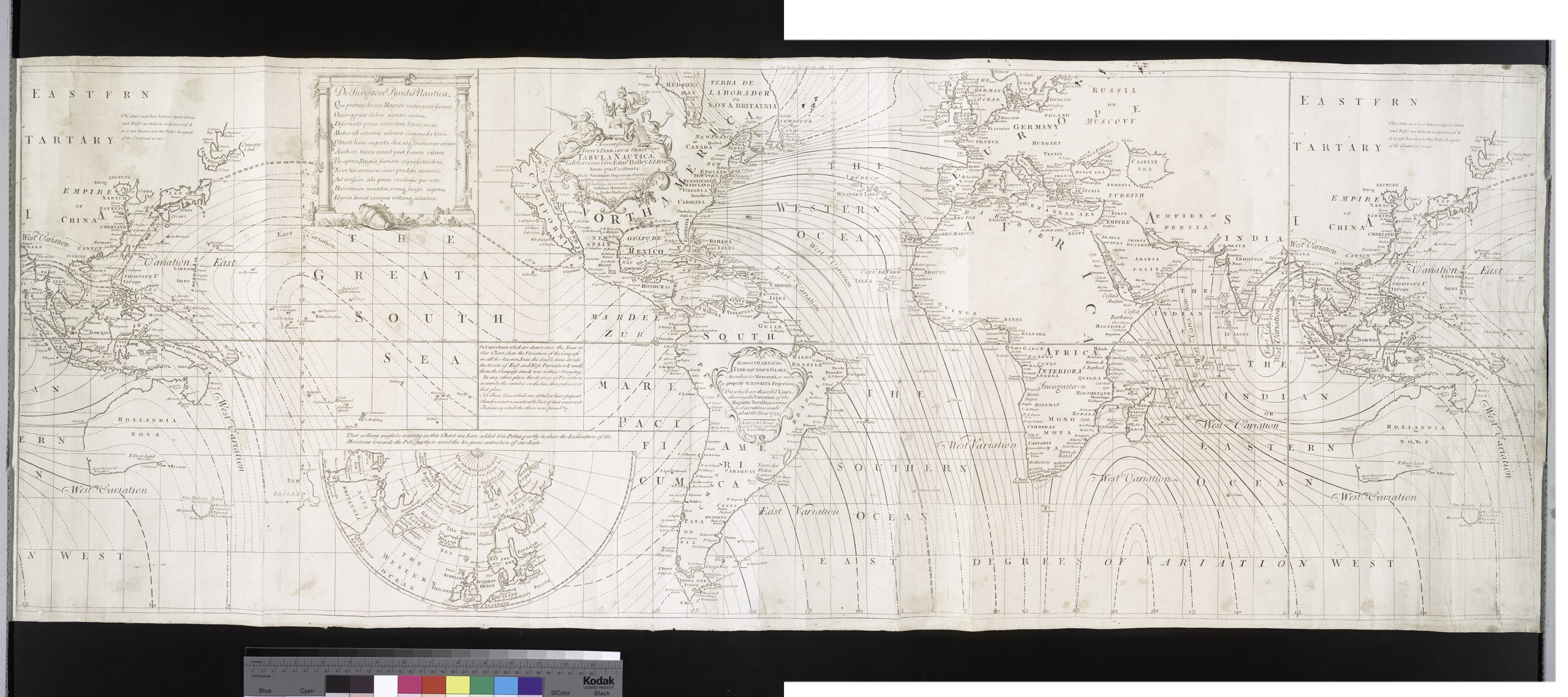
File:Accuratissima totius terrarum orbis tabula nautica - celeberrimo viro Edmd. Halley, LLD., anno 1700 contructa; indice variationes magneticas denota(m?) ad observationes circiter annu 1744 habitas NYPL465004.tiff
Jump to navigation
Jump to search

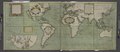
Size of this JPG preview of this TIF file: 800 × 356 pixels. Other resolutions: 320 × 142 pixels | 640 × 285 pixels | 1,024 × 455 pixels | 1,280 × 569 pixels | 2,560 × 1,138 pixels | 9,462 × 4,208 pixels.
Original file (9,462 × 4,208 pixels, file size: 113.92 MB, MIME type: image/tiff)
Captions
Captions
Add a one-line explanation of what this file represents
Summary[edit]
| Description | Accuratissima totius terrarum orbis tabula nautica / celeberrimo viro Edmd. Halley, LLD., anno 1700 contructa ; indice variationes magneticas denota[m?] ad observationes circiter annu 1744 habitas renovata Gulielmo Mountaine et Jacobo Dodson.; Lawrence H. Slaughter Collection of English maps, charts, globes, books and atlases / Charts and maps | |||||||||||||||||||||||
| Notes | Includes text and inset of the North Atlantic Ocean to the North Pole. ''Note 2.'') Lawrence H. Slaughter Collection ; 1036. ''Note 3.'') National Endowment for the Humanities Grant for Access to Early Maps of the Middle Atlantic Seaboard. ''Note 4.'') Backed with blue paper. ''Note 5.'') Backed with blue paper. ''Note 6.'') Backed with blue paper. ''Note 7.'') Backed with blue paper. | |||||||||||||||||||||||
| Catalogue call number | Map Div. 97-6493 [LHS 1036; rolled] | |||||||||||||||||||||||
| Alternate title | A correct chart of the terraqueous globe, according to Mercator's, or more properly Wright's projection, on which are describ'd lines, shewing the variation of the magnetic needle according to observations made about the year 1744. | |||||||||||||||||||||||
| Date | circa 1745 | |||||||||||||||||||||||
| Source |
http://digitalgallery.nypl.org/nypldigital/dgkeysearchdetail.cfm?imageID=465004
|
|||||||||||||||||||||||
| Author | Dodson, James, d. 1757 -- unknown role ;Mount, William -- unknown role ;W. Mount and T. Page -- Publisher ;Halley, Edmond, 1656-1742 -- Geographer (not in Relator list) | |||||||||||||||||||||||
| Permission (Reusing this file) |
From The Lionel Pincus & Princess Firyal Map Division. http://maps.nypl.org
|
|||||||||||||||||||||||
| Other versions |
|
|||||||||||||||||||||||
| Location | Stephen A. Schwarzman Building / The Lionel Pincus and Princess Firyal Map Division | |||||||||||||||||||||||
| Digital item published | 2-3-2004; updated 3-25-2011 | |||||||||||||||||||||||
| Digital ID | 465004 | |||||||||||||||||||||||


.jpg)

The making of this file was supported by Wikimedia UK.
To see other files made with the support of Wikimedia UK, please see the category Supported by Wikimedia UK.
|
File history
Click on a date/time to view the file as it appeared at that time.
| Date/Time | Thumbnail | Dimensions | User | Comment | |
|---|---|---|---|---|---|
| current | 06:56, 20 April 2014 |  | 9,462 × 4,208 (113.92 MB) | Fæ (talk | contribs) | GWToolset:: Creating mediafile for Fæ. Tranche 2.210 |
You cannot overwrite this file.
File usage on Commons
The following 4 pages use this file:
- File:1701-E.Halley World Chart of the equal declination.jpg
- File:Nova & accuratissima totius terrarum orbis tabula nautica variationum magneticarum index juxta observationes Anno 1700 (NYPL b13909432-1640713).jpg
- File:Nova and accuratissima totius terrarum orbis tabula nautica variationum magneticarum index juxta observationes Anno 1700 - habitas constructa per Edm. Halley NYPL1640713.jpg
- File:Nova and accuratissima totius terrarum orbis tabula nautica variationum magneticarum index juxta observationes Anno 1700 - habitas constructa per Edm. Halley NYPL1640713.tiff