File:Aerial view of Beaverton in early 1950's looking Northwest (Beaverton, Oregon Historical Photo Gallery) (265).jpg
Jump to navigation
Jump to search
Size of this preview: 771 × 600 pixels. Other resolutions: 309 × 240 pixels | 617 × 480 pixels | 988 × 768 pixels | 1,280 × 996 pixels | 2,560 × 1,991 pixels | 2,916 × 2,268 pixels.
Original file (2,916 × 2,268 pixels, file size: 1.24 MB, MIME type: image/jpeg)
Captions
Captions
Add a one-line explanation of what this file represents
| Description |
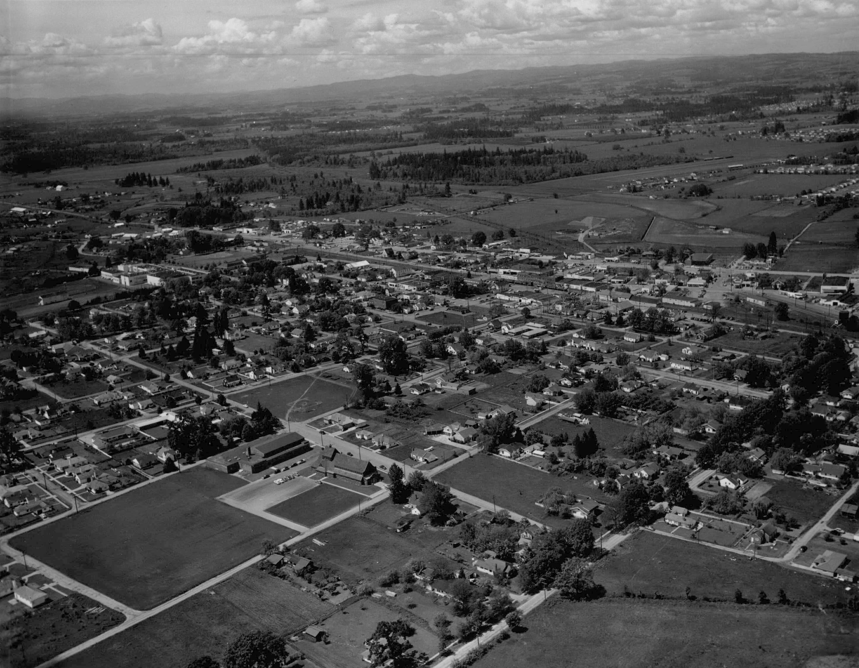
English: Aerial view of Beaverton in early 1950's looking Northwest. Historical images of Beaverton, Oregon. This view is looking northwest (from approximately above 11th or 12th & Alger) towards downtown. St. Cecilia Catholic Church is visible at the north end of the large open lot in the lower left quandrant of the frame. The two north–south streets that go out of frame at the bottom of the photo are Franklin Street (left) and Lombard Street (now Lombard Avenue). The east-west arterial street in the upper part of the frame is Highway 8 (Canyon Road), with Highway 10 (Farmington Road) just below it and almost parallel. The large, light-colored building near the left end of the frame is Beaverton High School. The runways of the former Bernard's Airport can just be discerned in the upper right quandrant of the photo. |
||
| Date | |||
| Source | |||
| Author | Unknown photographer | ||
| Permission (Reusing this file) |
|
||
| Other versions | File:View of Beaverton 1950's (Beaverton, Oregon Historical Photo Gallery) (10).jpg | ||
| Photo No. | 265 |
_(10).jpg)
File history
Click on a date/time to view the file as it appeared at that time.
| Date/Time | Thumbnail | Dimensions | User | Comment | |
|---|---|---|---|---|---|
| current | 15:28, 23 September 2012 | | 2,916 × 2,268 (1.24 MB) | Smallbot (talk | contribs) | Commons:Bots/Requests/Smallbot 4: Uploading images from Beaverton, Oregon Historical Photo Gallery |
You cannot overwrite this file.
File usage on Commons
There are no pages that use this file.
_(265).jpg&oldid=782657003)