File:Antarctica de.svg

Original file (SVG file, nominally 907 × 906 pixels, file size: 4.6 MB)
Captions
Captions
Summary[edit]
| DescriptionAntarctica de.svg |
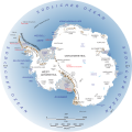
Deutsch: Karte der Antarktis und der umliegenden Gewässer.
English: Map of Antarctica. |
||||||
| Date | |||||||
| Source |
This file was derived from: Antarctica.svg |
||||||
| Author |
Landsat Image Mosaic of Antarctica team)
|
||||||
| Permission (Reusing this file) |
|
||||||
| Other versions |
[edit]
|
||||||
| SVG development InfoField | This oversized W3C-invalid map was created with Adobe Illustrator. |
| This SVG file contains embedded text that can be translated into your language, using any capable SVG editor, text editor or the SVG Translate tool. For more information see: About translating SVG files. |
File history
Click on a date/time to view the file as it appeared at that time.
| Date/Time | Thumbnail | Dimensions | User | Comment | |
|---|---|---|---|---|---|
| current | 20:54, 16 September 2017 |  | 907 × 906 (4.6 MB) | Furfur (talk | contribs) | correction |
| 20:31, 16 September 2017 |  | 907 × 906 (4.6 MB) | Furfur (talk | contribs) | details again and hopefully approximately correct then ... | |
| 20:10, 16 September 2017 |  | 907 × 906 (4.6 MB) | Furfur (talk | contribs) | next try ... | |
| 19:46, 16 September 2017 |  | 907 × 906 (4.6 MB) | Furfur (talk | contribs) | rendering of the previewe not correct - now some changes in the svg code | |
| 18:29, 16 September 2017 |  | 907 × 906 (4.61 MB) | Furfur (talk | contribs) | das Biuld wird ganz komisch gerendert ... hoffentlich geht das weg ... | |
| 18:15, 16 September 2017 |  | 907 × 906 (4.61 MB) | Furfur (talk | contribs) | == {{int:filedesc}} == {{Information |Description={{User:Medium69/Traduction}} {{de|1=Karte der Antarktis und der umliegenden Gewässer.}} {{en|1=Map of Antarctica.}} |Source={{Derived from|Antarctica.svg}} |Date=2017-09-16 |Author=*[[:File:Antarctica.... |
You cannot overwrite this file.
File usage on Commons
The following 11 pages use this file:
File usage on other wikis
The following other wikis use this file:
- Usage on als.wikipedia.org
- Usage on de.wikipedia.org
- Antarktika
- Westantarktika
- Ostantarktika
- Transantarktisches Gebirge
- Liste internationaler Flaggen
- Ellsworthgebirge
- Mawson-Kraton
- Haag-Nunatakker
- Ostgondwana
- Ross-Orogen
- Terre Adélie-Kraton
- Rayner-Provinz
- Napier-Komplex
- Ruker-Provinz
- Lützow-Holm-Komplex
- Nimrod-Orogenese
- Yamato-Belgica-Komplex
- Maud-Gürtel
- Darling Fault
- Pinjarra-Orogen
- Subglaziales Antarktisches Gebirge
- Pensacola-Pole Basin
- Geologie Ostantarktikas
- Weddellmeer-Riftsystem
- Benutzer:Hangluec/Artikelentwurf
- Antarktische Fauna
- Zerfall Gondwanas
- Usage on it.wikipedia.org
- Usage on lb.wikipedia.org
Metadata
This file contains additional information such as Exif metadata which may have been added by the digital camera, scanner, or software program used to create or digitize it. If the file has been modified from its original state, some details such as the timestamp may not fully reflect those of the original file. The timestamp is only as accurate as the clock in the camera, and it may be completely wrong.
| Width | 906.70001 |
|---|---|
| Height | 905.79999 |


