File:Bergheim - Wallfahrtskirche Maria Plain (a).JPG
Jump to navigation
Jump to search

Size of this preview: 800 × 600 pixels. Other resolutions: 320 × 240 pixels | 640 × 480 pixels | 1,024 × 768 pixels | 1,280 × 960 pixels | 2,560 × 1,920 pixels | 5,040 × 3,780 pixels.
Original file (5,040 × 3,780 pixels, file size: 8.4 MB, MIME type: image/jpeg)
Captions
Captions
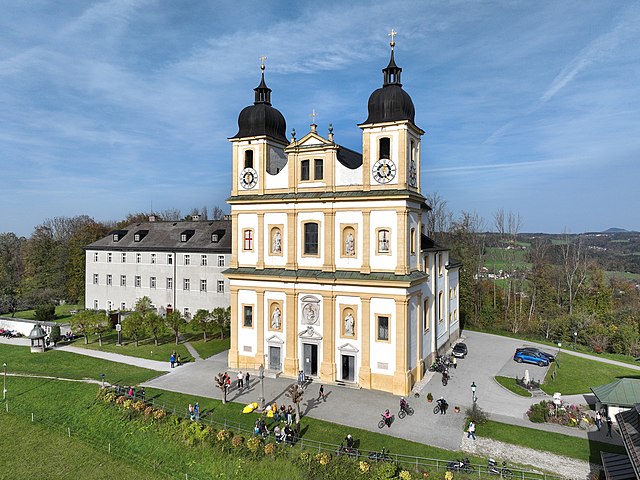
South-southeast view of the Maria Plain pilgrimage church in Austria.
Summary[edit]
| Description |
Deutsch: Südsüdostansicht der Wallfahrtkirche Maria Plain in der Salzburger Gemeinde Bergheim und links das
Superioratsgebäude (um 1675 errichtet).
Die Wallfahrtskirche wurde ab 1671 von dem Salzburger Hofbaumeister Giovanni Antonio Dario erbaut und am 12. August 1674 vom Bauherrn Erzbischof Max Gandolf geweiht. Die Doppelturmfassade mit drei Eingängen besitzt im Erdgeschoß und im ersten Obergeschoß je zwei halbrunde Nischen. Darin befinden sich die übergroßen Darstellungen der vier heiligen Evangelisten Matthäus (mit Engel, oben links), Markus (mit Löwen, oben rechts), Lukas (mit Stier, unten links) und Johannes (mit Adler, unten rechts). Im Giebel des Mittelportals befindet sich das Wappen des Erbauers und über diesem ein Relief mit Maria und dem Kinde: [1]. English: South-southeast view of the Maria Plain pilgrimage church in Austria. |
| Date | |
| Source | Own work |
| Author | C.Stadler/Bwag |
| Permission (Reusing this file) |
Deutsch: Hallo, du darfst mein Foto kostenlos nutzen, aber nenne mich bitte als Fotograf, beispielsweise „Foto: C.Stadler/Bwag“ oder © C.Stadler/Bwag; CC-BY-SA-4.0. Auf mehr Angaben bestehe ich nicht - im Gegensatz zu manch anderen, die die Vorgaben der unten angeführten Lizenzierung auf Punkt und Beistrich einfordern. English: Feel free to use my photos, but please mention me as the author like © C.Stadler/Bwag or © C.Stadler/Bwag; CC-BY-SA-4.0 (that's good enough) and if you want send me a message: bwag@gmx.net. |
| Other versions |
|
.JPG)
.JPG)

.JPG&action=edit§ion=1)
| Object location | | View this and other nearby images on: OpenStreetMap |
|---|
.JPG¶ms=047.838630_N_0013.039790_E_globe:Earth_class:object_type:object__&language=en)
| Camera location | | View this and other nearby images on: OpenStreetMap |
|---|
.JPG¶ms=047.838030_N_0013.039920_E_globe:Earth_type:camera_heading:345.00&language=en)
Licensing[edit]
.JPG&action=edit§ion=2)
I, the copyright holder of this work, hereby publish it under the following license:
This file is licensed under the Creative Commons Attribution-Share Alike 4.0 International license.
- You are free:
- to share – to copy, distribute and transmit the work
- to remix – to adapt the work
- Under the following conditions:
- attribution – You must give appropriate credit, provide a link to the license, and indicate if changes were made. You may do so in any reasonable manner, but not in any way that suggests the licensor endorses you or your use.
- share alike – If you remix, transform, or build upon the material, you must distribute your contributions under the same or compatible license as the original.
File history
Click on a date/time to view the file as it appeared at that time.
| Date/Time | Thumbnail | Dimensions | User | Comment | |
|---|---|---|---|---|---|
| current | 22:08, 2 November 2022 | | 5,040 × 3,780 (8.4 MB) | Bwag (talk | contribs) | == {{int:filedesc}} == {{Information |Description= {{de|1= Südsüdostansicht des Wallfahrtkirche Maria Plain in der Salzburger Gemeinde Bergheim und links das Superioratsgebäude (um 1675 errichtet).<br/>Die Wallfahrtskirche wurde ab 1671 von dem Salzburger Hofbaumeister Giovanni Antonio Dario erbaut und am 12. August 1674 vom Bauherrn Erzbischof Max Gandolf geweiht. Die Doppelturmfassade mit drei Eingängen besitzt im Erdgeschoß und im ersten Obergeschoß je zwei halbrunde Nischen. Darin befin... |
You cannot overwrite this file.
File usage on Commons
The following 3 pages use this file:
File usage on other wikis
The following other wikis use this file:
- Usage on de.wikipedia.org
- Usage on en.wikipedia.org
- Usage on eo.wikipedia.org
.JPG&oldid=821550968)