File:Carte oran2 Mona.jpg
Jump to navigation
Jump to search
No higher resolution available.
Carte_oran2_Mona.jpg (300 × 288 pixels, file size: 106 KB, MIME type: image/jpeg)
Captions
Captions
Add a one-line explanation of what this file represents
| Description |
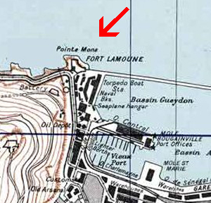
Français : Plan de Oran et sa région English: Town Plan of Oran in Algeria, 1942 |
| Date | (UTC) |
| Source | cropped version of Carte_oran2.jpg |
| Author |
|
| This is a retouched picture, which means that it has been digitally altered from its original version. Modifications: situation de la Mona. The original can be viewed here: Carte oran2.jpg:
|
This file is a work of a U.S. Army soldier or employee, taken or made as part of that person's official duties. As a work of the U.S. federal government, it is in the public domain in the United States.
|
 |
Original upload log[edit]
This image is a derivative work of the following images:
- File:Carte_oran2.jpg licensed with PD-USGov-Military-Army, PD-USGov-Military-Army/fr
- 2009-10-29T08:04:46Z File Upload Bot (Magnus Manske) 1880x1512 (1072284 Bytes) {{BotMoveToCommons|fr.wikipedia|year={{subst:CURRENTYEAR}}|month={{subst:CURRENTMONTHNAME}}|day={{subst:CURRENTDAY}}}} {{Information |Description={{fr|{{Information |Description = |Source = cropped verison of Carte militai
Uploaded with derivativeFX
|
According to article 50 of the Algerian copyright law, it shall be lawful to reproduce or to communicate to the public, without authorization of the author and without remuneration, a work of architecture or the fine arts, a work of applied arts or a photographic work that is permanently situated in a public place, with the exception of art galleries, museums and classified cultural or natural sites.
See COM:CRT/Algeria#Freedom of panorama for more information.
|
File history
Click on a date/time to view the file as it appeared at that time.
| Date/Time | Thumbnail | Dimensions | User | Comment | |
|---|---|---|---|---|---|
| current | 08:21, 8 November 2009 | | 300 × 288 (106 KB) | Égoïté (talk | contribs) | {{Information |Description={{fr|Plan de Oran et sa région}} {{en|Town Plan of Oran in Algeria, 1942}} |Source=*File:Carte_oran2.jpg |Date=2009-11-08 08:01 (UTC) |Author=*File:Carte_oran2.jpg: War Office (US War Service, US army). *derivative |
You cannot overwrite this file.
File usage on Commons
There are no pages that use this file.
File usage on other wikis
The following other wikis use this file:
- Usage on fr.wikipedia.org
- Usage on incubator.wikimedia.org