File:Connection of vertical to lower chord (note kerfs in members - Leatherwood Station Covered Bridge, Spanning Leatherwood Creek (moved to Billie Creek Village), Montezuma, Parke HAER IND,61-MONT,1-15.tif
Jump to navigation
Jump to search

Size of this JPG preview of this TIF file: 479 × 600 pixels. Other resolutions: 192 × 240 pixels | 383 × 480 pixels | 613 × 768 pixels | 818 × 1,024 pixels | 1,635 × 2,048 pixels | 3,984 × 4,989 pixels.
Original file (3,984 × 4,989 pixels, file size: 18.96 MB, MIME type: image/tiff)
Captions
Captions
Add a one-line explanation of what this file represents
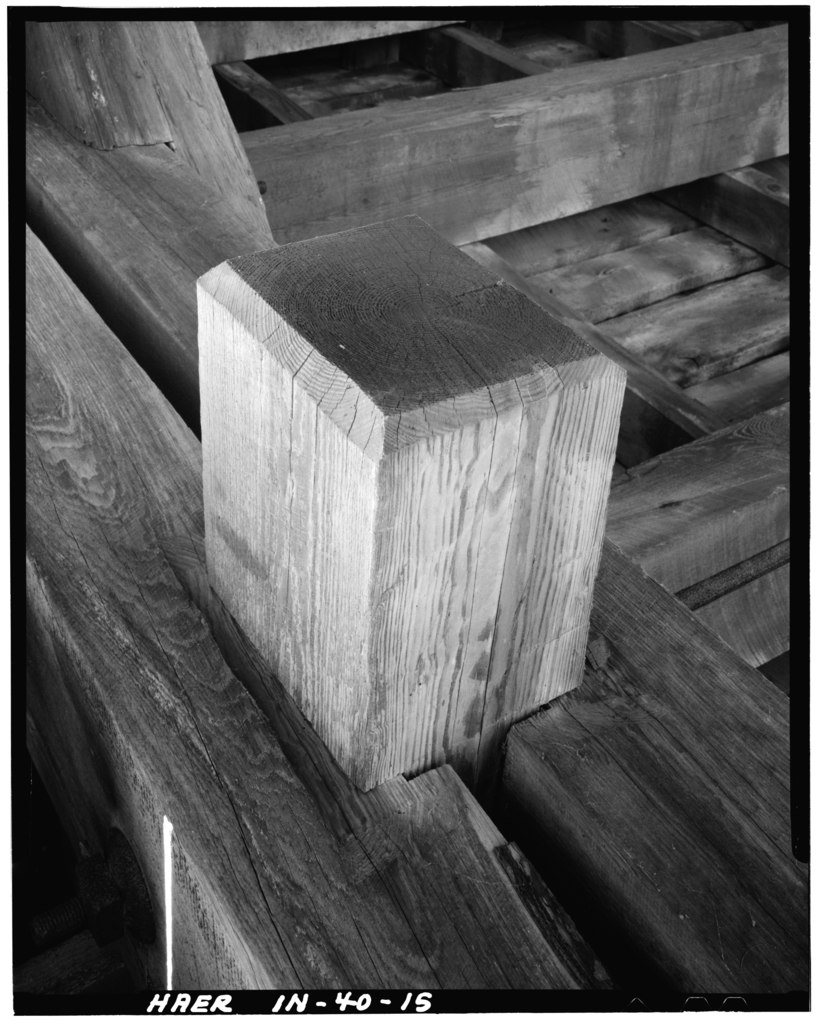
| Connection of vertical to lower chord (note kerfs in members - Leatherwood Station Covered Bridge, Spanning Leatherwood Creek (moved to Billie Creek Village), Montezuma, Parke County, IN | ||||
|---|---|---|---|---|
| Photographer |
Sels, Ed |
|||
| Title |
Connection of vertical to lower chord (note kerfs in members - Leatherwood Station Covered Bridge, Spanning Leatherwood Creek (moved to Billie Creek Village), Montezuma, Parke County, IN |
|||
| Description |
Britton, Joseph Albert |
|||
| Depicted place | Indiana; Parke County; Montezuma | |||
| Date | Documentation compiled after 1968; 1979 | |||
| Dimensions | height: 5 in (12.7 cm); width: 4 in (10.1 cm) | |||
| Current location |
Library of Congress Prints and Photographs Division Washington, D.C. 20540 USA http://hdl.loc.gov/loc.pnp/pp.print |
|||
| Accession number |
HAER IND,61-MONT,1-15 |
|||
| Credit line |
|
|||
| Notes |
|
|||
| Source | https://www.loc.gov/pictures/item/in0186.photos.065582p | |||
| Permission (Reusing this file) |
|
|||

| Object location | | View this and other nearby images on: OpenStreetMap |
|---|
File history
Click on a date/time to view the file as it appeared at that time.
| Date/Time | Thumbnail | Dimensions | User | Comment | |
|---|---|---|---|---|---|
| current | 06:25, 18 July 2014 |  | 3,984 × 4,989 (18.96 MB) | Fæ (talk | contribs) | GWToolset: Creating mediafile for Fæ. HABS 16 July 2014 (1201:1400) |
You cannot overwrite this file.
File usage on Commons
The following page uses this file:
File usage on other wikis
The following other wikis use this file:
- Usage on en.wikipedia.org