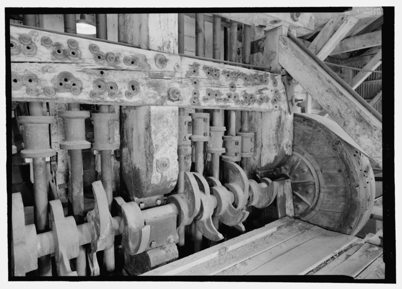
File:DETAIL VIEW OF THE STAMP BATTERIES SHOWING THE SUPPORT STRUCTURE, CAMS, TAPPETS ON THE STAMP SHAFTS AND ONE OF THE TWO DRIVE WHEELS. - Standard Gold Mill, East of Bodie Creek, Northeast HAER CA-299-43.tif
Jump to navigation
Jump to search
Size of this JPG preview of this TIF file: 800 × 576 pixels. Other resolutions: 320 × 230 pixels | 640 × 461 pixels | 1,024 × 737 pixels | 1,280 × 922 pixels | 2,560 × 1,843 pixels | 5,129 × 3,693 pixels.
Original file (5,129 × 3,693 pixels, file size: 18.07 MB, MIME type: image/tiff)
Captions
Captions
Add a one-line explanation of what this file represents
Summary
[edit]| DETAIL VIEW OF THE STAMP BATTERIES SHOWING THE SUPPORT STRUCTURE, CAMS, TAPPETS ON THE STAMP SHAFTS AND ONE OF THE TWO DRIVE WHEELS. - Standard Gold Mill, East of Bodie Creek, Northeast of Bodie, Bodie, Mono County, CA | ||||
|---|---|---|---|---|
| Photographer |
Lowe, Jet Related names:
|
|||
| Title |
DETAIL VIEW OF THE STAMP BATTERIES SHOWING THE SUPPORT STRUCTURE, CAMS, TAPPETS ON THE STAMP SHAFTS AND ONE OF THE TWO DRIVE WHEELS. - Standard Gold Mill, East of Bodie Creek, Northeast of Bodie, Bodie, Mono County, CA |
|||
| Depicted place | California; Mono County; Bodie | |||
| Date | 2000 | |||
| Dimensions | 5 x 7 in. | |||
| Current location |
Library of Congress Prints and Photographs Division Washington, D.C. 20540 USA http://hdl.loc.gov/loc.pnp/pp.print |
|||
| Accession number |
HAER CA-299-43 |
|||
| Credit line |
|
|||
| Notes |
|
|||
| Source | https://www.loc.gov/pictures/item/ca3098.photos.194343p | |||
| Permission (Reusing this file) |
|
|||

| Object location | | View this and other nearby images on: OpenStreetMap |
|---|
File history
Click on a date/time to view the file as it appeared at that time.
| Date/Time | Thumbnail | Dimensions | User | Comment | |
|---|---|---|---|---|---|
| current | 10:38, 6 July 2014 |  | 5,129 × 3,693 (18.07 MB) | Fæ (talk | contribs) | GWToolset: Creating mediafile for Fæ. HABS 05 July 2014 (501:600) |
You cannot overwrite this file.
File usage on Commons
The following page uses this file: