File:Detail view from east of the 1st water pier from north - Augwick Creek Bridge, Aughwick, Huntingdon County, PA HAER PA,31-AUGH,1-7.tif
Jump to navigation
Jump to search
Size of this JPG preview of this TIF file: 800 × 580 pixels. Other resolutions: 320 × 232 pixels | 640 × 464 pixels | 1,024 × 742 pixels | 1,280 × 927 pixels | 2,560 × 1,854 pixels | 5,000 × 3,622 pixels.
Original file (5,000 × 3,622 pixels, file size: 17.27 MB, MIME type: image/tiff)
Captions
Captions
Add a one-line explanation of what this file represents
Summary[edit]
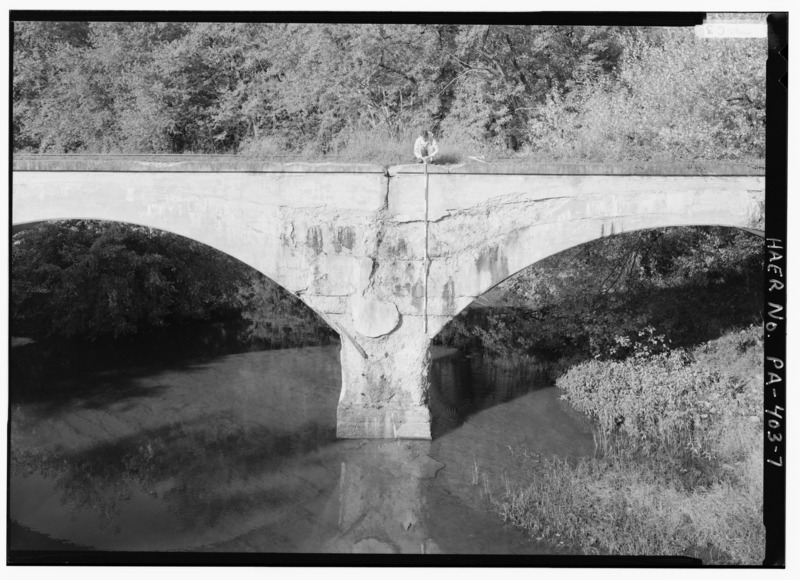
| Detail view from east of the 1st water pier from north - Augwick Creek Bridge, Aughwick, Huntingdon County, PA | ||||
|---|---|---|---|---|
| Photographer |
Boucher, Jack E. |
|||
| Title |
Detail view from east of the 1st water pier from north - Augwick Creek Bridge, Aughwick, Huntingdon County, PA |
|||
| Description |
East Broad Top Railroad and Coal Company; Benz, transmitter |
|||
| Depicted place | Pennsylvania; Huntingdon County; Aughwick | |||
| Date | 1986 | |||
| Dimensions | 5 x 7 in. | |||
| Current location |
Library of Congress Prints and Photographs Division Washington, D.C. 20540 USA http://hdl.loc.gov/loc.pnp/pp.print |
|||
| Accession number |
HAER PA,31-AUGH,1-7 |
|||
| Credit line |
|
|||
| Notes |
|
|||
| Source | https://www.loc.gov/pictures/item/pa3445.photos.188803p | |||
| Permission (Reusing this file) |
|
|||

| Object location | | View this and other nearby images on: OpenStreetMap |
|---|
File history
Click on a date/time to view the file as it appeared at that time.
| Date/Time | Thumbnail | Dimensions | User | Comment | |
|---|---|---|---|---|---|
| current | 02:25, 1 August 2014 |  | 5,000 × 3,622 (17.27 MB) | Fæ (talk | contribs) | GWToolset: Creating mediafile for Fæ. HABS 31 July 2014 (3000:3200) |
You cannot overwrite this file.
File usage on Commons
The following page uses this file: