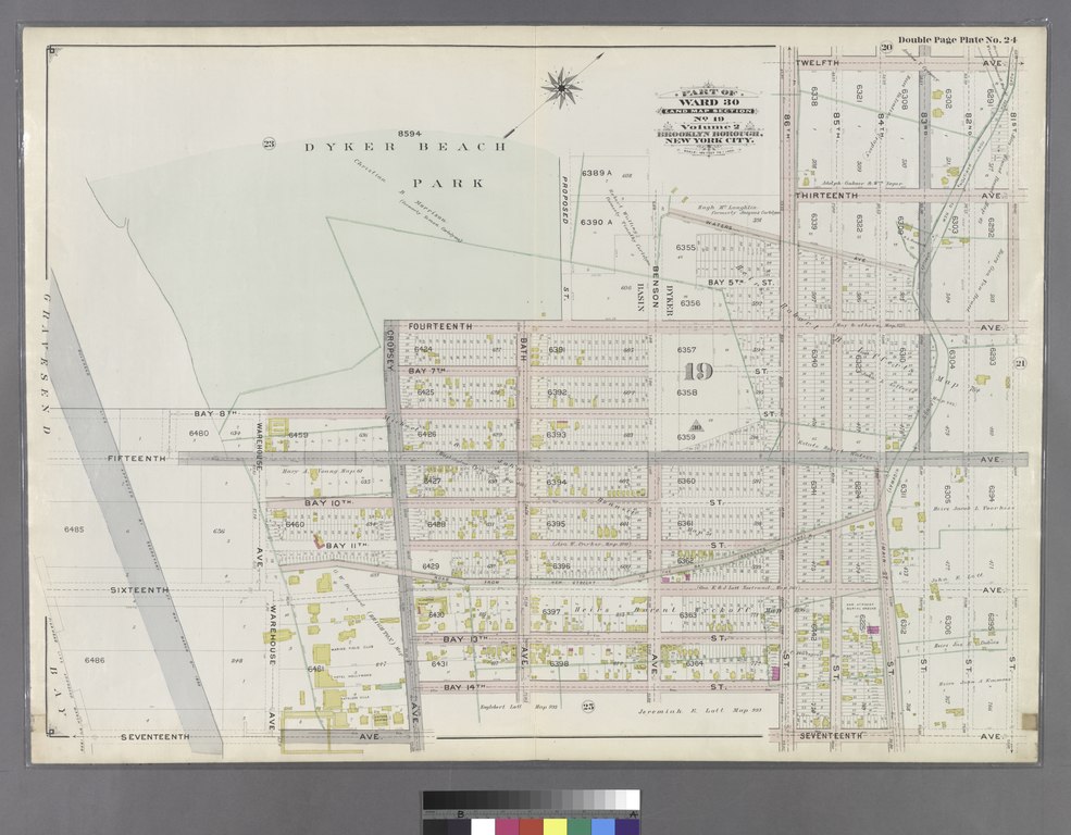
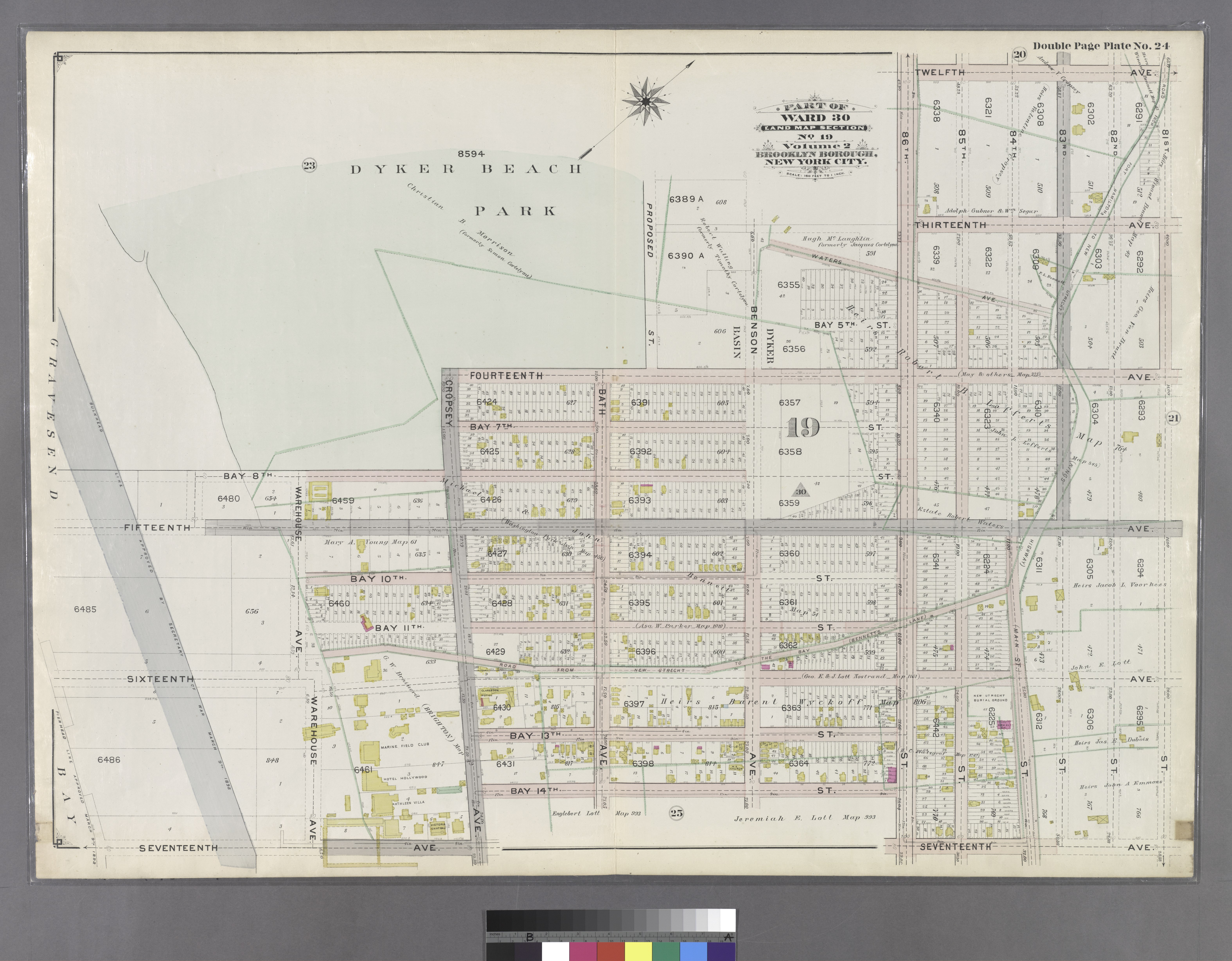
File:Double Page Plate No. 24- (Bounded by (Dyker Beach Park) Bay 8th Street, Fourteenth Avenue, 86th Street, Twelfth Avenue, 81st Street, Seventeenth Avenue, 86th Street, Bay 14th Street, Cropsey Avenue.) NYPL1517500.tiff
Jump to navigation
Jump to search

Size of this JPG preview of this TIF file: 769 × 600 pixels. Other resolutions: 308 × 240 pixels | 616 × 480 pixels | 985 × 768 pixels | 1,280 × 998 pixels | 2,560 × 1,996 pixels | 6,299 × 4,912 pixels.
Original file (6,299 × 4,912 pixels, file size: 88.54 MB, MIME type: image/tiff)
Captions
Captions
Add a one-line explanation of what this file represents
Summary[edit]
| Description | Double Page Plate No. 24: [Bounded by (Dyker Beach Park) Bay 8th Street, Fourteenth Avenue, 86th Street, Twelfth Avenue, 81st Street, Seventeenth Avenue, 86th Street, Bay 14th Street, Cropsey Avenue, Seventeenth Avenue and Warehouse Avenue.]; Atlases of New York city. / Atlas of the Brooklyn borough of the City of New York : originally Kings Co.; complete in three volumes ... based upon official maps and plans ... / by and under the supervision of Hugo Ullitz, C.E. | |||||||||||||||||||||||
| Catalogue call number | Map Div.+++ (Brooklyn) (Hyde, E. B., Map Co., Inc. Atlas of the Brooklyn borough) [Vols. 1 and 2 disbound and filed with sheet map | |||||||||||||||||||||||
| Item/Page/Plate | Plate 24 | |||||||||||||||||||||||
| Alternate title | Part of Ward 30, Land Map Section, No. 19. Volume 2, Brooklyn Borough, New York City. | |||||||||||||||||||||||
| Date | between 1898 and 1899 | |||||||||||||||||||||||
| Source |
http://digitalgallery.nypl.org/nypldigital/dgkeysearchdetail.cfm?imageID=1517500
|
|||||||||||||||||||||||
| Author | Ullitz, Hugo -- Engineer | |||||||||||||||||||||||
| Permission (Reusing this file) |
From The Lionel Pincus and Princess Firyal Map Division. http://maps.nypl.org
|
|||||||||||||||||||||||
| Source description | 1 atlas (3 v.) : col. maps (folded) ; 70 cm. | |||||||||||||||||||||||
| Location | Stephen A. Schwarzman Building / The Lionel Pincus and Princess Firyal Map Division | |||||||||||||||||||||||
| Digital item published | 5-24-2006; updated 3-25-2011 | |||||||||||||||||||||||
| Digital ID | 1517500 | |||||||||||||||||||||||

The making of this file was supported by Wikimedia UK.
To see other files made with the support of Wikimedia UK, please see the category Supported by Wikimedia UK.
|
File history
Click on a date/time to view the file as it appeared at that time.
| Date/Time | Thumbnail | Dimensions | User | Comment | |
|---|---|---|---|---|---|
| current | 20:41, 27 April 2014 |  | 6,299 × 4,912 (88.54 MB) | Fæ (talk | contribs) | GWToolset:: Creating mediafile for Fæ. Tranche 3 5495-7474 (2) |
You cannot overwrite this file.
File usage on Commons
There are no pages that use this file.