File:ESA Tafel Mariental.jpg
Jump to navigation
Jump to search
Size of this preview: 504 × 599 pixels. Other resolutions: 202 × 240 pixels | 404 × 480 pixels | 646 × 768 pixels | 861 × 1,024 pixels | 1,846 × 2,194 pixels.
Original file (1,846 × 2,194 pixels, file size: 954 KB, MIME type: image/jpeg)
Captions
Captions
Add a one-line explanation of what this file represents
Summary[edit]
| Description |
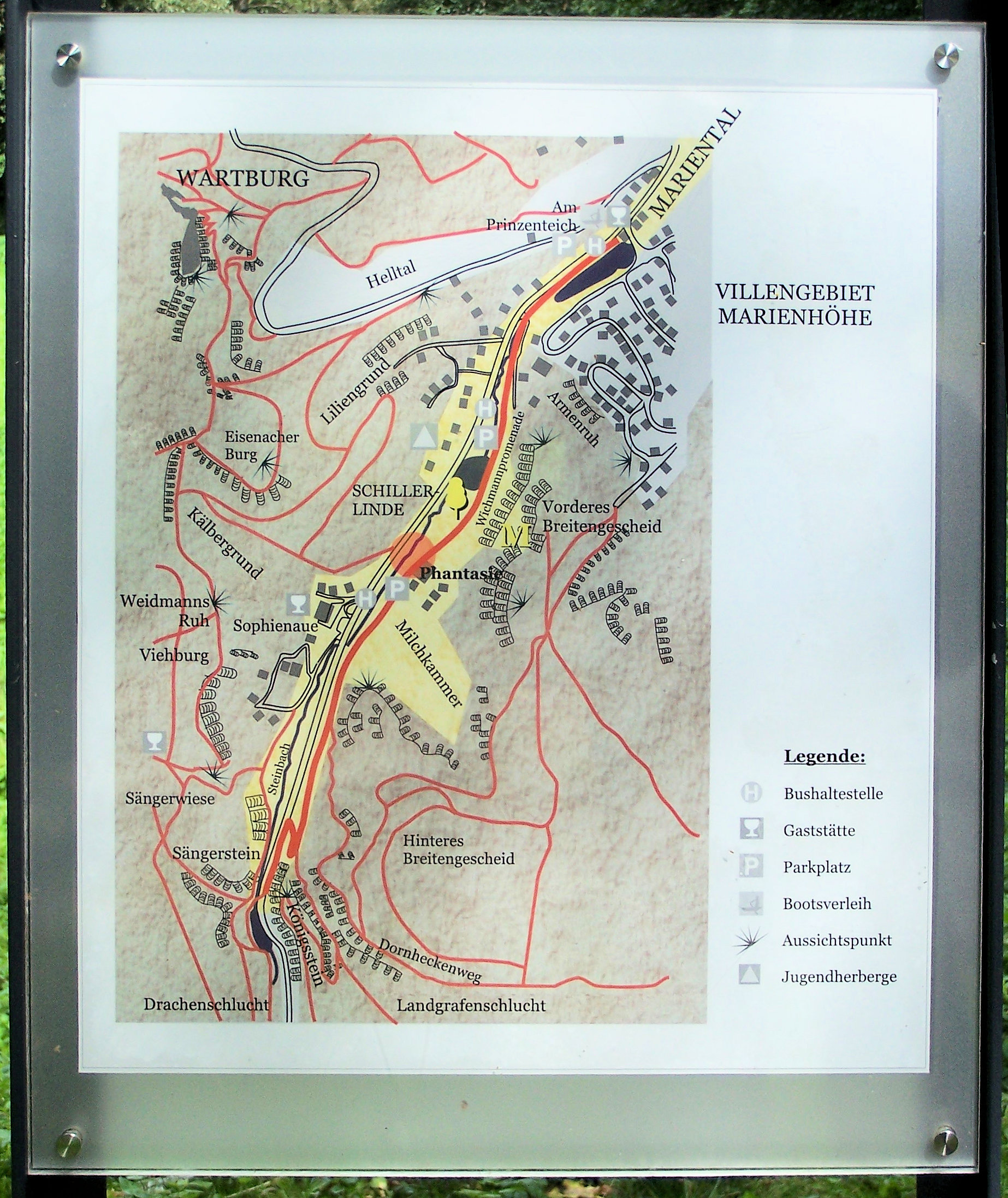
Deutsch: Eine Übersichtskarte erläutert die Lage der Hauptsehenswürdigkeiten im Mariental in der Eisenacher Südstadt. |
| Date | |
| Source | Own work |
| Author | Metilsteiner |
Licensing[edit]
I, the copyright holder of this work, hereby publish it under the following license:
This file is licensed under the Creative Commons Attribution 3.0 Unported license.
- You are free:
- to share – to copy, distribute and transmit the work
- to remix – to adapt the work
- Under the following conditions:
- attribution – You must give appropriate credit, provide a link to the license, and indicate if changes were made. You may do so in any reasonable manner, but not in any way that suggests the licensor endorses you or your use.
|
The photographical reproduction of this work is covered under the article § 59 of the German copyright law, which states that "It shall be permissible to reproduce, by painting, drawing, photography or cinematography, works which are permanently located on public ways, streets or places and to distribute and publicly communicate such copies. For works of architecture, this provision shall be applicable only to the external appearance."
As with all other “limits of copyright by legally permitted uses”, no changes to the actual work are permitted under § 62 of the German copyright law (UrhG). See Commons:Copyright rules by territory/Germany#Freedom of panorama for more information.
|
File history
Click on a date/time to view the file as it appeared at that time.
| Date/Time | Thumbnail | Dimensions | User | Comment | |
|---|---|---|---|---|---|
| current | 18:15, 23 April 2024 | | 1,846 × 2,194 (954 KB) | EACC80 (talk | contribs) | Bildbearbeitung - Vollprogramm |
| 13:32, 6 December 2011 |  | 1,488 × 2,232 (1.53 MB) | Metilsteiner (talk | contribs) | {{Information |Description ={{de|1=Eine Übersichtskarte erläutert die Lage der Hauptsehenswürdigkeiten im Mariental in der Eisenacher Südstadt.}} |Source ={{own}} |Author =Metilsteiner |Date =2011-08- |
You cannot overwrite this file.
File usage on Commons
There are no pages that use this file.
File usage on other wikis
The following other wikis use this file:
- Usage on de.wikipedia.org
- Usage on eo.wikipedia.org