File:EU Member states and Candidate countries map 17 March 2015.svg
Jump to navigation
Jump to search

Size of this PNG preview of this SVG file: 701 × 599 pixels. Other resolutions: 281 × 240 pixels | 561 × 480 pixels | 898 × 768 pixels | 1,198 × 1,024 pixels | 2,395 × 2,048 pixels | 1,401 × 1,198 pixels.
Original file (SVG file, nominally 1,401 × 1,198 pixels, file size: 845 KB)
Captions
Captions
Add a one-line explanation of what this file represents
Summary[edit]
| Description |
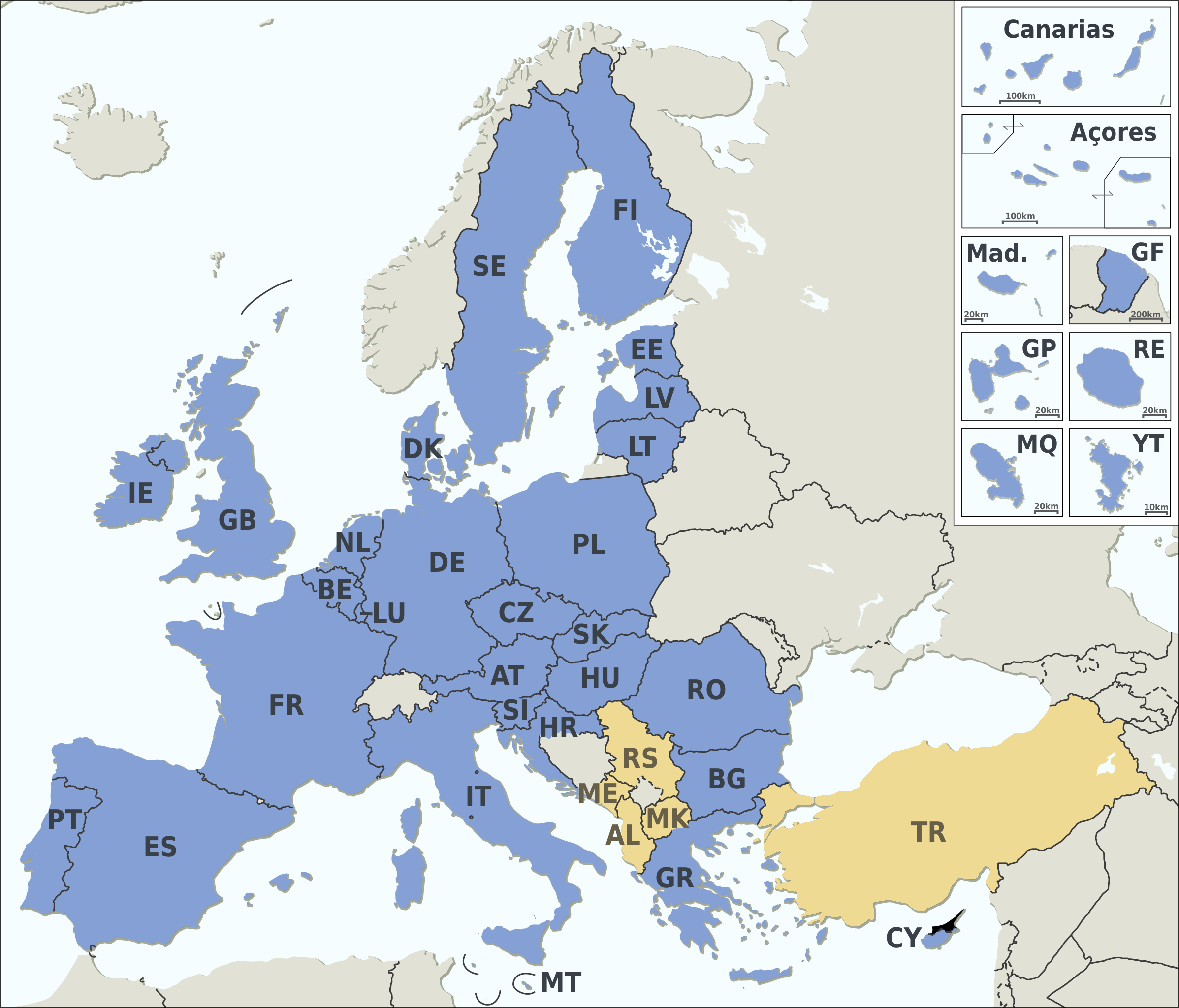
English: Member states of the EU (+ Candidate countries), File:EU Member states and Candidate countries map.svg as it was on 17 March 2015. (before Brexit)
Member states of the EU
Candidate countries
|
|||||||||||||||||||||||||||||||||||||||||||||||||||||||||||||||||||||||||||||
| Date | ||||||||||||||||||||||||||||||||||||||||||||||||||||||||||||||||||||||||||||||
| Source |
Natural Earth 1:50m (http://www.naturalearthdata.com) |
|||||||||||||||||||||||||||||||||||||||||||||||||||||||||||||||||||||||||||||
| Author | Alexrk2 | |||||||||||||||||||||||||||||||||||||||||||||||||||||||||||||||||||||||||||||
| Other versions |
|
|||||||||||||||||||||||||||||||||||||||||||||||||||||||||||||||||||||||||||||
| SVG development | and with Inkscape.
|


Licensing[edit]
I, the copyright holder of this work, hereby publish it under the following license:
This file is licensed under the Creative Commons Attribution-Share Alike 3.0 Unported license.
- You are free:
- to share – to copy, distribute and transmit the work
- to remix – to adapt the work
- Under the following conditions:
- attribution – You must give appropriate credit, provide a link to the license, and indicate if changes were made. You may do so in any reasonable manner, but not in any way that suggests the licensor endorses you or your use.
- share alike – If you remix, transform, or build upon the material, you must distribute your contributions under the same or compatible license as the original.
File history
Click on a date/time to view the file as it appeared at that time.
| Date/Time | Thumbnail | Dimensions | User | Comment | |
|---|---|---|---|---|---|
| current | 19:46, 1 February 2020 | | 1,401 × 1,198 (845 KB) | Alexis Jazz (talk | contribs) | == {{int:filedesc}} == {{Information |description={{en|Member states of the EU (+ Candidate countries), File:EU Member states and Candidate countries map.svg as it was on 17 March 2015. (before Brexit)}} {{Legend|#94a9d3|Member states of the EU}} {{Legend|#efd389|Candidate countries}} {{Template:EU Member states and Candidate countries map}} |source=Natural Earth 1:50m (http://www.naturalearthdata.com) {{Attribs|t=m |Guadeloupe department location map.svg|Sting |Guyane department locatio... |
You cannot overwrite this file.
File usage on Commons
The following page uses this file: