File:EXTERIOR SOUTHEAST CORNER VIEW, FACING NORTHWEST. - NASA Industrial Plant, Missile Research Laboratory, 12214 Lakewood Boulevard, Downey, Los Angeles County, CA HAER CA-310-G-2.tif
Jump to navigation
Jump to search

Size of this JPG preview of this TIF file: 735 × 600 pixels. Other resolutions: 294 × 240 pixels | 588 × 480 pixels | 941 × 768 pixels | 1,255 × 1,024 pixels | 2,509 × 2,048 pixels | 5,273 × 4,304 pixels.
Original file (5,273 × 4,304 pixels, file size: 21.65 MB, MIME type: image/tiff)
Captions
Captions
Add a one-line explanation of what this file represents
Summary[edit]
| EXTERIOR SOUTHEAST CORNER VIEW, FACING NORTHWEST. - NASA Industrial Plant, Missile Research Laboratory, 12214 Lakewood Boulevard, Downey, Los Angeles County, CA | ||||
|---|---|---|---|---|
| Photographer |
Olmos, Tavo Related names:
|
|||
| Title |
EXTERIOR SOUTHEAST CORNER VIEW, FACING NORTHWEST. - NASA Industrial Plant, Missile Research Laboratory, 12214 Lakewood Boulevard, Downey, Los Angeles County, CA |
|||
| Depicted place | California; Los Angeles County; Downey | |||
| Date | 2002 | |||
| Dimensions | 4 x 5 in. | |||
| Current location |
Library of Congress Prints and Photographs Division Washington, D.C. 20540 USA http://hdl.loc.gov/loc.pnp/pp.print |
|||
| Accession number |
HAER CA-310-G-2 |
|||
| Credit line |
|
|||
| Notes |
|
|||
| Source | https://www.loc.gov/pictures/item/ca3134.photos.194490p | |||
| Permission (Reusing this file) |
|
|||

| Object location | | View this and other nearby images on: OpenStreetMap |
|---|
File history
Click on a date/time to view the file as it appeared at that time.
| Date/Time | Thumbnail | Dimensions | User | Comment | |
|---|---|---|---|---|---|
| current | 18:30, 6 July 2014 | 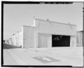 | 5,273 × 4,304 (21.65 MB) | Fæ (talk | contribs) | GWToolset: Creating mediafile for Fæ. HABS 05 July 2014 (501:600) |
You cannot overwrite this file.
File usage on Commons
The following page uses this file: