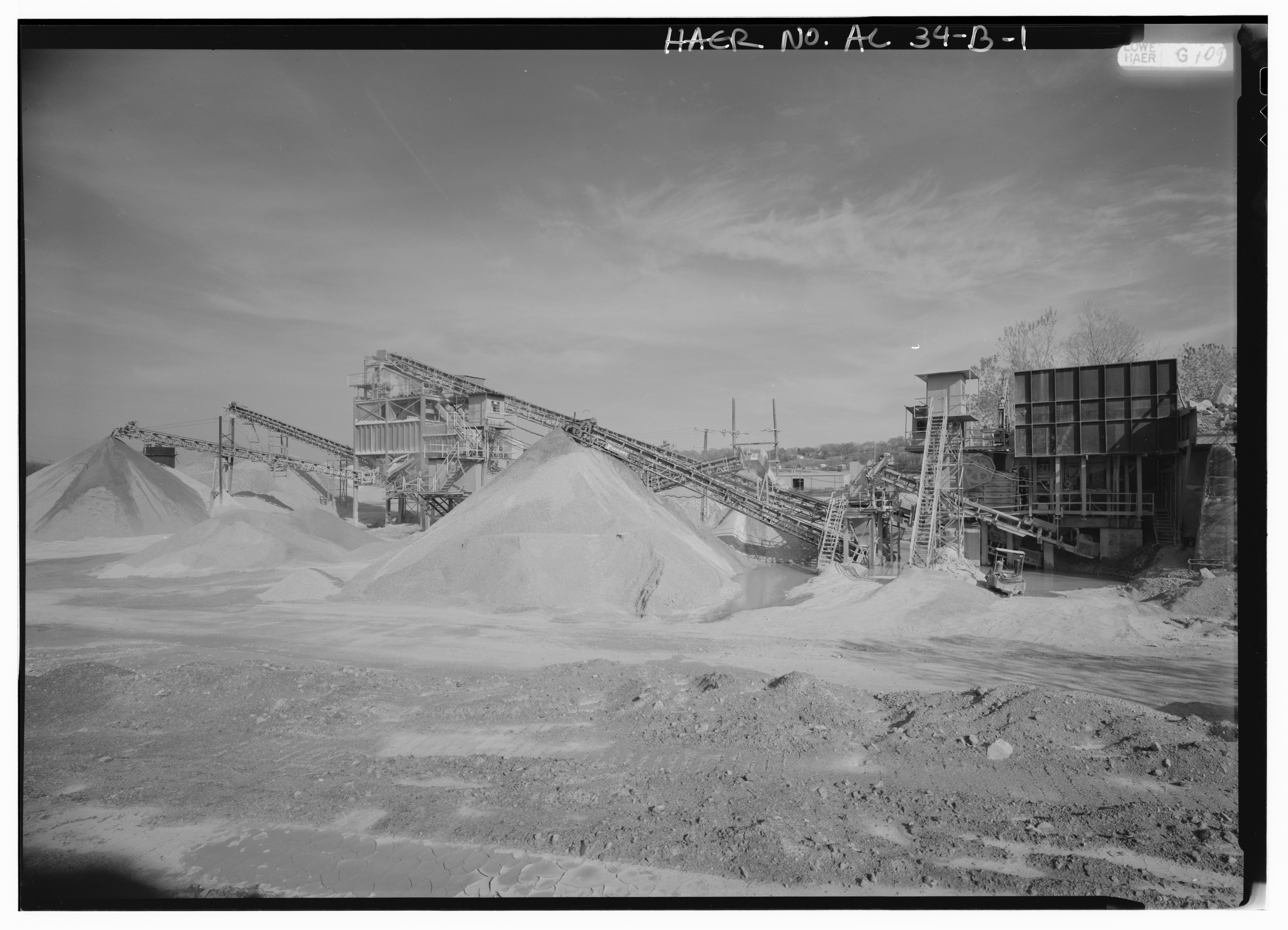
File:EXTERIOR VIEW, LOOKING EAST, OF REDUCTION PLANT NO. 6 WITH PRIMARY AND SECONDARY LIMESTONE REDUCTION ('CRUSHING') IN PROGRESS. FEEDER (RIGHT) FEEDS TO CONVEYOR BELTS (CENTER) AND HAER ALA,37-THOS,8B-1.tif
Jump to navigation
Jump to search

Size of this JPG preview of this TIF file: 800 × 577 pixels. Other resolutions: 320 × 231 pixels | 640 × 462 pixels | 1,024 × 739 pixels | 1,280 × 924 pixels | 2,560 × 1,848 pixels | 5,000 × 3,609 pixels.
Original file (5,000 × 3,609 pixels, file size: 17.21 MB, MIME type: image/tiff)
Captions
Captions
Add a one-line explanation of what this file represents
Summary[edit]
| Photographer |
Lowe, Jet Related names:
|
|||
| Title |
EXTERIOR VIEW, LOOKING EAST, OF REDUCTION PLANT NO. 6 WITH PRIMARY AND SECONDARY LIMESTONE REDUCTION ('CRUSHING') IN PROGRESS. FEEDER (RIGHT) FEEDS TO CONVEYOR BELTS (CENTER) AND CRUSHER (LEFT). LIMESTONE PROCESSED THROUGH THIS OPERATION IS FURTHER SCREENED AND PROCESSED AT ANOTHER PLANT ON THE THOMAS SITE. OPERATION OF THIS PLANT, WHICH BEGAN IN 1960, INCORPORATES WITHIN THE FEEDER A CONCRETE RETAINING WALL DATING TO A TURN OF THE CENTURY QUARRY OPERATION FORMERLY ON THIS SITE. - Wade Sand and Gravel Company, Reduction Plant No. 6, State Route 78, Thomas, Jefferson County, AL |
|||
| Depicted place | Alabama; Jefferson County; Thomas | |||
| Date | 1993 | |||
| Dimensions | 5 x 7 in. | |||
| Current location |
Library of Congress Prints and Photographs Division Washington, D.C. 20540 USA http://hdl.loc.gov/loc.pnp/pp.print |
|||
| Accession number |
HAER ALA,37-THOS,8B-1 |
|||
| Credit line |
|
|||
| Notes |
|
|||
| Source | https://www.loc.gov/pictures/item/al1147.photos.046543p | |||
| Permission (Reusing this file) |
|

| Object location | | View this and other nearby images on: OpenStreetMap |
|---|
File history
Click on a date/time to view the file as it appeared at that time.
| Date/Time | Thumbnail | Dimensions | User | Comment | |
|---|---|---|---|---|---|
| current | 02:33, 1 July 2014 |  | 5,000 × 3,609 (17.21 MB) | Fæ (talk | contribs) | GWToolset: Creating mediafile for Fæ. HABS batch upload 29 June 2014 (101:150) |
You cannot overwrite this file.
File usage on Commons
The following page uses this file: