File:Ethiopia-Somalia boundary. LOC 84692130.jpg
Jump to navigation
Jump to search
Size of this preview: 454 × 600 pixels. Other resolutions: 181 × 240 pixels | 363 × 480 pixels | 581 × 768 pixels | 775 × 1,024 pixels | 1,550 × 2,048 pixels | 3,178 × 4,200 pixels.
Original file (3,178 × 4,200 pixels, file size: 1.22 MB, MIME type: image/jpeg)
Captions
Captions
Add a one-line explanation of what this file represents
Summary[edit]
| Description |
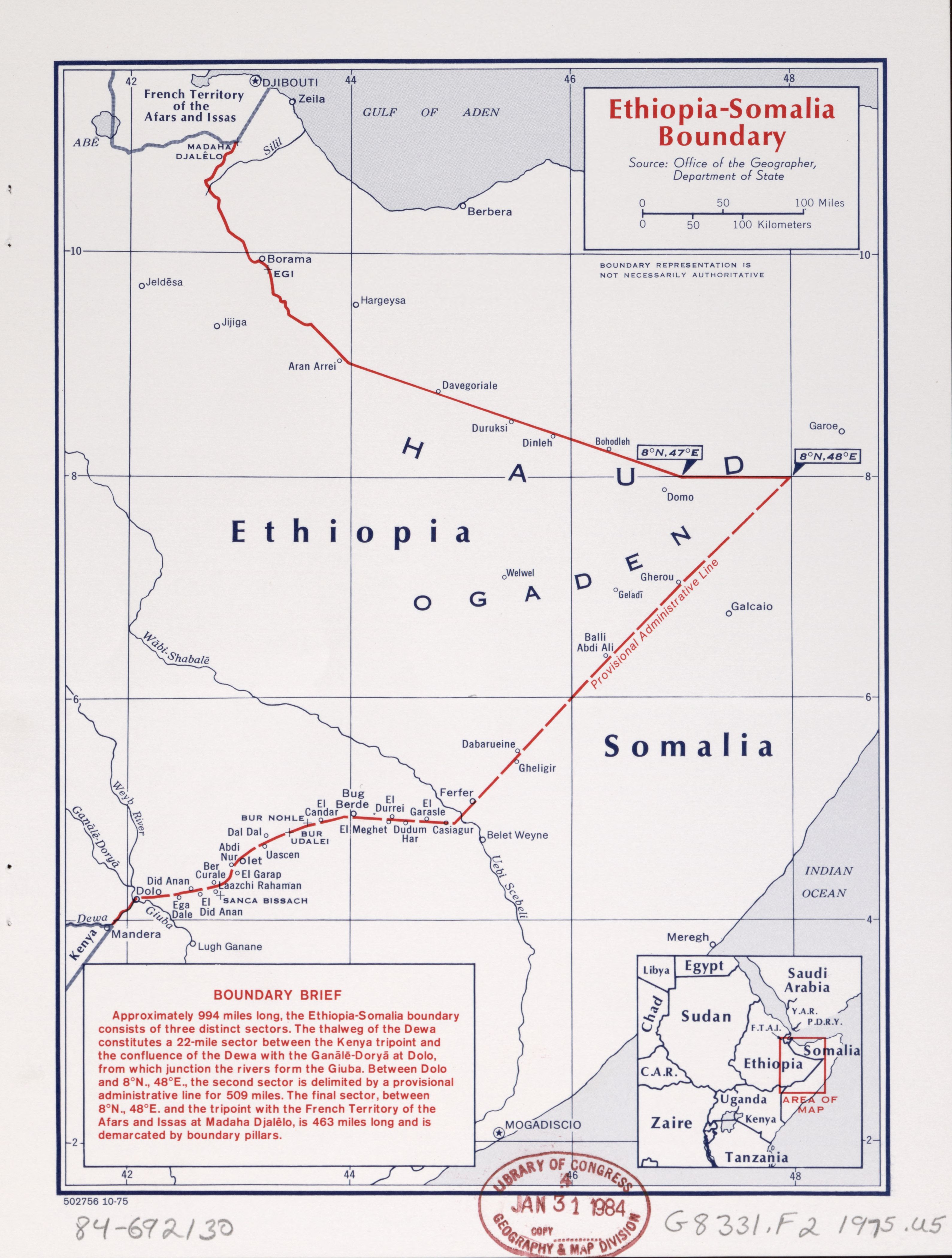
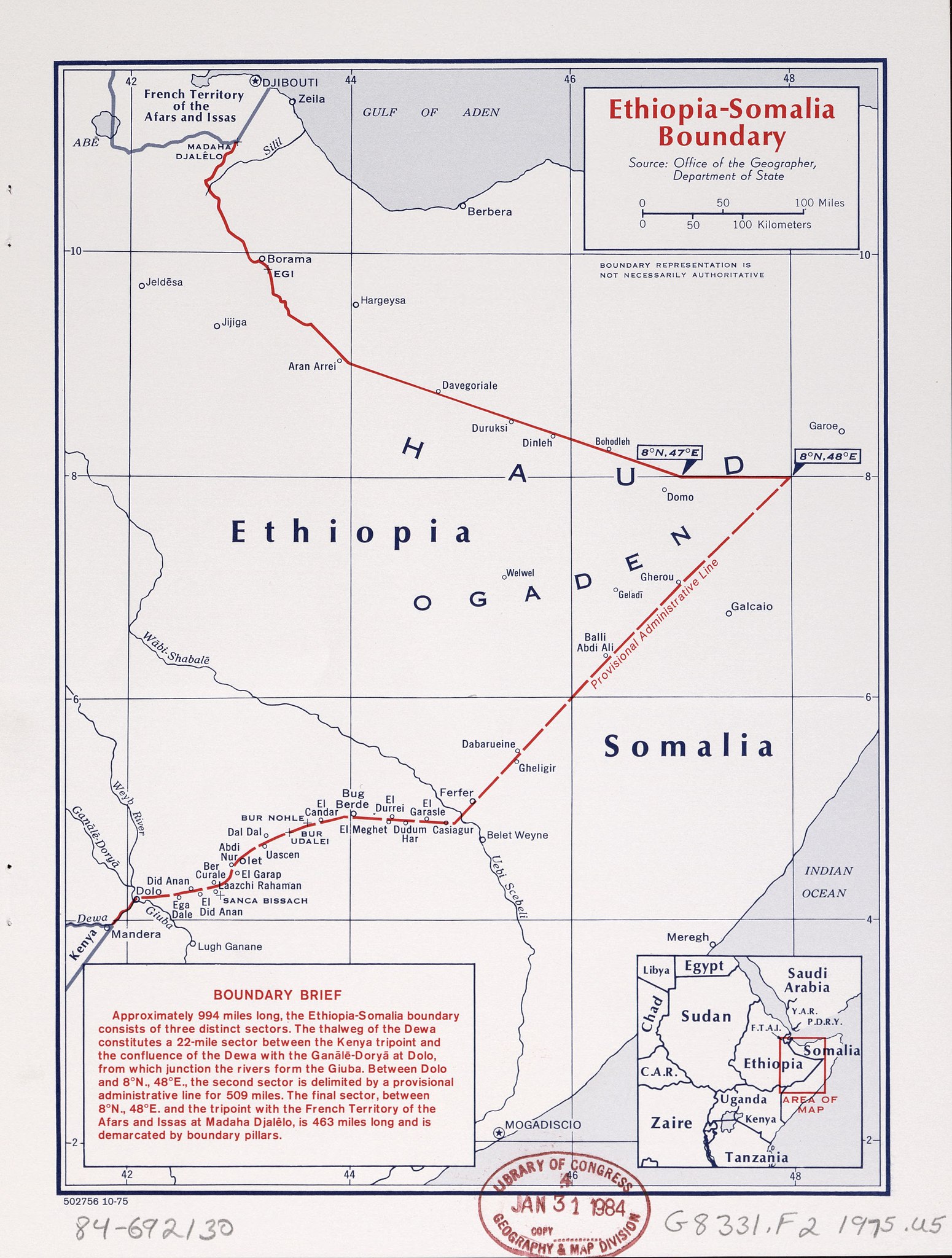
English: "502756 10-75." "Source: Office of the Geographer, Department of State." Includes note and key map. Available also through the Library of Congress Web site as a raster image. |
||
| Title | Ethiopia-Somalia boundary. | ||
| Shelf ID | G8331.F2 1975 .U5 | ||
| Date | |||
| Source | https://www.loc.gov/item/84692130/ | ||
| Author | United States. Central Intelligence Agency; United States. Department Of State. Office Of The Geographer | ||
| Permission (Reusing this file) |
|
||
| Other versions |
|
||
| Location | Ethiopia · Somalia | ||
| Part of | American Memory · General Maps · Catalog · Geography And Map Division | ||
| Subject | Boundaries · Ethiopia · Somalia · Maps |

Licensing[edit]
| This image is a work of a Central Intelligence Agency employee, taken or made as part of that person's official duties. As a Work of the United States Government, this image or media is in the public domain in the United States.
|

|
File history
Click on a date/time to view the file as it appeared at that time.
| Date/Time | Thumbnail | Dimensions | User | Comment | |
|---|---|---|---|---|---|
| current | 13:50, 15 May 2018 | | 3,178 × 4,200 (1.22 MB) | Fæ (talk | contribs) | LOC Maps https://www.loc.gov/item/84692130/ #8988 |
You cannot overwrite this file.
File usage on Commons
The following page uses this file: