File:First Manassas map.jpg
Jump to navigation
Jump to search

Size of this preview: 611 × 599 pixels. Other resolutions: 245 × 240 pixels | 489 × 480 pixels | 783 × 768 pixels | 1,044 × 1,024 pixels | 2,088 × 2,048 pixels | 4,750 × 4,660 pixels.
Original file (4,750 × 4,660 pixels, file size: 13.24 MB, MIME type: image/jpeg)
Captions
Captions
Add a one-line explanation of what this file represents
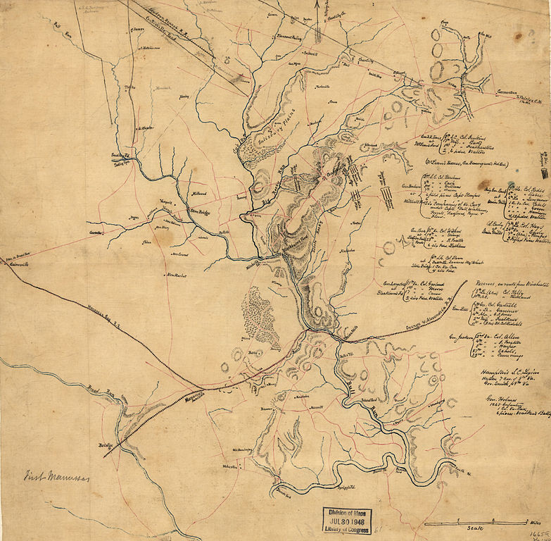
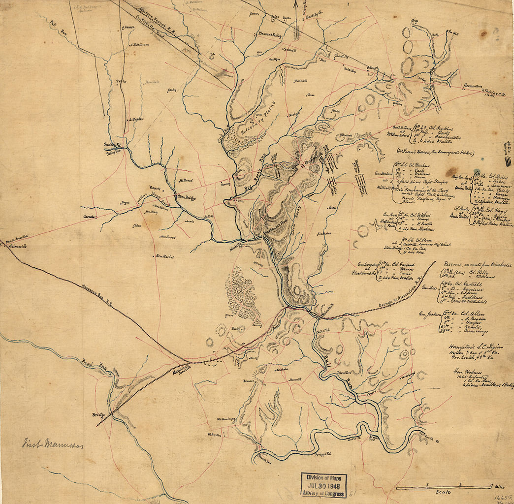
| Description | Confederate map from the American Civil War of First Manassas (First Battle of Bull Run). Includes some troop positions, and lists of Confederate regiments engaged in the battle of Manassas, with the names of their commanders. Relief shown by hachures. Digitized from Pen-and-ink and pencil manuscript on tracing linen, mounted on paper (original 41cm x 41cm). Scale [1:63,360]. |
| Date | |
| Source | Library of Congress[1] |
| Author | Unknown author |
| Other versions | Unrestored version of File:First Manassas map2.jpg. |
This work is in the public domain in the United States because it was published (or registered with the U.S. Copyright Office) before January 1, 1929.
Public domain works must be out of copyright in both the United States and in the source country of the work in order to be hosted on the Commons. If the work is not a U.S. work, the file must have an additional copyright tag indicating the copyright status in the source country.
Note: This tag should not be used for sound recordings. |
File history
Click on a date/time to view the file as it appeared at that time.
| Date/Time | Thumbnail | Dimensions | User | Comment | |
|---|---|---|---|---|---|
| current | 06:18, 31 January 2009 | | 4,750 × 4,660 (13.24 MB) | Durova (talk | contribs) | {{Information |Description=Confederate map from the American Civil War of First Manassas (First Battle of Bull Run). Includes some troop positions, and lists of Confederate regiments engaged in the battle of Manassas, with the names of their commanders. |
You cannot overwrite this file.
File usage on Commons
The following page uses this file: