File:GENERAL VIEW LOOKING NORTHEAST, SHOWING NEW ROADBED APPLIED OVER ORIGINAL BRIDGE - Dunlap's Creek Bridge, Spanning Dunlap's Creek, Brownsville, Fayette County, PA HAER PA,26-BROVI,2-2.tif
Jump to navigation
Jump to search

Size of this JPG preview of this TIF file: 751 × 600 pixels. Other resolutions: 301 × 240 pixels | 601 × 480 pixels | 962 × 768 pixels | 1,280 × 1,022 pixels | 2,560 × 2,044 pixels | 5,000 × 3,992 pixels.
Original file (5,000 × 3,992 pixels, file size: 19.04 MB, MIME type: image/tiff)
Captions
Captions
Add a one-line explanation of what this file represents
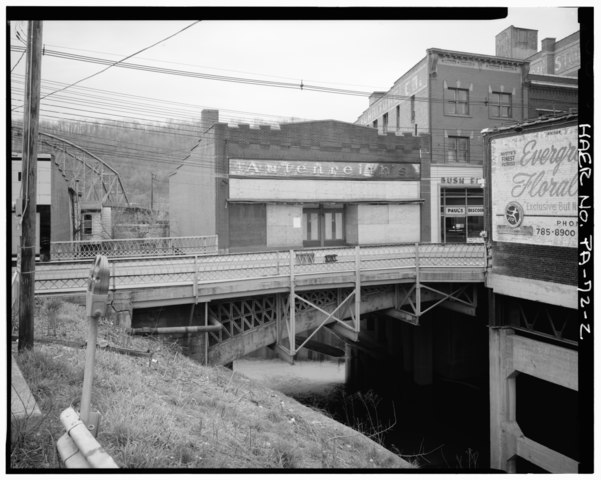
| GENERAL VIEW LOOKING NORTHEAST, SHOWING NEW ROADBED APPLIED OVER ORIGINAL BRIDGE - Dunlap's Creek Bridge, Spanning Dunlap's Creek, Brownsville, Fayette County, PA | ||||
|---|---|---|---|---|
| Title |
GENERAL VIEW LOOKING NORTHEAST, SHOWING NEW ROADBED APPLIED OVER ORIGINAL BRIDGE - Dunlap's Creek Bridge, Spanning Dunlap's Creek, Brownsville, Fayette County, PA |
|||
| Description |
Pennsylvania Department of Transportation; Keys and Searight; Herbertson Foundry; John Snowden; Delafield, Richard; Murphy, Kevin, historian; Zacher, Susan M, historian; Lowe, Jet, photographer |
|||
| Depicted place | Pennsylvania; Fayette County; Brownsville | |||
| Date | Documentation compiled after 1968 | |||
| Dimensions | 4 x 5 in. | |||
| Current location |
Library of Congress Prints and Photographs Division Washington, D.C. 20540 USA http://hdl.loc.gov/loc.pnp/pp.print |
|||
| Accession number |
HAER PA,26-BROVI,2-2 |
|||
| Credit line |
|
|||
| Notes |
|
|||
| Source | https://www.loc.gov/pictures/item/pa1412.photos.134042p | |||
| Permission (Reusing this file) |
|
|||

File history
Click on a date/time to view the file as it appeared at that time.
| Date/Time | Thumbnail | Dimensions | User | Comment | |
|---|---|---|---|---|---|
| current | 11:08, 30 July 2014 |  | 5,000 × 3,992 (19.04 MB) | Fæ (talk | contribs) | GWToolset: Creating mediafile for Fæ. HABS 30 July 2014 (2901:3000) |
You cannot overwrite this file.
File usage on Commons
The following page uses this file:
File usage on other wikis
The following other wikis use this file:
- Usage on uk.wikipedia.org