File:GER — BY – Oberbayern — Lkr. Rosenheim — Gemeinde Aschau im Chiemgau — Hohenaschau im Chiemgau — Fuchslug 1 (ehem. Forsthaus) D-1-87-114-62 Mattes Huawei P30 Pro 2021.jpg
Jump to navigation
Jump to search

Size of this preview: 800 × 368 pixels. Other resolutions: 320 × 147 pixels | 640 × 295 pixels | 1,024 × 472 pixels | 1,280 × 589 pixels | 3,648 × 1,680 pixels.
Original file (3,648 × 1,680 pixels, file size: 1.91 MB, MIME type: image/jpeg)
Captions
Captions
Add a one-line explanation of what this file represents
Summary
[edit]_D-1-87-114-62_Mattes_Huawei_P30_Pro_2021.jpg&action=edit§ion=1)
| Description |
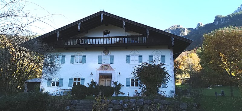
Deutsch: Einfirsthof, Putzbau mit Flachsatteldach und Hochlaube, nach Plänen von Johann Baptist Gunetzrhainer, 1749/50; ehem. Forsthaus Fuxlug, heute Wohnhaus
|
||||||
| Date | Taken on 28 October 2021 | ||||||
| Source | Self-photographed | ||||||
| Author | User:Mateus2019 |
_D-1-87-114-62_Mattes_Huawei_P30_Pro_2021.jpg¶ms=047.766361_N_0012.329161_E_globe:Earth_type:camera_scale:6250_&language=en)
Licensing
[edit]_D-1-87-114-62_Mattes_Huawei_P30_Pro_2021.jpg&action=edit§ion=2)
I, the copyright holder of this work, hereby publish it under the following license:
This file is licensed under the Creative Commons Attribution-Share Alike 4.0 International license.
- You are free:
- to share – to copy, distribute and transmit the work
- to remix – to adapt the work
- Under the following conditions:
- attribution – You must give appropriate credit, provide a link to the license, and indicate if changes were made. You may do so in any reasonable manner, but not in any way that suggests the licensor endorses you or your use.
- share alike – If you remix, transform, or build upon the material, you must distribute your contributions under the same or compatible license as the original.
|
The photographical reproduction of this work is covered under the article § 59 of the German copyright law, which states that "It shall be permissible to reproduce, by painting, drawing, photography or cinematography, works which are permanently located on public ways, streets or places and to distribute and publicly communicate such copies. For works of architecture, this provision shall be applicable only to the external appearance."
As with all other “limits of copyright by legally permitted uses”, no changes to the actual work are permitted under § 62 of the German copyright law (UrhG). See Commons:Copyright rules by territory/Germany#Freedom of panorama for more information.
|
File history
Click on a date/time to view the file as it appeared at that time.
| Date/Time | Thumbnail | Dimensions | User | Comment | |
|---|---|---|---|---|---|
| current | 16:46, 28 October 2021 | | 3,648 × 1,680 (1.91 MB) | Mateus2019 (talk | contribs) | == {{int:filedesc}} == {{Information |Description={{Loc desc}} {{DEU}} > {{Bavaria}} > Regierungsbezirk Oberbayern > Landkreis Rosenheim > Gemeinde Aschau im Chiemgau > Hohenaschau im Chiemgau > An der Festhalle 4-6 {{de|1=Einfirsthof, Putzbau mit Flachsatteldach und Hochlaube, nach Plänen von Johann Baptist Gunetzrhainer, 1749/50; ehem. Forthaus, heute Wohnhaus}} {{Baudenkmal Bayern|D-1-87-114-62 }} {{location possible}} |Date={{Taken on |1=2021-10-28 |cat= |location=Germany |source=... |
You cannot overwrite this file.
File usage on Commons
The following 3 pages use this file:
_Mattes_Huawei_P30_Pro_2021.jpg)
File usage on other wikis
The following other wikis use this file:
- Usage on de.wikipedia.org
_D-1-87-114-62_Mattes_Huawei_P30_Pro_2021.jpg&oldid=768857217)