File:Hemel hempsted midland map2.png
Jump to navigation
Jump to search
Size of this preview: 618 × 600 pixels. Other resolutions: 247 × 240 pixels | 495 × 480 pixels | 792 × 768 pixels | 1,056 × 1,024 pixels | 1,307 × 1,268 pixels.
Original file (1,307 × 1,268 pixels, file size: 1.03 MB, MIME type: image/png)
Captions
Captions
Add a one-line explanation of what this file represents
Summary[edit]
| Description |
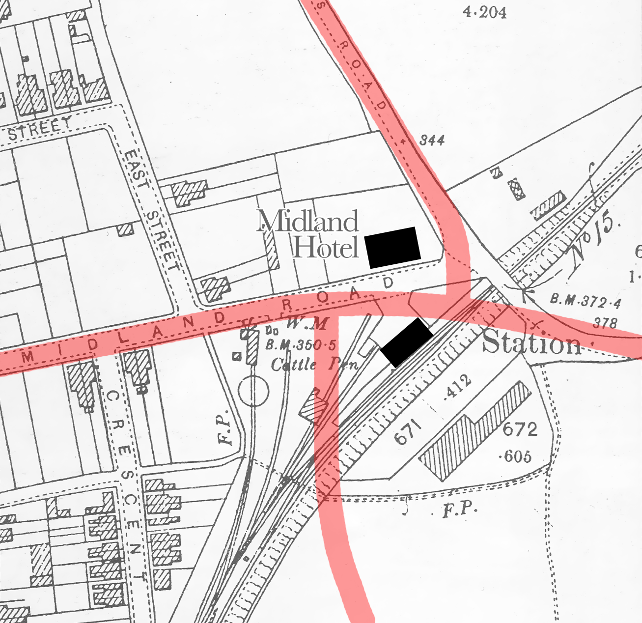
English: 1898 OS map showing the location of the Hemel Hempstead Midland Railway station, overlaid with modern road layout; the former station and the Midland Hotel are marked, |
| Date | |
| Source | Based on 1898 Ordnance Survey map of Hemel Hempstead |
| Author | Ordnance Survey |
| Camera location | | View this and other nearby images on: OpenStreetMap |
|---|
Licensing[edit]
This work is an Ordnance Survey map over 50 years old, which is covered by Crown Copyright which in this case expires 50 years after publication. Ordnance Survey does however ask that they be credited and that the date of publication be given.
Any ancillary rights gained through the creation of the electronic version are granted as freely usable under any circumstances.
|
This work created by the United Kingdom Government is in the public domain.
This is because it is one of the following:
HMSO has declared that the expiry of Crown Copyrights applies worldwide (ref: HMSO Email Reply)
|
 |
File history
Click on a date/time to view the file as it appeared at that time.
| Date/Time | Thumbnail | Dimensions | User | Comment | |
|---|---|---|---|---|---|
| current | 16:56, 9 June 2013 | | 1,307 × 1,268 (1.03 MB) | Cnbrb (talk | contribs) | more accurate road alignment illustrated |
| 13:35, 8 June 2013 |  | 1,307 × 1,268 (939 KB) | Cnbrb (talk | contribs) | User created page with UploadWizard |
You cannot overwrite this file.
File usage on Commons
The following page uses this file:
File usage on other wikis
The following other wikis use this file:
- Usage on en.wikipedia.org
- Usage on www.wikidata.org