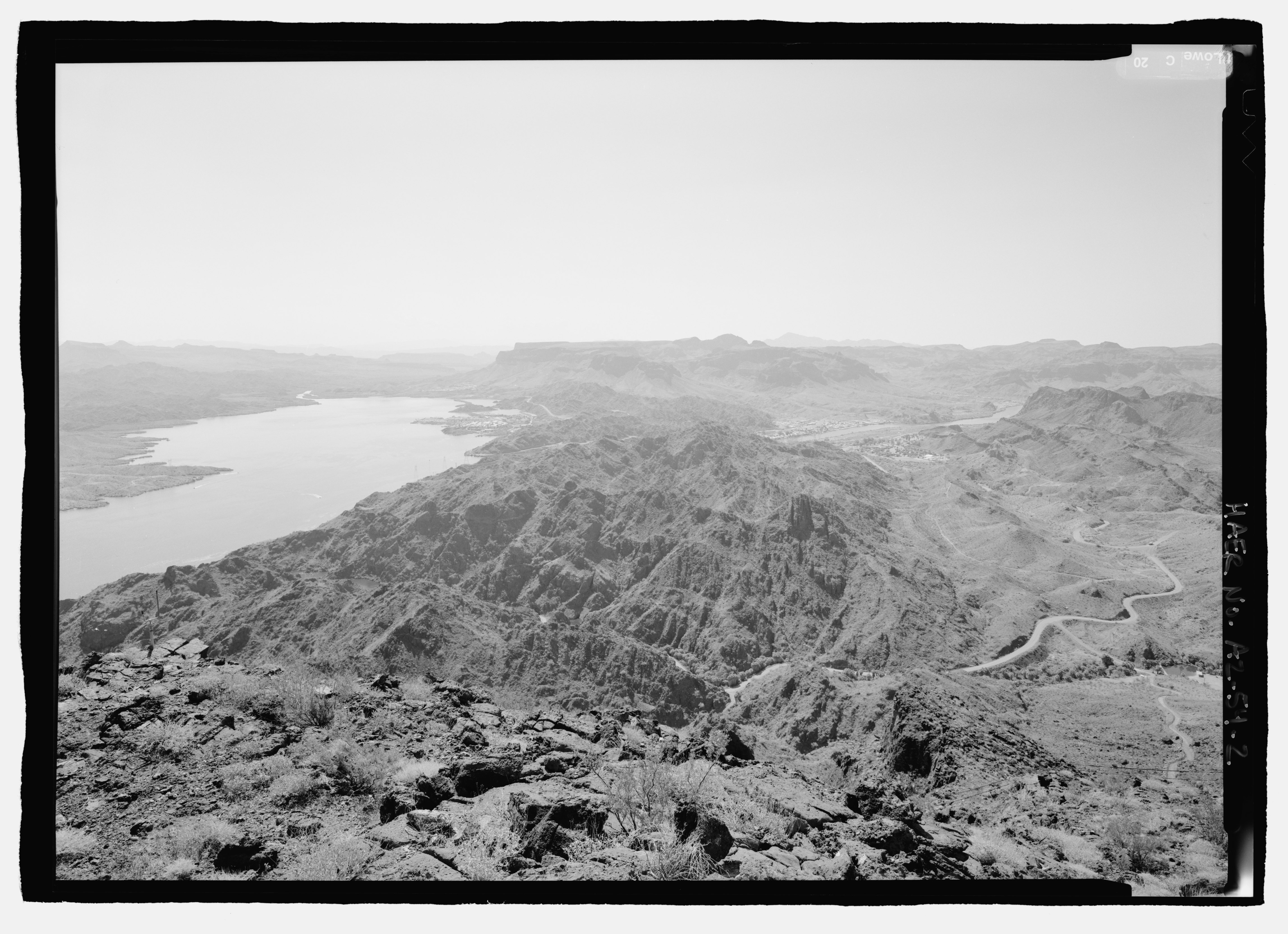
File:Lake Havasu on left, Colorado River on right below Parker Dam; View southeast from TV Hill above Whitsett Pump Plant. - Parker Dam, Spanning Colorado River between AZ and CA, Parker, La HAER AZ-54-2.tif
Jump to navigation
Jump to search

Size of this JPG preview of this TIF file: 800 × 580 pixels. Other resolutions: 320 × 232 pixels | 640 × 464 pixels | 1,024 × 743 pixels | 1,280 × 929 pixels | 2,560 × 1,857 pixels | 4,592 × 3,331 pixels.
Original file (4,592 × 3,331 pixels, file size: 14.59 MB, MIME type: image/tiff)
Captions
Captions
Add a one-line explanation of what this file represents
Summary
[edit]| Lake Havasu on left, Colorado River on right below Parker Dam; View southeast from TV Hill above Whitsett Pump Plant. - Parker Dam, Spanning Colorado River between AZ and CA, Parker, La Paz County, AZ | ||||
|---|---|---|---|---|
| Photographer |
Lowe, Jet, creator |
|||
| Title |
Lake Havasu on left, Colorado River on right below Parker Dam; View southeast from TV Hill above Whitsett Pump Plant. - Parker Dam, Spanning Colorado River between AZ and CA, Parker, La Paz County, AZ |
|||
| Depicted place | Arizona; La Paz County; Parker | |||
| Date | 1998 | |||
| Dimensions | 5 x 7 in. | |||
| Current location |
Library of Congress Prints and Photographs Division Washington, D.C. 20540 USA http://hdl.loc.gov/loc.pnp/pp.print |
|||
| Accession number |
HAER AZ-54-2 |
|||
| Credit line |
|
|||
| Source | https://www.loc.gov/pictures/item/az0467.photos.193664p | |||
| Permission (Reusing this file) |
|
|||

| Camera location | | View this and other nearby images on: OpenStreetMap |
|---|
[[Category:Castle Rock (Arizona)
File history
Click on a date/time to view the file as it appeared at that time.
| Date/Time | Thumbnail | Dimensions | User | Comment | |
|---|---|---|---|---|---|
| current | 21:53, 1 July 2014 |  | 4,592 × 3,331 (14.59 MB) | Fæ (talk | contribs) | GWToolset: Creating mediafile for Fæ. HABS 1 July 2014 (201:300) |
You cannot overwrite this file.
File usage on Commons
The following page uses this file: