File:Map of Russia - Tyumen Oblast, Yamalo-Nenets and Khanty-Mansi Autonomous Okrugs (2008-03).svg
Jump to navigation
Jump to search

Size of this PNG preview of this SVG file: 800 × 462 pixels. Other resolutions: 320 × 185 pixels | 640 × 369 pixels | 1,024 × 591 pixels | 1,280 × 738 pixels | 2,560 × 1,477 pixels | 1,092 × 630 pixels.
Original file (SVG file, nominally 1,092 × 630 pixels, file size: 209 KB)
Captions
Captions
Add a one-line explanation of what this file represents
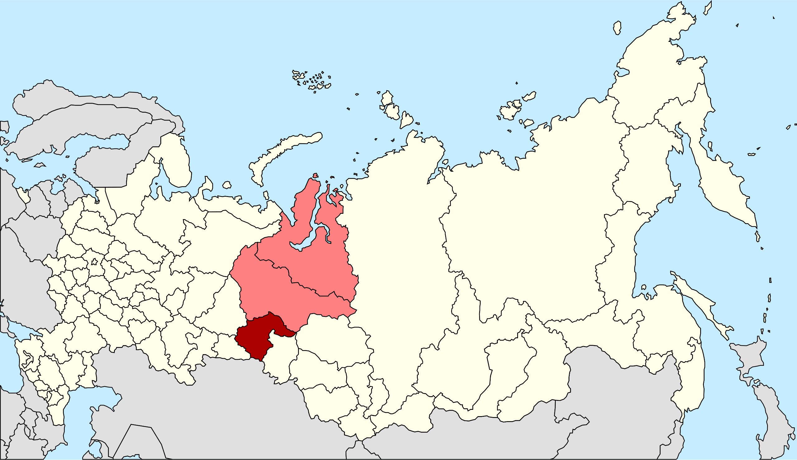
| Description | Autogenerated image to indicate Russian subjects as of 2008-03. Tyumen Oblast and the Yamalo-Nenets and Khanty-Mansi Autonomous Okrugs since these are subordinated to Tyumen Oblast. |
| Date | |
| Source | Made from Image:Map of Russian subjects, 2008-03-01.svg |
| Author | Marmelad |
| Permission (Reusing this file) |
Attribution ShareAlike 2.5 |
| Other versions | Tyumen Oblast only, Khanty-Mansi Autonomous Okrug only, Yamalo-Nenets Autonomous Okrug only. |
.svg)
.svg)
.svg)
This file is licensed under the Creative Commons Attribution-Share Alike 2.5 Generic license.
- You are free:
- to share – to copy, distribute and transmit the work
- to remix – to adapt the work
- Under the following conditions:
- attribution – You must give appropriate credit, provide a link to the license, and indicate if changes were made. You may do so in any reasonable manner, but not in any way that suggests the licensor endorses you or your use.
- share alike – If you remix, transform, or build upon the material, you must distribute your contributions under the same or compatible license as the original.
File history
Click on a date/time to view the file as it appeared at that time.
| Date/Time | Thumbnail | Dimensions | User | Comment | |
|---|---|---|---|---|---|
| current | 19:41, 27 May 2014 | | 1,092 × 630 (209 KB) | Knyaz-1988 (talk | contribs) | New version |
| 19:40, 27 May 2014 |  | 1,092 × 630 (222 KB) | Knyaz-1988 (talk | contribs) | Reverted to version as of 00:06, 1 March 2008 | |
| 17:21, 4 February 2010 |  | 1,092 × 630 (208 KB) | Виктор В (talk | contribs) | new color | |
| 00:06, 1 March 2008 |  | 1,092 × 630 (222 KB) | Lokal Profil (talk | contribs) | {{Information |Description=Autogenerated image to indicate Russian subjects as of 2008-03. Tyumen Oblast and the Yamalo-Nenets and Khanty-Mansi Autonomous Okrugs since these are subordinated to Tyumen Oblast. |Source=Made from [[:Image:Map of Russian subj |
You cannot overwrite this file.
File usage on Commons
There are no pages that use this file.
File usage on other wikis
The following other wikis use this file:
- Usage on be-tarask.wikipedia.org
- Usage on be.wikipedia.org
- Usage on bs.wikipedia.org
- Usage on eo.wikipedia.org
- Usage on fa.wikipedia.org
- Usage on fr.wikipedia.org
- Usage on mr.wikipedia.org
- Usage on nl.wikipedia.org
- Usage on pl.wikipedia.org
- Usage on pnb.wikipedia.org
- Usage on ru.wikipedia.org
- Usage on ru.wikinews.org
- Usage on sv.wikipedia.org
- Usage on tr.wikipedia.org
- Usage on uk.wikipedia.org
- Usage on xmf.wikipedia.org
.svg&oldid=456641707)