File:Puncak Jaya topographic map-id.svg
Jump to navigation
Jump to search

Size of this PNG preview of this SVG file: 800 × 572 pixels. Other resolutions: 320 × 229 pixels | 640 × 458 pixels | 1,024 × 732 pixels | 1,280 × 915 pixels | 2,560 × 1,830 pixels.
Original file (SVG file, nominally 1,280 × 915 pixels, file size: 1.17 MB)
Captions
Captions
Add a one-line explanation of what this file represents
Summary[edit]
| Description |
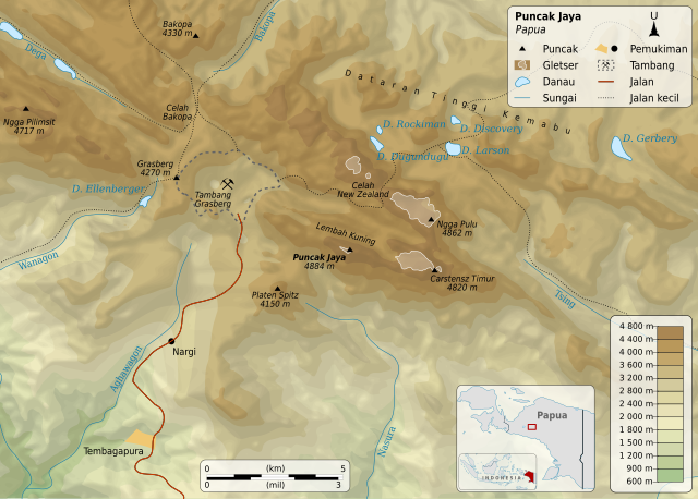
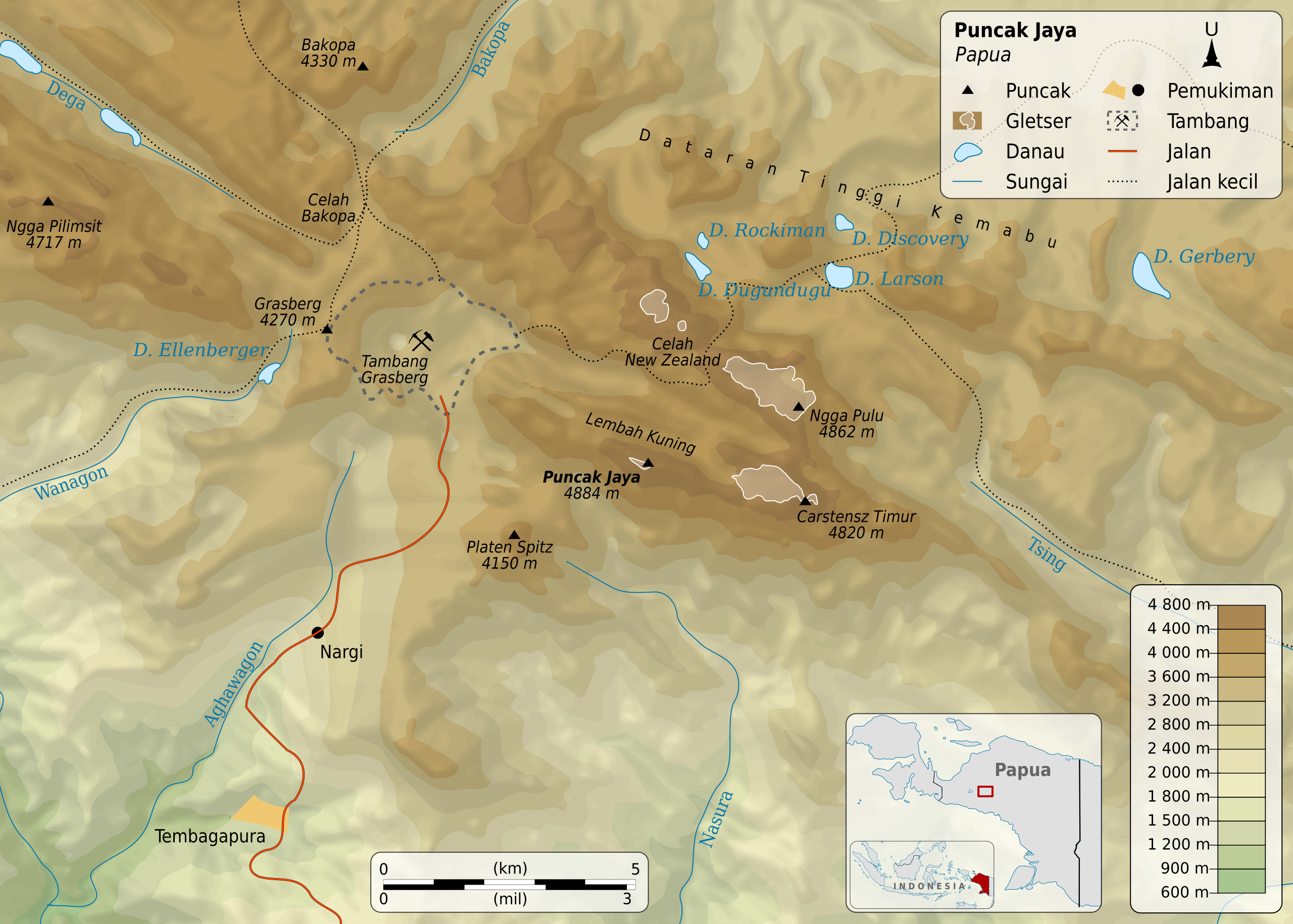
English: Map of Puncak Jaya, Central Papua, Indonesia. Equirectangular projection.
Français : Carte du Puncak Jaya, île de Nouvelle-Guinée, Indonésie.
Bahasa Indonesia: Peta wilayah Puncak Jaya, Papua Tengah. |
||||
| Date | |||||
| Source | File:Puncak Jaya topographic map-fr.svg © Sémhur / Wikimedia Commons / CC-BY-SA-3.0 | ||||
| Creator | |||||
| Geotemporal data | |||||
| Bounding box |
|
||||
| Georeferencing | If inappropriate please set warp_status = skip to hide. | ||||
| Other versions |
|
||||
| SVG development | |||||


Licensing[edit]
I, the copyright holder of this work, hereby publish it under the following license:
This file is licensed under the Creative Commons Attribution-Share Alike 4.0 International license.
- You are free:
- to share – to copy, distribute and transmit the work
- to remix – to adapt the work
- Under the following conditions:
- attribution – You must give appropriate credit, provide a link to the license, and indicate if changes were made. You may do so in any reasonable manner, but not in any way that suggests the licensor endorses you or your use.
- share alike – If you remix, transform, or build upon the material, you must distribute your contributions under the same or compatible license as the original.
File history
Click on a date/time to view the file as it appeared at that time.
| Date/Time | Thumbnail | Dimensions | User | Comment | |
|---|---|---|---|---|---|
| current | 08:22, 3 January 2018 | | 1,280 × 915 (1.17 MB) | RXerself (talk | contribs) | name spacing |
| 06:24, 3 January 2018 |  | 1,280 × 915 (1.17 MB) | RXerself (talk | contribs) | == {{int:filedesc}} == {{Map |Description= {{en|1=Map of Puncak Jaya, Papua, Indonesia. Equirectangular projection.}} {{fr|1=Carte du Puncak Jaya, île de Nouvelle-Guinée, Indonésie.}} {{id|1=Peta wilayah [[:id... |
You cannot overwrite this file.
File usage on Commons
The following page uses this file:
File usage on other wikis
The following other wikis use this file:
- Usage on id.wikipedia.org