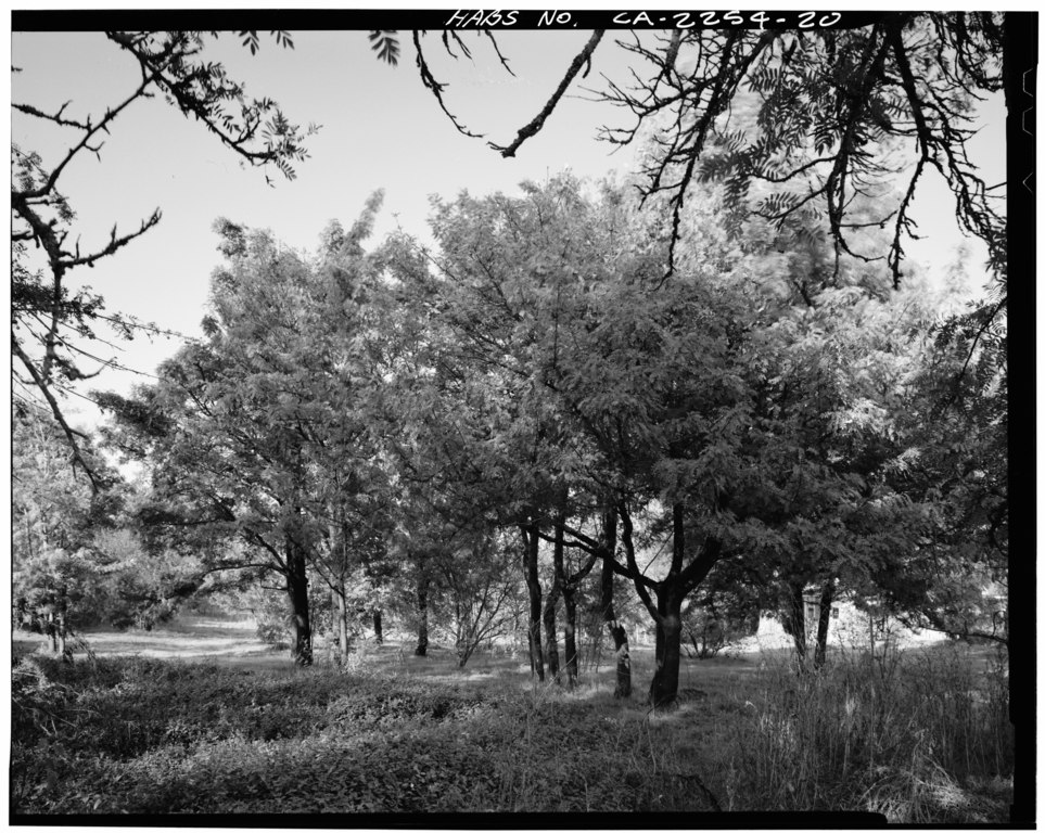
File:ROWS OF SORBUS (MOUNTAIN ASH) FROM EXPERIMENTS PLANTED IN BEDS BY BURBANK. HE TRIED TO DEVELOP AN EDIBLE NUT. LOOKING NORTH. - Gold Ridge Farm, 7777 Bodega Avenue, Sebastopol, HABS CAL,49-SEBA,1-20.tif
Jump to navigation
Jump to search

Size of this JPG preview of this TIF file: 752 × 600 pixels. Other resolutions: 301 × 240 pixels | 602 × 480 pixels | 963 × 768 pixels | 1,280 × 1,021 pixels | 2,560 × 2,042 pixels | 4,993 × 3,982 pixels.
Original file (4,993 × 3,982 pixels, file size: 18.96 MB, MIME type: image/tiff)
Captions
Captions
Add a one-line explanation of what this file represents
Summary[edit]
| ROWS OF SORBUS (MOUNTAIN ASH) FROM EXPERIMENTS PLANTED IN BEDS BY BURBANK. HE TRIED TO DEVELOP AN EDIBLE NUT. LOOKING NORTH. - Gold Ridge Farm, 7777 Bodega Avenue, Sebastopol, Sonoma County, CA | ||||
|---|---|---|---|---|
| Photographer |
Silverek, Don, creator |
|||
| Title |
ROWS OF SORBUS (MOUNTAIN ASH) FROM EXPERIMENTS PLANTED IN BEDS BY BURBANK. HE TRIED TO DEVELOP AN EDIBLE NUT. LOOKING NORTH. - Gold Ridge Farm, 7777 Bodega Avenue, Sebastopol, Sonoma County, CA |
|||
| Depicted place | California; Sonoma County; Sebastopol | |||
| Date | 1986 | |||
| Dimensions | 4 x 5 in. | |||
| Current location |
Library of Congress Prints and Photographs Division Washington, D.C. 20540 USA http://hdl.loc.gov/loc.pnp/pp.print |
|||
| Accession number |
HABS CAL,49-SEBA,1-20 |
|||
| Credit line |
|
|||
| Source | https://www.loc.gov/pictures/item/ca1438.photos.019594p | |||
| Permission (Reusing this file) |
|
|||

| Camera location | | View this and other nearby images on: OpenStreetMap |
|---|
File history
Click on a date/time to view the file as it appeared at that time.
| Date/Time | Thumbnail | Dimensions | User | Comment | |
|---|---|---|---|---|---|
| current | 06:18, 3 July 2014 |  | 4,993 × 3,982 (18.96 MB) | Fæ (talk | contribs) | GWToolset: Creating mediafile for Fæ. HABS batch upload 2 July 2014 (301:400) |
You cannot overwrite this file.
File usage on Commons
The following page uses this file: