File:Soil inventory of the Benton-Owens Valley area - parts of Inyo and Mono counties, California (IA soilinventoryofb00vaug).pdf
Jump to navigation
Jump to search

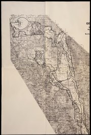
Size of this JPG preview of this PDF file: 396 × 599 pixels. Other resolutions: 158 × 240 pixels | 317 × 480 pixels | 507 × 768 pixels | 677 × 1,024 pixels | 2,420 × 3,662 pixels.
Original file (2,420 × 3,662 pixels, file size: 61.83 MB, MIME type: application/pdf, 270 pages)
Captions
Captions
Add a one-line explanation of what this file represents
Summary[edit]
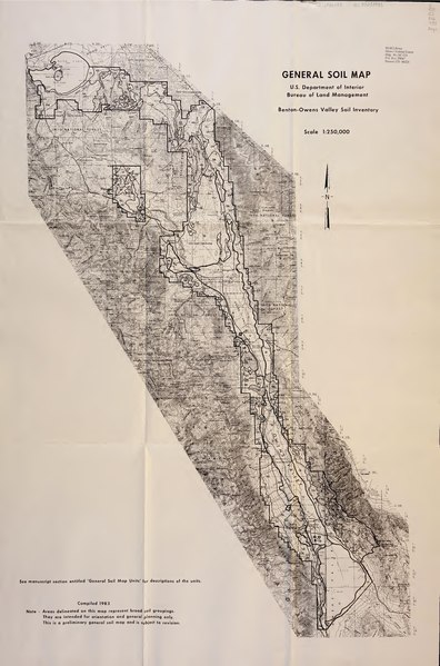
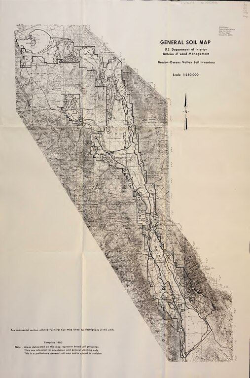
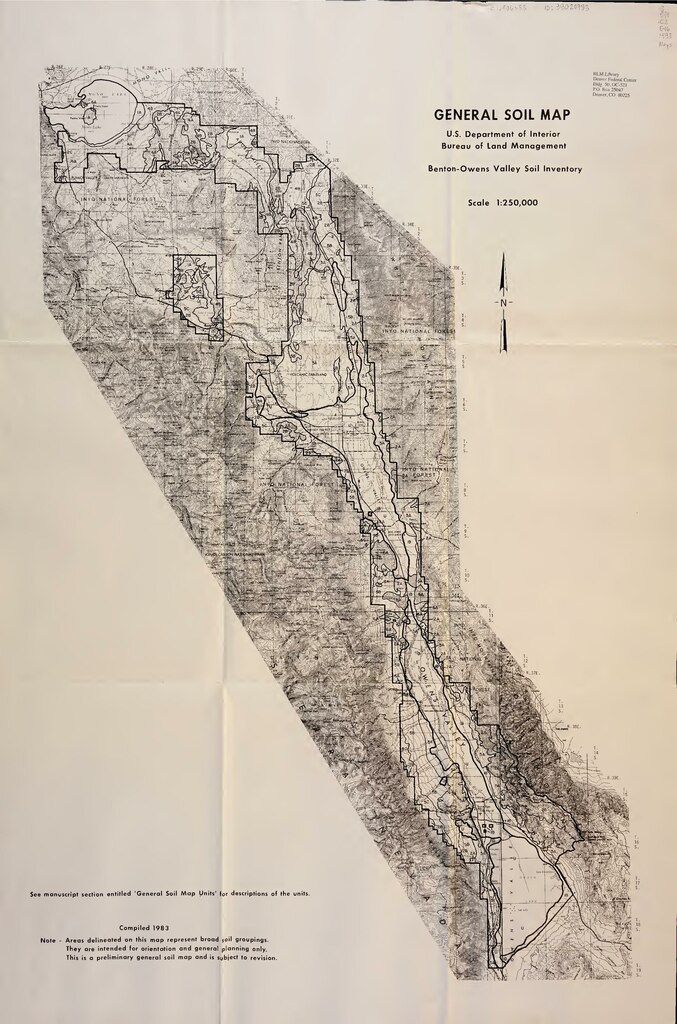
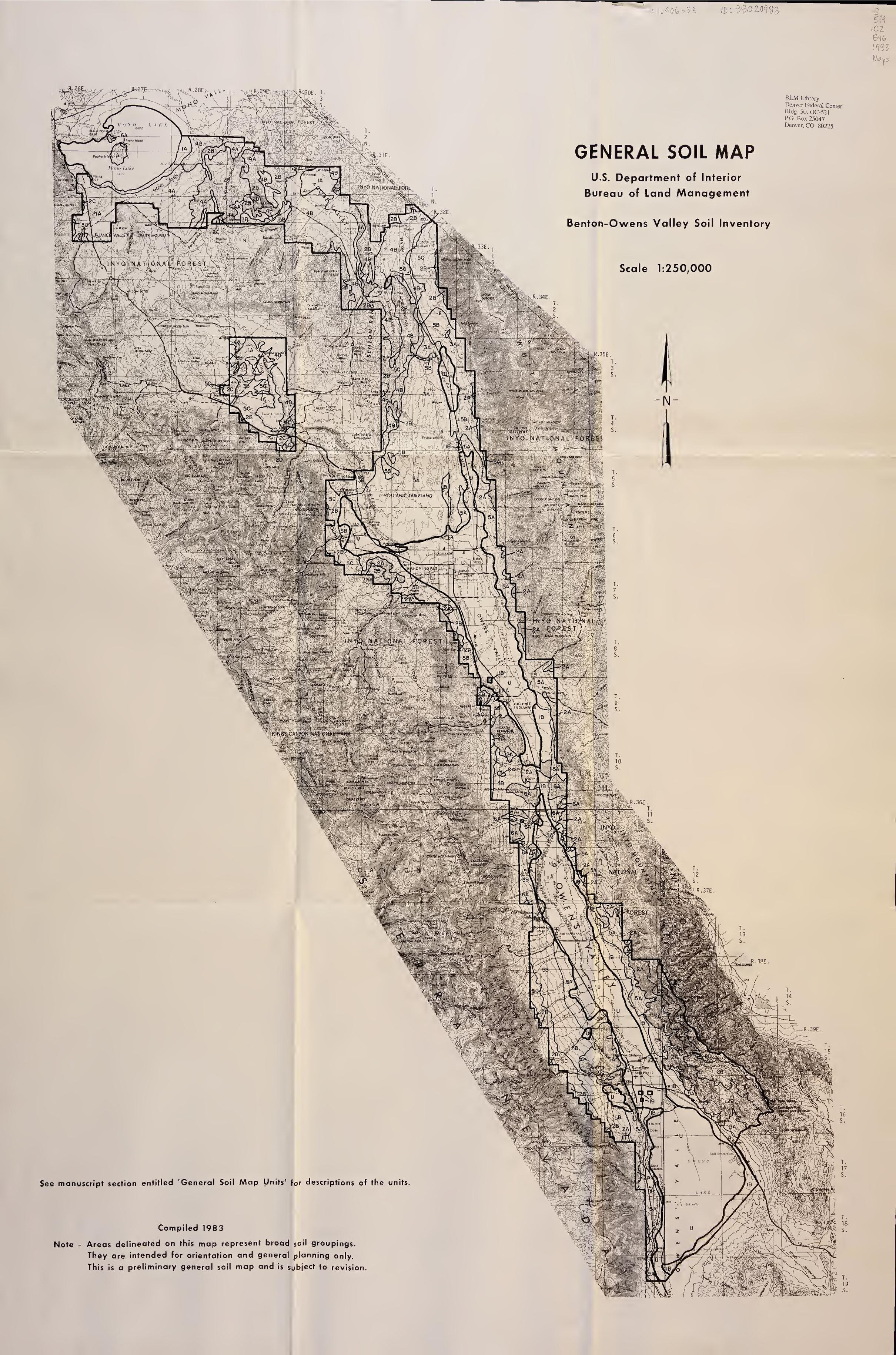
| Soil inventory of the Benton-Owens Valley area : parts of Inyo and Mono counties, California
( |
||
|---|---|---|
| Author |
Vaughn, Daniel E |
 |
| Title |
Soil inventory of the Benton-Owens Valley area : parts of Inyo and Mono counties, California |
|
| Publisher |
|
|
| Description |
Subjects: Soils -- California -- Inyo County -- Maps; Soils -- California -- Mono County -- Maps; Soils -- California -- Owens Valley -- Maps; Soil surveys -- California -- Inyo County; Soil surveys -- California -- Mono County; Soil surveys -- California -- Owens Valley; Soil surveys; Soils; California -- Inyo County; California -- Mono County; California -- Owens Valley |
|
| Language | English | |
| Publication date | 1983 | |
| Current location |
IA Collections: blmlibrary; fedlink; americana |
|
| Accession number |
soilinventoryofb00vaug |
|
| Notes |
Maps are double-sided and have been shot at full-size and in sections, per partner request. Map numbers are not sequential from front to back, and the maps have been photographed in the order they were found in the envelope. |
|
| Authority file | OCLC: 1157220858 | |
| Source | ||
Licensing[edit]
This work is in the public domain in the United States because it is a work prepared by an officer or employee of the United States Government as part of that person’s official duties under the terms of Title 17, Chapter 1, Section 105 of the US Code.
Note: This only applies to original works of the Federal Government and not to the work of any individual U.S. state, territory, commonwealth, county, municipality, or any other subdivision. This template also does not apply to postage stamp designs published by the United States Postal Service since 1978. (See § 313.6(C)(1) of Compendium of U.S. Copyright Office Practices). It also does not apply to certain US coins; see The US Mint Terms of Use.
|
 | |
| This file has been identified as being free of known restrictions under copyright law, including all related and neighboring rights. | ||
File history
Click on a date/time to view the file as it appeared at that time.
| Date/Time | Thumbnail | Dimensions | User | Comment | |
|---|---|---|---|---|---|
| current | 18:38, 1 July 2020 |  | 2,420 × 3,662, 270 pages (61.83 MB) | Fæ (talk | contribs) | FEDLINK - United States Federal Collection soilinventoryofb00vaug (User talk:Fæ/CCE volumes#Fork8) (batch 1983-1986 #7707) |
You cannot overwrite this file.
File usage on Commons
The following page uses this file: