File:South Florida Satellite Image Map.jpg
Jump to navigation
Jump to search

Size of this preview: 380 × 599 pixels. Other resolutions: 152 × 240 pixels | 305 × 480 pixels | 487 × 768 pixels | 650 × 1,024 pixels | 1,300 × 2,048 pixels | 2,715 × 4,277 pixels.
Original file (2,715 × 4,277 pixels, file size: 2.91 MB, MIME type: image/jpeg)
Captions
Captions
Add a one-line explanation of what this file represents
Summary[edit]
| Description |
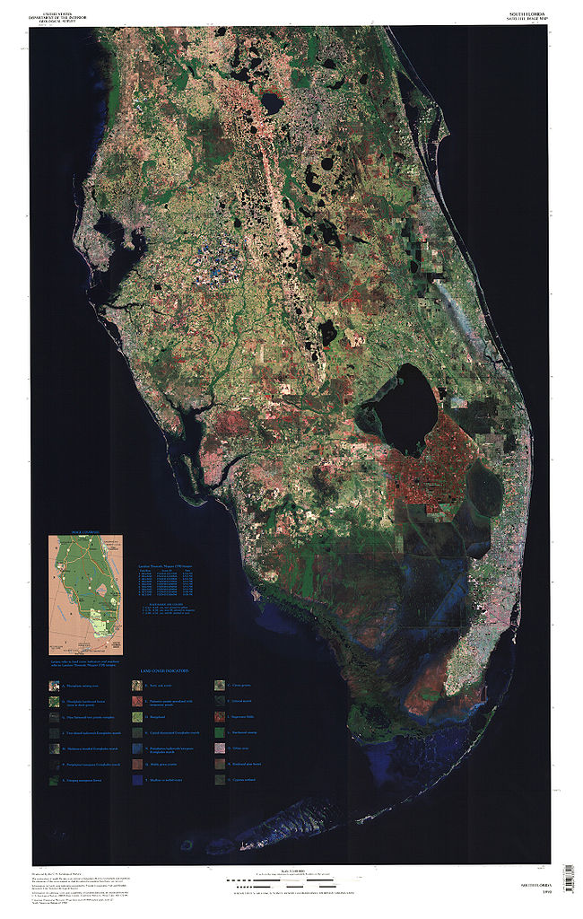
English: Satellite image of the lower Florida peninsula. The darkened portion south of Lake Okeechobee is the Everglades. |
| Date | |
| Source | http://education.usgs.gov/common/lessons/map_mysteries.html |
| Author | US Geological Survey |
| Permission (Reusing this file) |
Public domain |
| Other versions | Derivative works of this file: Florida Lake Wales Ridge Labeled.jpg |
Licensing[edit]
This image is in the public domain in the United States because it only contains materials that originally came from the United States Geological Survey, an agency of the United States Department of the Interior. For more information, see the official USGS copyright policy.
|
File history
Click on a date/time to view the file as it appeared at that time.
| Date/Time | Thumbnail | Dimensions | User | Comment | |
|---|---|---|---|---|---|
| current | 04:01, 17 October 2009 | | 2,715 × 4,277 (2.91 MB) | Melchoir (talk | contribs) | Use full source resolution |
| 19:26, 17 July 2008 |  | 374 × 608 (97 KB) | Moni3 (talk | contribs) | {{Information |Description={{en|1=Satellite image of the lower Florida peninsula. The darkened portion south of Lake Okeechobee is the Everglades.}} |Source=http://education.usgs.gov/common/lessons/map_mysteries.html |Author=US Geological Survey |Date=200 |
You cannot overwrite this file.
File usage on Commons
The following page uses this file:
File usage on other wikis
The following other wikis use this file:
- Usage on en.wikipedia.org
- Usage on es.wikipedia.org
- Usage on ja.wikipedia.org